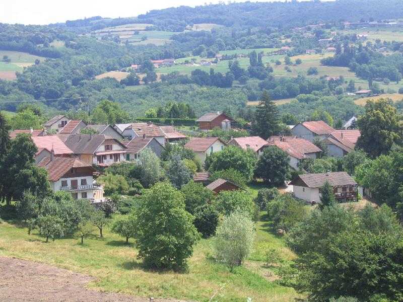
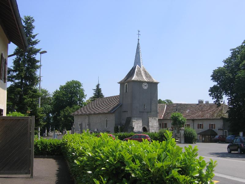
Usinens (Usinens)
- commune in Haute-Savoie, France
Usinens isn't a widely recognized hiking destination, and there may be a misunderstanding regarding the location. If you meant the general area of the U.S. or a specific region or park (like Yosemite in California or another area), please clarify, and I’d be happy to provide detailed information.
If you are looking to hike in a specific area, here are some general tips for hiking in the U.S.:
-
Know the Trails: Research the trails in the area you plan to visit. Websites like AllTrails or local park service websites often have detailed maps, descriptions, and user reviews.
-
Plan Accordingly: Check the weather, trail conditions, and park regulations. Make sure you have the necessary permits if required.
-
Pack Essentials: Always carry enough water, snacks, a first aid kit, appropriate clothing layers, sturdy footwear, and a map or GPS.
-
Leave No Trace: Be conscious of your impact on nature. Follow the Leave No Trace principles to keep the trails and parks pristine.
-
Safety First: Inform someone of your hiking plans, especially if you’re going on a less traveled trail. Always be aware of your surroundings and know your limits.
If you have a specific location or park in mind, let me know for more tailored guidance!
- Country:

- Postal Code: 74910
- Coordinates: 46° 0' 32" N, 5° 50' 28" E


- GPS tracks (wikiloc): [Link]
- Area: 7.63 sq km
- Population: 391
- Wikipedia en: wiki(en)
- Wikipedia: wiki(fr)
- Wikidata storage: Wikidata: Q845348
- Wikipedia Commons Category: [Link]
- Freebase ID: [/m/03ntxnm]
- GeoNames ID: Alt: [6443065]
- SIREN number: [217402858]
- BnF ID: [15274538p]
- INSEE municipality code: 74285
Shares border with regions:


Bassy
- commune in Haute-Savoie, France
It seems there might be a typo or misunderstanding regarding "Bassy," as it doesn't correspond to a well-known hiking destination. However, if you meant "Basilicata" in Italy, "Basse-Terre" in Guadeloupe, or a similar-sounding location, I can provide information on those areas....
- Country:

- Postal Code: 74910
- Coordinates: 45° 58' 51" N, 5° 49' 47" E


- GPS tracks (wikiloc): [Link]
- Area: 7.57 sq km
- Population: 417


Challonges
- commune in Haute-Savoie, France
Challonges is a charming area located in the Auvergne-Rhône-Alpes region of France, near the border with Switzerland. It offers a variety of hiking opportunities for different skill levels, with beautiful landscapes featuring rolling hills, forests, and the stunning backdrop of the Alps....
- Country:

- Postal Code: 74910
- Coordinates: 46° 1' 10" N, 5° 49' 52" E


- GPS tracks (wikiloc): [Link]
- Area: 7.9 sq km
- Population: 501


Desingy
- commune in Haute-Savoie, France
Desingy, located in the Haute-Savoie region of France, offers a picturesque setting for hiking enthusiasts. It’s surrounded by the stunning landscapes of the French Alps, making it an excellent base for exploring various trails suitable for different skill levels....
- Country:

- Postal Code: 74270
- Coordinates: 45° 59' 43" N, 5° 53' 24" E


- GPS tracks (wikiloc): [Link]
- Area: 18.93 sq km
- Population: 799
- Web site: [Link]


Chêne-en-Semine
- commune in Haute-Savoie, France
Chêne-en-Semine is a charming destination for hiking enthusiasts, located in the Auvergne-Rhône-Alpes region of France. Known for its picturesque natural surroundings, this area offers a variety of trails suitable for different skill levels. Here are some highlights of hiking in Chêne-en-Semine:...
- Country:

- Postal Code: 74270
- Coordinates: 46° 2' 49" N, 5° 51' 31" E


- GPS tracks (wikiloc): [Link]
- Area: 9.46 sq km
- Population: 463
- Web site: [Link]


Vanzy
- commune in Haute-Savoie, France
Vanzy, a beautiful and serene location, is perfect for hiking enthusiasts. It offers a variety of trails that cater to different skill levels, from easy walks suitable for families to challenging hikes that provide stunning views for more experienced hikers....
- Country:

- Postal Code: 74270
- Coordinates: 46° 1' 46" N, 5° 53' 19" E


- GPS tracks (wikiloc): [Link]
- Area: 5.57 sq km
- Population: 318


Seyssel
- commune in Haute-Savoie, France
Seyssel, located in the Haute-Savoie region of France, is a charming town nestled at the confluence of the Rhône and the Fier rivers. It's surrounded by beautiful natural landscapes, making it a great destination for hiking enthusiasts. Here’s an overview of what you can expect when hiking in the Seyssel area:...
- Country:

- Postal Code: 74910
- Coordinates: 45° 57' 32" N, 5° 50' 11" E


- GPS tracks (wikiloc): [Link]
- Area: 16.86 sq km
- Population: 2290

