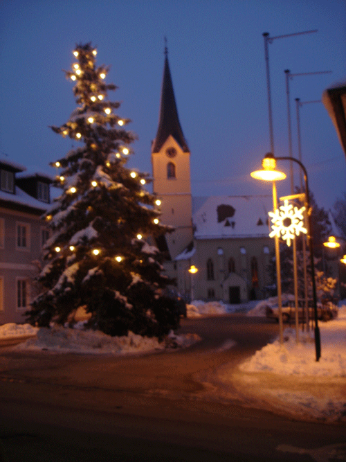
Vöcklabruck District (Bezirk Vöcklabruck)

- district of Austria
 Hiking in Vöcklabruck District
Vöcklabruck District, located in the Upper Austria region, offers a diverse range of hiking opportunities amidst picturesque landscapes, lakes, and rolling hills. Here are some highlights for hikers in the area:
1. :
This stunning lake is surrounded by majestic mountains and offers numerous trails with varying difficulty levels. The Traunsee loop is particularly popular, providing breathtaking views of the water and surrounding peaks.
2. :
The two lakes—Attersee and Mondsee—are not only beautiful but also offer a variety of hiking trails. You can find paths that lead along the shores, as well as more challenging routes that take you up into the mountains, offering panoramic views of both lakes.
3. :
The Almtal Valley is known for its scenic beauty and ample hiking options. Trails here often wind through lush forests and along streams, making it perfect for nature lovers. The Almsee lake at the end of the valley is a great destination for a peaceful break.
4. :
The Salzkammergut area, which partly lies within the Vöcklabruck District, is famous for its hiking trails. The region is dotted with traditional Alpine villages and offers everything from easy walks to more strenuous mountain hikes.
5. :
- Trail Conditions: Always check current trail conditions before heading out, especially in spring and autumn when weather can change quickly.
- Maps and Guides: Use detailed hiking maps or guide apps to navigate the trails effectively. Local tourism offices can provide valuable resources.
- Safety: Bring enough water, snacks, and gear suited to the trail difficulty. Dress in layers, as mountain weather can vary significantly.
6. :
The area is known for its rich biodiversity. Keep an eye out for local wildlife, including deer and various bird species, as well as diverse plant life typical of the Alpine environment.
7. :
Many hiking trails can be accessed via public transport, making it easy to reach starting points without needing a car. Local buses often connect towns and trailheads.
With its stunning scenery and well-marked trails, Vöcklabruck District is an excellent destination for both beginner and experienced hikers. Enjoy your hike!
- Country:

- Capital: Vöcklabruck
- Licence Plate Code: VB
- Coordinates: 48° 0' 32" N, 13° 34' 30" E


- GPS tracks (wikiloc): [Link]
- AboveSeaLevel: 424 м m
- Area: 1084.26 sq km
- Web site: http://www.bh-voecklabruck.gv.at/
- Wikipedia en: wiki(en)
- Wikipedia: wiki(de)
- Wikidata storage: Wikidata: Q267479
- Wikipedia Commons Category: [Link]
- Freebase ID: [/m/0dy_mx]
- GeoNames ID: Alt: [2762342]
- VIAF ID: Alt: [159474380]
- GND ID: Alt: [4063672-0]
- archINFORM location ID: [14682]
- Library of Congress authority ID: Alt: [n82151171]
Includes regions:

Steinbach am Attersee
- municipality in Austria
Hiking in Steinbach am Attersee
Steinbach am Attersee is a beautiful village located on the northern shore of Lake Attersee in Austria, surrounded by stunning landscapes, lush forests, and the impressive peaks of the Salzkammergut region. Hiking in this area offers a diverse range of trails suited for different skill levels, making it a popular destination for outdoor enthusiasts....
- Country:
- Postal Code: 4853
- Local Dialing Code: 07663
- Licence Plate Code: VB
- Coordinates: 47° 49' 55" N, 13° 33' 0" E
- GPS tracks (wikiloc): [Link]
- AboveSeaLevel: 509 м m
- Area: 62 sq km
- Population: 866
- Web site: [Link]

Zell am Moos
- municipality in Austria
Hiking in Zell am Moos
Zell am Moos, located in the scenic Salzkammergut region of Austria, is an excellent destination for hiking enthusiasts. Here's what you can expect when hiking in this picturesque area:...
- Country:
- Postal Code: 4893
- Local Dialing Code: 06234
- Licence Plate Code: VB
- Coordinates: 47° 54' 1" N, 13° 19' 1" E
- GPS tracks (wikiloc): [Link]
- AboveSeaLevel: 573 м m
- Area: 25 sq km
- Population: 1575
- Web site: [Link]

Zell am Pettenfirst
- municipality in Austria
Hiking in Zell am Pettenfirst
Hiking in Zell am Pettenfirst, located in the Salzkammergut region of Austria, offers breathtaking views and a variety of trails suitable for different skill levels. The area is characterized by its picturesque landscapes, including rolling hills, lush woods, and stunning mountain vistas....
- Country:
- Postal Code: 4842
- Local Dialing Code: 07675
- Licence Plate Code: VB
- Coordinates: 48° 4' 42" N, 13° 36' 0" E
- GPS tracks (wikiloc): [Link]
- AboveSeaLevel: 550 м m
- Area: 14 sq km
- Population: 1236
- Web site: [Link]

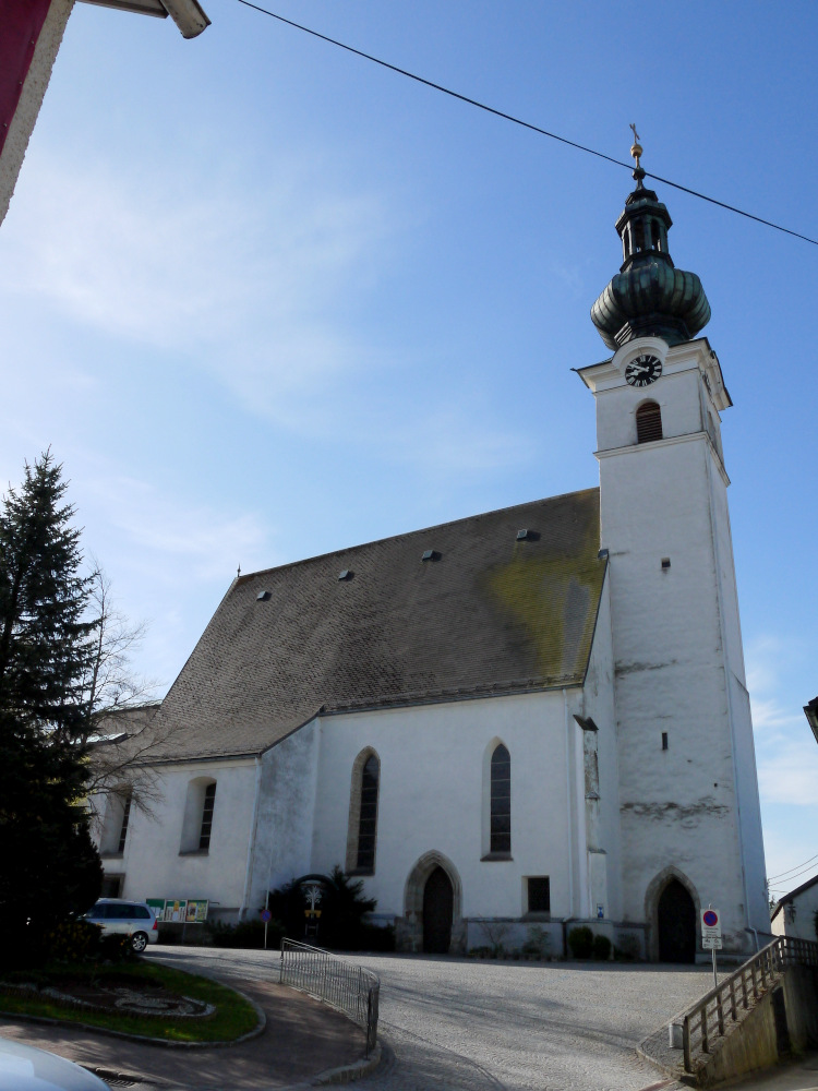
Vöcklabruck
- municipality in Austria
Hiking in Vöcklabruck
Vöcklabruck, located in Upper Austria, offers a variety of hiking opportunities suitable for all skill levels, thanks to its beautiful natural surroundings and scenic landscapes. Here are some key aspects to consider when hiking in this area:...
- Country:
- Postal Code: 4840
- Local Dialing Code: 07672
- Licence Plate Code: VB
- Coordinates: 48° 0' 31" N, 13° 39' 21" E
- GPS tracks (wikiloc): [Link]
- AboveSeaLevel: 433 м m
- Area: 16 sq km
- Population: 12179
- Web site: [Link]

Attnang-Puchheim
- municipality in Austria
Hiking in Attnang-Puchheim
Attnang-Puchheim is a charming town located in the Salzkammergut region of Austria, surrounded by beautiful landscapes, making it a great base for hikers. The area features various hiking trails that cater to different skill levels and preferences, showcasing stunning views of the surrounding mountains and lakes....
- Country:
- Postal Code: 4800
- Local Dialing Code: 07674
- Licence Plate Code: VB
- Coordinates: 48° 1' 0" N, 13° 43' 0" E
- GPS tracks (wikiloc): [Link]
- AboveSeaLevel: 416 м m
- Area: 1232 sq km
- Population: 8944
- Web site: [Link]

Schwanenstadt
- municipality in Austria
Hiking in Schwanenstadt
Schwanenstadt, located in Upper Austria, is surrounded by beautiful landscapes and offers great opportunities for hiking enthusiasts. The area is characterized by rolling hills, lush forests, and scenic views of the Traun River and the surrounding mountains....
- Country:
- Postal Code: 4690
- Local Dialing Code: 07673
- Licence Plate Code: VB
- Coordinates: 48° 3' 19" N, 13° 46' 33" E
- GPS tracks (wikiloc): [Link]
- AboveSeaLevel: 389 м m
- Area: 2.58 sq km
- Population: 4264
- Web site: [Link]
Regau
- municipality in Austria
Hiking in Regau
Regau, located in Upper Austria, offers a range of beautiful hiking opportunities for nature enthusiasts. The region is characterized by rolling hills, lush forests, and scenic views of the surrounding countryside. Here are some key points to consider when hiking in Regau:...
- Country:
- Postal Code: 4844
- Local Dialing Code: 07672
- Licence Plate Code: VB
- Coordinates: 47° 59' 31" N, 13° 41' 17" E
- GPS tracks (wikiloc): [Link]
- AboveSeaLevel: 429 м m
- Area: 34 sq km
- Population: 6780
- Web site: [Link]
Redlham
- municipality in Austria
Hiking in Redlham
It seems there might be a typo or a miscommunication regarding "Redlham," as it's not a widely recognized hiking destination. However, if you meant "Redlands," which is located in California, or a specific area within a region, I would be happy to provide information based on that....
- Country:
- Postal Code: 4846
- Licence Plate Code: VB
- Coordinates: 48° 1' 27" N, 13° 44' 41" E
- GPS tracks (wikiloc): [Link]
- AboveSeaLevel: 403 м m
- Area: 8 sq km
- Population: 1515
- Web site: [Link]

Wolfsegg am Hausruck
- municipality in Austria
Hiking in Wolfsegg am Hausruck
Wolfsegg am Hausruck is a picturesque village located in the Hausruck region of Austria, known for its stunning landscapes and diverse hiking opportunities. Here are some highlights and key considerations for hiking in this area:...
- Country:
- Postal Code: 4902
- Local Dialing Code: 07676
- Licence Plate Code: VB
- Coordinates: 48° 6' 27" N, 13° 40' 28" E
- GPS tracks (wikiloc): [Link]
- AboveSeaLevel: 638 м m
- Area: 12 sq km
- Population: 1982
- Web site: [Link]

Desselbrunn
- municipality in Austria
Hiking in Desselbrunn
Desselbrunn is a charming area located in Upper Austria, known for its picturesque landscapes and nature trails, making it a great destination for hiking enthusiasts. Here are some key points to consider if you’re planning a hiking trip in Desselbrunn:...
- Country:
- Postal Code: 4693
- Local Dialing Code: 07673
- Licence Plate Code: VB
- Coordinates: 48° 1' 22" N, 13° 46' 25" E
- GPS tracks (wikiloc): [Link]
- AboveSeaLevel: 421 м m
- Area: 17 sq km
- Population: 1857
- Web site: [Link]


Ampflwang im Hausruckwald
- municipality in Austria
Hiking in Ampflwang im Hausruckwald
Ampflwang im Hausruckwald is a beautiful destination for hiking enthusiasts, situated in the Upper Austria region of Austria. The area is known for its lush forests, rolling hills, and scenic landscapes that are ideal for outdoor activities, including hiking....
- Country:
- Postal Code: 4843
- Local Dialing Code: 07675
- Licence Plate Code: VB
- Coordinates: 48° 5' 34" N, 13° 34' 0" E
- GPS tracks (wikiloc): [Link]
- AboveSeaLevel: 566 м m
- Area: 21 sq km
- Population: 3376
- Web site: [Link]
Oberndorf bei Schwanenstadt
- municipality in Austria
Hiking in Oberndorf bei Schwanenstadt
Oberndorf bei Schwanenstadt is a charming village situated in the scenic Salzkammergut region of Austria. This area is renowned for its beautiful landscapes, rich cultural heritage, and a variety of outdoor activities, making it an excellent destination for hiking enthusiasts....
- Country:
- Postal Code: 4690
- Local Dialing Code: 07673
- Licence Plate Code: VB
- Coordinates: 48° 3' 24" N, 13° 45' 44" E
- GPS tracks (wikiloc): [Link]
- AboveSeaLevel: 390 м m
- Area: 6 sq km
- Population: 1416
- Web site: [Link]

Timelkam
- municipality in Austria
Hiking in Timelkam
Timelkam, located in Upper Austria near the shores of Lake Traunsee and surrounded by beautiful landscapes, offers a variety of hiking opportunities for all experience levels. Here are some key points to consider when hiking in Timelkam:...
- Country:
- Postal Code: 4850
- Local Dialing Code: 07672
- Licence Plate Code: VB
- Coordinates: 48° 0' 5" N, 13° 36' 45" E
- GPS tracks (wikiloc): [Link]
- AboveSeaLevel: 454 м m
- Area: 18 sq km
- Population: 5708
- Web site: [Link]


Ottnang am Hausruck
- municipality in Austria
Hiking in Ottnang am Hausruck
Ottnang am Hausruck, located in the Upper Austria region, is a picturesque village surrounded by beautiful natural landscapes, making it a great destination for hiking enthusiasts. The Hausruckwald region, where Ottnang is situated, features rolling hills, forests, and charming meadows that provide a variety of trails for different skill levels....
- Country:
- Postal Code: 4901
- Local Dialing Code: 07676
- Licence Plate Code: VB
- Coordinates: 48° 5' 44" N, 13° 39' 41" E
- GPS tracks (wikiloc): [Link]
- AboveSeaLevel: 554 м m
- Area: 30 sq km
- Population: 3990
- Web site: [Link]
Fornach
- municipality in Austria
Hiking in Fornach
Fornach is a charming area that offers beautiful hiking opportunities, especially for those who enjoy nature and scenic landscapes. Situated in Austria, it's known for its lush forests, rolling hills, and picturesque views of the surrounding mountains....
- Country:
- Postal Code: 4892
- Local Dialing Code: 07682
- Licence Plate Code: VB
- Coordinates: 48° 1' 25" N, 13° 25' 53" E
- GPS tracks (wikiloc): [Link]
- AboveSeaLevel: 565 м m
- Area: 18 sq km
- Population: 976
- Web site: [Link]

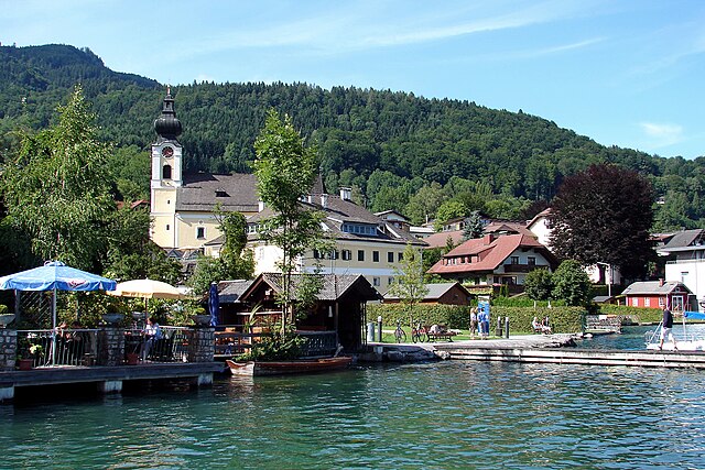
Mondsee
- municipality in Austria
Hiking in Mondsee
Mondsee is a picturesque town located in the Salzkammergut region of Austria, known for its beautiful lakes, stunning mountain views, and charming architecture. It's a great destination for hiking enthusiasts of all levels. Here are some highlights and tips for hiking in the Mondsee area:...
- Country:
- Postal Code: 5310
- Local Dialing Code: 06232
- Licence Plate Code: VB
- Coordinates: 47° 51' 24" N, 13° 21' 6" E
- GPS tracks (wikiloc): [Link]
- AboveSeaLevel: 493 м m
- Area: 16.62 sq km
- Population: 3734
- Web site: [Link]
Frankenmarkt
- municipality in Austria
Hiking in Frankenmarkt
Frankenmarkt is a quaint town located in the Upper Austria region, offering stunning landscapes and picturesque views that make it a wonderful destination for hiking enthusiasts. The area is characterized by its rolling hills, lush forests, and serene lakes, providing a range of trails suitable for hikers of all skill levels....
- Country:
- Postal Code: 4890
- Local Dialing Code: 07684
- Licence Plate Code: VB
- Coordinates: 47° 59' 1" N, 13° 25' 24" E
- GPS tracks (wikiloc): [Link]
- AboveSeaLevel: 536 м m
- Area: 18 sq km
- Population: 3636
- Web site: [Link]
Frankenburg am Hausruck
- municipality in Austria
Hiking in Frankenburg am Hausruck
Frankenburg am Hausruck, located in Austria's Upper Austria region, is an excellent destination for hiking enthusiasts. The area is characterized by stunning natural landscapes, rolling hills, and picturesque views of the Hausruck mountain range. Here are some key highlights and tips for hiking in this region:...
- Country:
- Postal Code: 4873
- Local Dialing Code: 07683
- Licence Plate Code: VB
- Coordinates: 48° 4' 6" N, 13° 29' 31" E
- GPS tracks (wikiloc): [Link]
- AboveSeaLevel: 519 м m
- Area: 49 sq km
- Population: 4842
- Web site: [Link]

Lenzing
- municipality in Austria
Hiking in Lenzing
Lenzing, located in Austria, is surrounded by beautiful natural landscapes that offer a variety of hiking opportunities. Nestled near the Traun River and close to the lush forests of the Salzkammergut region, it provides a stunning backdrop for outdoor enthusiasts....
- Country:
- Postal Code: 4860
- Local Dialing Code: 07672
- Licence Plate Code: VB
- Coordinates: 47° 58' 34" N, 13° 35' 44" E
- GPS tracks (wikiloc): [Link]
- AboveSeaLevel: 485 м m
- Area: 8.89 sq km
- Population: 5043
- Web site: [Link]

Weyregg am Attersee
- municipality in Austria
Hiking in Weyregg am Attersee
Weyregg am Attersee is a picturesque village located by the Attersee Lake in Austria, surrounded by stunning natural landscapes that make it a great destination for hiking enthusiasts. Here’s an overview of what you can expect when hiking in this region:...
- Country:
- Postal Code: 4852
- Local Dialing Code: 07664
- Licence Plate Code: VB
- Coordinates: 47° 54' 1" N, 13° 34' 29" E
- GPS tracks (wikiloc): [Link]
- AboveSeaLevel: 482 м m
- Area: 55 sq km
- Population: 1588
- Web site: [Link]


Aurach am Hongar
- municipality in Austria
Hiking in Aurach am Hongar
Aurach am Hongar is a picturesque area in Austria, offering a variety of hiking opportunities that showcase its stunning natural landscapes and picturesque mountain scenery. Here are some key points you might find useful for hiking in or around Aurach am Hongar:...
- Country:
- Postal Code: 4861
- Local Dialing Code: 07662
- Licence Plate Code: VB
- Coordinates: 47° 57' 1" N, 13° 40' 2" E
- GPS tracks (wikiloc): [Link]
- AboveSeaLevel: 488 м m
- Area: 25 sq km
- Population: 1715
- Web site: [Link]

Weißenkirchen im Attergau
- municipality in Austria
Hiking in Weißenkirchen im Attergau
Weißenkirchen im Attergau is a charming village located near the Attersee in Upper Austria and is surrounded by beautiful landscapes, making it a fantastic spot for hiking enthusiasts. The region offers trails for all skill levels, from easy walks to more challenging hikes, allowing everyone to enjoy the natural beauty of the area. Here are some highlights you can expect while hiking around Weißenkirchen im Attergau:...
- Country:
- Postal Code: 4890
- Local Dialing Code: 07684
- Licence Plate Code: VB
- Coordinates: 47° 56' 52" N, 13° 25' 0" E
- GPS tracks (wikiloc): [Link]
- AboveSeaLevel: 653 м m
- Area: 27 sq km
- Population: 964
- Web site: [Link]
Puchkirchen am Trattberg
- municipality in Austria
Hiking in Puchkirchen am Trattberg
Puchkirchen am Trattberg is a picturesque area in Austria, nestled in the Salzkammergut region, which offers excellent opportunities for hiking and enjoying nature. Here are some key aspects of hiking in this region:...
- Country:
- Postal Code: 4849
- Local Dialing Code: 07682
- Licence Plate Code: VB
- Coordinates: 48° 3' 41" N, 13° 34' 27" E
- GPS tracks (wikiloc): [Link]
- AboveSeaLevel: 558 м m
- Area: 8 sq km
- Population: 1036
- Web site: [Link]

Vöcklamarkt
- municipality in Austria
Hiking in Vöcklamarkt
Vöcklamarkt, located in Upper Austria, is surrounded by beautiful landscapes, making it a great destination for hiking enthusiasts. The region features a variety of trails that cater to different skill levels, from gentle walks to more challenging hikes. Here are some highlights and tips for hiking in the Vöcklamarkt area:...
- Country:
- Postal Code: 4870
- Local Dialing Code: 07682
- Licence Plate Code: VB
- Coordinates: 48° 0' 11" N, 13° 29' 7" E
- GPS tracks (wikiloc): [Link]
- AboveSeaLevel: 488 м m
- Area: 27.35 sq km
- Population: 4924
- Web site: [Link]


Straß im Attergau
- municipality in Austria
Hiking in Straß im Attergau
Straß im Attergau, located in the scenic Salzkammergut region of Austria, offers a variety of hiking opportunities amidst stunning natural landscapes. This area is known for its rolling hills, lush forests, and picturesque lakes, making it a perfect destination for outdoor enthusiasts. Here are some highlights and tips for hiking in the region:...
- Country:
- Postal Code: 4881
- Local Dialing Code: 07667
- Licence Plate Code: VB
- Coordinates: 47° 54' 34" N, 13° 27' 1" E
- GPS tracks (wikiloc): [Link]
- AboveSeaLevel: 570 м m
- Area: 31 sq km
- Population: 1471
- Web site: [Link]

Oberwang
- municipality in Austria
Hiking in Oberwang
Oberwang, a charming village in Austria, offers beautiful hiking opportunities with scenic views and a tranquil atmosphere. Nestled near the scenic region of Salzkammergut, it's a perfect base for outdoor enthusiasts looking to explore the foothills of the Alps. Here are some highlights and tips for hiking in Oberwang:...
- Country:
- Postal Code: 4882
- Local Dialing Code: 06233
- Licence Plate Code: VB
- Coordinates: 47° 52' 1" N, 13° 26' 0" E
- GPS tracks (wikiloc): [Link]
- AboveSeaLevel: 573 м m
- Area: 39 sq km
- Population: 1708
- Web site: [Link]

Pöndorf
- municipality in Austria
Hiking in Pöndorf
Pöndorf, located in the Salzkammergut region of Austria, offers beautiful landscapes and a variety of hiking options for outdoor enthusiasts. The area is characterized by its stunning lakes, rolling hills, and picturesque alpine scenery, making it a great spot for both leisurely walks and more challenging hikes....
- Country:
- Local Dialing Code: 07684
- Licence Plate Code: VB
- Coordinates: 47° 59' 50" N, 13° 22' 1" E
- GPS tracks (wikiloc): [Link]
- AboveSeaLevel: 574 м m
- Area: 51 sq km
- Population: 2386
- Web site: [Link]

Schörfling am Attersee
- municipality in Austria
Hiking in Schörfling am Attersee
Schörfling am Attersee is a picturesque village located at the northern tip of Lake Attersee in Austria, surrounded by stunning landscapes, including beautiful hills and mountains. The area offers a variety of hiking trails suitable for all levels, making it an excellent destination for both beginners and experienced hikers....
- Country:
- Postal Code: 4861
- Local Dialing Code: 07662
- Licence Plate Code: VB
- Coordinates: 47° 56' 50" N, 13° 36' 2" E
- GPS tracks (wikiloc): [Link]
- AboveSeaLevel: 512 м m
- Area: 23 sq km
- Population: 3438
- Web site: [Link]

Oberhofen am Irrsee
- municipality in Austria
Hiking in Oberhofen am Irrsee
Oberhofen am Irrsee is a charming village located in the Salzkammergut region of Austria, known for its stunning natural beauty and outdoor recreational opportunities. Hiking in this area offers a range of trails suitable for various skill levels, making it a great destination for both novice and experienced hikers....
- Country:
- Postal Code: 4894
- Local Dialing Code: 06213
- Licence Plate Code: VB
- Coordinates: 47° 57' 1" N, 13° 18' 2" E
- GPS tracks (wikiloc): [Link]
- AboveSeaLevel: 573 м m
- Area: 21 sq km
- Population: 1646
- Web site: [Link]

Niederthalheim
- municipality in Austria
Hiking in Niederthalheim
Niederthalheim, a charming village in Austria, offers various hiking opportunities for outdoor enthusiasts. The region is characterized by its stunning landscapes, which include rolling hills, lush forests, and scenic views of the surrounding mountains....
- Country:
- Postal Code: 4692
- Local Dialing Code: 07673
- Licence Plate Code: VB
- Coordinates: 48° 6' 0" N, 13° 46' 6" E
- GPS tracks (wikiloc): [Link]
- AboveSeaLevel: 431 м m
- Area: 16 sq km
- Population: 1125
- Web site: [Link]

Nußdorf am Attersee
- municipality in Austria
Hiking in Nußdorf am Attersee
Nußdorf am Attersee is a picturesque village located on the northern shore of Lake Attersee in Austria, surrounded by stunning alpine scenery. It's a fantastic starting point for hiking enthusiasts, offering a variety of trails that cater to different skill levels....
- Country:
- Postal Code: 4865
- Local Dialing Code: 07666
- Licence Plate Code: VB
- Coordinates: 47° 53' 0" N, 13° 31' 29" E
- GPS tracks (wikiloc): [Link]
- AboveSeaLevel: 500 м m
- Area: 27 sq km
- Population: 1128
- Web site: [Link]

Rüstorf
- municipality in Austria
Hiking in Rüstorf
Rüstorf, located in Austria, is a charming area that offers a variety of hiking opportunities. The region is characterized by picturesque landscapes, including rolling hills, lush forests, and tranquil lakes, making it a great destination for outdoor enthusiasts....
- Country:
- Postal Code: 4690
- Local Dialing Code: 07673
- Licence Plate Code: VB
- Coordinates: 48° 2' 42" N, 13° 47' 33" E
- GPS tracks (wikiloc): [Link]
- AboveSeaLevel: 387 м m
- Area: 14 sq km
- Population: 2056
- Web site: [Link]


Schlatt
- municipality in Austria
Hiking in Schlatt
Schlatt, located in Austria, is a charming area that offers a variety of hiking opportunities. While it may not be as widely known as some of the more prominent hiking destinations in Austria, it is surrounded by beautiful landscapes and provides access to the scenic beauty of the foothills of the Alps....
- Country:
- Local Dialing Code: 07673
- Licence Plate Code: VB
- Coordinates: 48° 4' 21" N, 13° 47' 2" E
- GPS tracks (wikiloc): [Link]
- AboveSeaLevel: 409 м m
- Area: 11 sq km
- Population: 1399
- Web site: [Link]

Gampern
- municipality in Austria
Hiking in Gampern
Gampern is a charming village located in Austria, specifically within the Upper Austrian region. While it may not be as well-known as some of the larger tourist destinations, it offers some lovely opportunities for hiking and enjoying the natural beauty of the surrounding area....
- Country:
- Postal Code: 4851
- Local Dialing Code: 07682
- Licence Plate Code: VB
- Coordinates: 47° 59' 21" N, 13° 33' 2" E
- GPS tracks (wikiloc): [Link]
- AboveSeaLevel: 509 м m
- Area: 26 sq km
- Population: 2927
- Web site: [Link]
Pühret
- municipality in Austria
Hiking in Pühret
Pühret, located in Austria, offers a variety of hiking opportunities for enthusiasts of all levels. The region is characterized by its stunning landscapes, peaceful forests, and scenic views of the surrounding mountains....
- Country:
- Postal Code: 4690
- Local Dialing Code: 07674
- Licence Plate Code: VB
- Coordinates: 48° 1' 49" N, 13° 42' 25" E
- GPS tracks (wikiloc): [Link]
- AboveSeaLevel: 440 м m
- Area: 7 sq km
- Population: 613
- Web site: [Link]

Sankt Lorenz
- municipality in Austria
Hiking in Sankt Lorenz
Sankt Lorenz, located in Austria near the famous Lake Traunsee, is a fantastic destination for hiking enthusiasts. The area is known for its stunning natural landscapes, including beautiful alpine scenery, lush forests, and picturesque views of the lake....
- Country:
- Postal Code: 5310
- Local Dialing Code: 06232
- Licence Plate Code: VB
- Coordinates: 47° 49' 24" N, 13° 21' 24" E
- GPS tracks (wikiloc): [Link]
- AboveSeaLevel: 490 м m
- Area: 23 sq km
- Population: 2493
- Web site: [Link]

Neukirchen an der Vöckla
- municipality in Austria
Hiking in Neukirchen an der Vöckla
Neukirchen an der Vöckla is a picturesque village located in Upper Austria, and it offers a variety of hiking opportunities for those looking to explore the natural beauty of the region. Here are some aspects to consider when hiking in this area:...
- Country:
- Postal Code: 4872
- Local Dialing Code: 07682
- Licence Plate Code: VB
- Coordinates: 48° 2' 28" N, 13° 32' 18" E
- GPS tracks (wikiloc): [Link]
- AboveSeaLevel: 516 м m
- Area: 24 sq km
- Population: 2559
- Web site: [Link]

Sankt Georgen im Attergau
- municipality in Austria
Hiking in Sankt Georgen im Attergau
St. Georgen im Attergau is a charming village in Austria, situated near the beautiful Attersee Lake and surrounded by the stunning Salzkammergut mountain range. This area is an excellent destination for hiking enthusiasts, offering a variety of trails that cater to different skill levels and provide breathtaking views of the landscape....
- Country:
- Postal Code: 4880
- Local Dialing Code: 07667
- Licence Plate Code: VB
- Coordinates: 47° 56' 0" N, 13° 29' 32" E
- GPS tracks (wikiloc): [Link]
- AboveSeaLevel: 540 м m
- Area: 15.40 sq km
- Population: 4375
- Web site: [Link]
Manning, Upper Austria
- municipality in Austria
Hiking in Manning, Upper Austria
Manning, located in Upper Austria, is not as widely recognized as some other hiking destinations in Austria. However, the region offers beautiful landscapes, lush forests, and serene trails that are perfect for hiking enthusiasts....
- Country:
- Postal Code: 4903
- Local Dialing Code: 07676
- Licence Plate Code: VB
- Coordinates: 48° 5' 13" N, 13° 40' 2" E
- GPS tracks (wikiloc): [Link]
- AboveSeaLevel: 510 м m
- Area: 10 sq km
- Population: 795
- Web site: [Link]

Pitzenberg
- municipality in Austria
Hiking in Pitzenberg
Pitzenberg is a popular hiking destination located in South Korea, particularly known for its scenic vistas and diverse trails. While it’s not as widely recognized internationally as some other mountains, it offers a great experience for both novice and seasoned hikers....
- Country:
- Postal Code: 4690
- Local Dialing Code: 07673
- Licence Plate Code: VB
- Coordinates: 48° 4' 26" N, 13° 43' 36" E
- GPS tracks (wikiloc): [Link]
- AboveSeaLevel: 445 м m
- Area: 6 sq km
- Population: 524
- Web site: [Link]
Redleiten
- municipality in Austria
Hiking in Redleiten
Redleiten is not a widely recognized hiking destination, but if you're referring to the general concept of hiking in areas that might include scenic spots or trails known as "Redleiten" or similar, it’s likely you’re thinking of a region with natural landscapes, forests, or mountainous terrain....
- Country:
- Postal Code: 4875
- Local Dialing Code: 07683
- Licence Plate Code: VB
- Coordinates: 48° 5' 10" N, 13° 28' 23" E
- GPS tracks (wikiloc): [Link]
- AboveSeaLevel: 555 м m
- Area: 14 sq km
- Population: 537
- Web site: [Link]

Atzbach
- municipality in Austria
Hiking in Atzbach
Atzbach is a picturesque area in Austria that offers a variety of hiking opportunities suitable for different skill levels. Nestled in the beautiful landscapes of the region, hikers can expect to encounter stunning natural scenery, including forests, rivers, and panoramic views of the mountains....
- Country:
- Postal Code: 4904
- Local Dialing Code: 07676
- Licence Plate Code: VB
- Coordinates: 48° 5' 6" N, 13° 42' 13" E
- GPS tracks (wikiloc): [Link]
- AboveSeaLevel: 464 м m
- Area: 14 sq km
- Population: 1196
- Web site: [Link]
Rutzenham
- municipality in Austria
Hiking in Rutzenham
Rutzenham is a picturesque village located in Upper Austria, near the shores of Lake Attersee. The area is known for its stunning natural beauty, including rolling hills, lush forests, and views of the Alps, making it a great destination for hiking enthusiasts....
- Country:
- Postal Code: 4690
- Local Dialing Code: 07673
- Licence Plate Code: VB
- Coordinates: 48° 3' 15" N, 13° 42' 21" E
- GPS tracks (wikiloc): [Link]
- AboveSeaLevel: 421 м m
- Area: 4.8 sq km
- Population: 298
- Web site: [Link]

Ungenach
- municipality in Austria
Hiking in Ungenach
Ungenach is a picturesque village located in Austria, in the region of Upper Austria. It's surrounded by beautiful landscapes, making it an ideal starting point for various hiking adventures. While the specifics may vary depending on seasonal conditions and local regulations, here are some general insights about hiking in and around Ungenach:...
- Country:
- Postal Code: 4841
- Local Dialing Code: 07672
- Licence Plate Code: VB
- Coordinates: 48° 2' 51" N, 13° 36' 48" E
- GPS tracks (wikiloc): [Link]
- AboveSeaLevel: 486 м m
- Area: 14 sq km
- Population: 1492
- Web site: [Link]
Pilsbach
- municipality in Austria
Hiking in Pilsbach
Pilsbach, located in Austria's beautiful Salzkammergut region, is a fantastic destination for hiking enthusiasts. The area is characterized by its stunning landscapes, picturesque lakes, and dramatic mountain scenery. Here are some aspects to consider when hiking in Pilsbach:...
- Country:
- Licence Plate Code: VB
- Coordinates: 48° 2' 23" N, 13° 40' 6" E
- GPS tracks (wikiloc): [Link]
- AboveSeaLevel: 475 м m
- Area: 10 sq km
- Population: 629
- Web site: [Link]

Attersee am Attersee
- municipality in Austria
Hiking in Attersee am Attersee
Attersee am Attersee is a beautiful destination in the Salzkammergut region of Austria, known for its stunning lake, lush landscapes, and surrounding mountains. Hiking in this area offers a variety of trails for all skill levels, with picturesque views of Lake Attersee and the surrounding Alps....
- Country:
- Postal Code: 4864
- Local Dialing Code: 07666
- Licence Plate Code: VB
- Coordinates: 47° 55' 0" N, 13° 32' 29" E
- GPS tracks (wikiloc): [Link]
- AboveSeaLevel: 496 м m
- Area: 14.62 sq km
- Population: 1585
- Web site: [Link]
Unterach am Attersee
- municipality in Austria
Hiking in Unterach am Attersee
Unterach am Attersee is a picturesque village located on the shores of Lake Attersee in the Salzkammergut region of Austria. It is surrounded by stunning natural landscapes, making it a fantastic destination for hiking enthusiasts. Here’s what you can expect when hiking in and around Unterach am Attersee:...
- Country:
- Postal Code: 4866
- Local Dialing Code: 07665
- Licence Plate Code: VB
- Coordinates: 47° 48' 25" N, 13° 29' 30" E
- GPS tracks (wikiloc): [Link]
- AboveSeaLevel: 477 м m
- Area: 26.11 sq km
- Population: 1448
- Web site: [Link]
Pfaffing
- municipality in Austria
Hiking in Pfaffing
Pfaffing is a small village located in Austria, nestled within the picturesque landscapes of the country, which is known for its stunning natural beauty, including mountains, forests, and lakes. While Pfaffing itself may not be a widely recognized hiking destination, the surrounding areas in Tyrol and Salzburg offer numerous hiking opportunities for enthusiasts of all levels....
- Country:
- Postal Code: 4870
- Local Dialing Code: 07682
- Licence Plate Code: VB
- Coordinates: 48° 1' 10" N, 13° 29' 0" E
- GPS tracks (wikiloc): [Link]
- AboveSeaLevel: 555 м m
- Area: 13 sq km
- Population: 1482
- Web site: [Link]

Berg im Attergau
- municipality in Austria
Hiking in Berg im Attergau
Berg im Attergau, located in the Salzkammergut region of Austria, offers a range of beautiful hiking trails amidst stunning landscapes. This picturesque village is surrounded by rolling hills, lush meadows, and nearby lakes, providing hikers with a diverse terrain and scenic views....
- Country:
- Postal Code: 4880
- Local Dialing Code: 07667
- Licence Plate Code: VB
- Coordinates: 47° 56' 31" N, 13° 31' 32" E
- GPS tracks (wikiloc): [Link]
- AboveSeaLevel: 654 м m
- Area: 20 sq km
- Population: 1044
- Web site: [Link]
Innerschwand am Mondsee
- municipality in Austria
Hiking in Innerschwand am Mondsee
Innerschwand am Mondsee is a picturesque village located in the Salzkammergut region of Austria, situated on the shores of Lake Mondsee. This area is known for its stunning natural beauty, lush landscapes, and outdoor recreational activities, making it a great destination for hiking enthusiasts. Here are some highlights and tips for hiking in the area:...
- Country:
- Postal Code: 5310
- Local Dialing Code: 06232
- Licence Plate Code: VB
- Coordinates: 47° 49' 54" N, 13° 24' 2" E
- GPS tracks (wikiloc): [Link]
- AboveSeaLevel: 493 м m
- Area: 18.76 sq km
- Population: 1183
- Web site: [Link]

Tiefgraben
- municipality in Austria
Hiking in Tiefgraben
Tiefgraben is a beautiful region located near the Austrian town of Mondsee in Salzburg. It's known for its stunning natural scenery, including lush forests, rolling hills, and views of both Lake Mondsee and the surrounding mountains....
- Country:
- Postal Code: 5310
- Local Dialing Code: 06232
- Licence Plate Code: VB
- Coordinates: 47° 51' 31" N, 13° 21' 46" E
- GPS tracks (wikiloc): [Link]
- AboveSeaLevel: 740 м m
- Area: 38 sq km
- Population: 3974
- Web site: [Link]

Seewalchen am Attersee
- municipality in Austria
Hiking in Seewalchen am Attersee
Seewalchen am Attersee is a picturesque village located on the shores of Lake Attersee in Austria, making it a fantastic destination for hiking enthusiasts. The surrounding region offers a variety of trails that cater to different skill levels, ranging from leisurely lakeside walks to more challenging mountain hikes....
- Country:
- Postal Code: 4863
- Local Dialing Code: 07662
- Licence Plate Code: VB
- Coordinates: 47° 57' 1" N, 13° 35' 1" E
- GPS tracks (wikiloc): [Link]
- AboveSeaLevel: 498 м m
- Area: 24 sq km
- Population: 5491
- Web site: [Link]