Vösendorf (Vösendorf)

- municipality in Austria
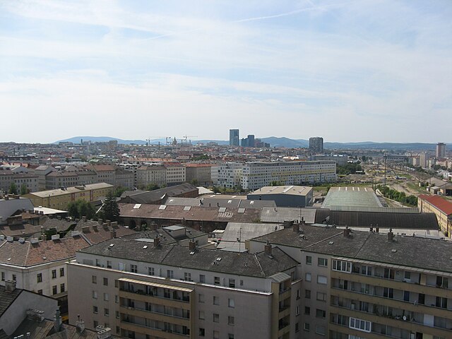
 Hiking in Vösendorf
Vösendorf, located just south of Vienna in Austria, is a charming town surrounded by nature, making it a great location for hiking enthusiasts. While Vösendorf itself may not be home to extensive hiking trails, it serves as a convenient gateway to several nearby hiking areas. Here are some key points to consider when hiking around Vösendorf:
Nearby Hiking Areas
-
Lainzer Tiergarten: Located just a short drive from Vösendorf, this former hunting ground is now a wildlife preserve with numerous trails. You can explore various paths that wind through beautiful forests, and you may encounter wildlife such as deer and wild boar.
-
Vienna Woods (Wienerwald): The Vienna Woods are a vast area of forest and rolling hills perfect for hiking. There are many marked trails ranging from easy to challenging, offering stunning views of the surroundings and the city of Vienna.
-
Rexhausenpark: If you're looking for a lighter hike or a nice stroll, Rexhausenpark offers trails that are more family-friendly and suitable for casual walkers.
Trail Information
- Difficulty Levels: Trails in the area offer a range of difficulties, making it accessible for beginners and experienced hikers alike.
- Length: The trails vary in length, allowing you to choose shorter walks or longer hikes depending on your energy and time constraints.
- Signage: Most trails are well-marked with signage, which makes it easy to navigate.
Tips for Hiking in Vösendorf:
- Weather Considerations: Check the weather forecast before heading out, as conditions can change rapidly, especially in wooded areas.
- Hydration and Snacks: Bring plenty of water and some snacks, especially if you plan on hiking longer distances.
- What to Wear: Dress in layers, wear sturdy hiking shoes, and consider bringing a light raincoat if the forecast indicates rain.
- Companions: Hiking with a friend or a group is advisable for safety and to enhance the experience.
- Wildlife Awareness: While encountering wildlife can be exciting, it's important to observe animals from a distance and respect their space.
Additional Attractions
After your hike, you might want to explore Vösendorf itself, which offers quaint streets, local shops, and nearby shopping centers like Shopping City Süd (SCS) for those looking to indulge in retail therapy.
Hiking in and around Vösendorf provides a great opportunity to enjoy the natural beauty of the region while also being close to the vibrant city life of Vienna.
- Country:

- Postal Code: 2331
- Local Dialing Code: 01
- Licence Plate Code: MD
- Coordinates: 48° 7' 0" N, 16° 20' 0" E


- GPS tracks (wikiloc): [Link]
- AboveSeaLevel: 194 м m
- Area: 10.49 sq km
- Population: 6990
- Web site: http://voesendorf.gv.at
- Wikipedia en: wiki(en)
- Wikipedia: wiki(de)
- Wikidata storage: Wikidata: Q661694
- Wikipedia Commons Category: [Link]
- Freebase ID: [/m/02qzjtl]
- GeoNames ID: Alt: [2762150]
- VIAF ID: Alt: [134965765]
- GND ID: Alt: [4494738-0]
- archINFORM location ID: [9957]
- Library of Congress authority ID: Alt: [n87893301]
- Austrian municipality key: [31723]
Shares border with regions:
Liesing
- 23. district of Vienna
Hiking in Liesing
Liesing is a district in Vienna, Austria, that is often known for its lush landscapes and access to nature. While Liesing itself is more urban, it’s also adjacent to several natural areas that offer great hiking opportunities. Here are some insights into hiking in and around Liesing:...
- Country:
- Postal Code: 1230
- Licence Plate Code: W
- Coordinates: 48° 8' 16" N, 16° 17' 4" E
- GPS tracks (wikiloc): [Link]
- AboveSeaLevel: 212 м m
- Area: 32.02 sq km
- Web site: [Link]
Hennersdorf
- municipality in Austria
Hiking in Hennersdorf
Hennersdorf bei Wien is a charming area located on the outskirts of Vienna, Austria, offering a wonderful setting for hiking enthusiasts. The region is characterized by its scenic landscapes, rolling hills, and access to natural parks, making it ideal for both casual walkers and more experienced hikers....
- Country:
- Postal Code: 2332
- Local Dialing Code: 02235
- Licence Plate Code: MD
- Coordinates: 48° 6' 42" N, 16° 21' 42" E
- GPS tracks (wikiloc): [Link]
- AboveSeaLevel: 183 м m
- Area: 5.48 sq km
- Population: 1541
- Web site: [Link]

Wiener Neudorf
- municipality in Austria
Hiking in Wiener Neudorf
Wiener Neudorf, located just south of Vienna in Austria, offers a beautiful backdrop for hiking enthusiasts. The region features a mix of scenic trails, ranging from easy walks to more challenging hikes, making it suitable for all levels of hikers....
- Country:
- Local Dialing Code: 02236
- Licence Plate Code: MD
- Coordinates: 48° 5' 8" N, 16° 18' 47" E
- GPS tracks (wikiloc): [Link]
- AboveSeaLevel: 205 м m
- Area: 6 sq km
- Population: 9405
- Web site: [Link]

Biedermannsdorf
- municipality in Austria
Hiking in Biedermannsdorf
Biedermannsdorf, located in Austria near Vienna, offers a range of outdoor activities, including hiking, due to its picturesque landscapes and proximity to nature reserves. While it may not have extensive and well-known hiking trails, there are several options for enjoying the scenic beauty of the area....
- Country:
- Postal Code: 2362
- Local Dialing Code: 02236
- Licence Plate Code: MD
- Coordinates: 48° 5' 0" N, 16° 20' 45" E
- GPS tracks (wikiloc): [Link]
- AboveSeaLevel: 185 м m
- Area: 8.94 sq km
- Population: 2988
- Web site: [Link]

Favoriten
- 10. district of Vienna
Hiking in Favoriten
Favoriten is the 10th district of Vienna, Austria, and while it is primarily known as an urban area, it offers some opportunities for hiking and outdoor activities. Here are a few points to consider if you're looking to hike in or near Favoriten:...
- Country:
- Postal Code: 1100
- Licence Plate Code: W
- Coordinates: 48° 9' 28" N, 16° 21' 33" E
- GPS tracks (wikiloc): [Link]
- AboveSeaLevel: 230 м m
- Area: 31.8 sq km
- Web site: [Link]

Brunn am Gebirge
- municipality in Austria
Hiking in Brunn am Gebirge
Brunn am Gebirge is a charming town situated in Lower Austria, just south of Vienna. It's often recognized for its scenic landscapes and proximity to the Wienerwald (Vienna Woods), making it a great spot for hiking enthusiasts. Here are some key points about hiking in and around Brunn am Gebirge:...
- Country:
- Postal Code: 2345
- Local Dialing Code: 02236
- Licence Plate Code: MD
- Coordinates: 48° 6' 25" N, 16° 17' 3" E
- GPS tracks (wikiloc): [Link]
- AboveSeaLevel: 221 м m
- Area: 7.26 sq km
- Population: 11864
- Web site: [Link]