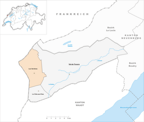
Val-de-Travers District (Bezirk Val-de-Travers)

- district in Switzerland
 Hiking in Val-de-Travers District
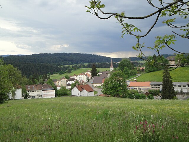
Val-de-Travers is a stunning region located in Switzerland's canton of Neuchâtel, known for its picturesque landscapes, rich history, and limestone formations. Hiking in this district offers a variety of trails suited for different skill levels, from leisurely walks to more challenging hikes.
Key Features of Hiking in Val-de-Travers:
-
Diverse Trails: The region boasts a network of marked trails that traverse lush forests, rolling hills, and breathtaking viewpoints overlooking the valleys. It is ideal for both casual walkers and seasoned hikers.
-
Natural Attractions: One of the highlights is the Creux du Van, a natural rock formation that offers panoramic views. The circular hike around this giant amphitheater is incredibly popular and provides the chance to see local wildlife, such as chamois and various bird species.
-
Cultural Heritage: Historical sites are abundant in Val-de-Travers. Many trails pass by charming villages, old farmhouses, and historical landmarks related to the area's watchmaking tradition and absinthe production.
-
Accessibility: The district is accessible by public transportation, making it easier for hikers to reach trailheads. The charming town of Travers serves as a good starting point for many hikes.
-
Seasonal Hiking: In addition to summer and fall hiking, winter hiking opportunities exist with snowshoe trails and designated winter paths. Spring brings vibrant wildflowers, adding to the visual appeal of hikes.
-
Practical Considerations: Always check the weather conditions before heading out, as they can change rapidly in mountainous areas. It’s a good idea to wear sturdy hiking boots and carry sufficient water, snacks, and a map or GPS.
Suggested Hikes:
- Creux du Van Loop: Approx. 12 km, offering stunning views and a chance to see wildlife.
- Les Échelles de la Mort: A more challenging route that showcases the dramatic landscape and historical significance.
Conclusion:
Hiking in Val-de-Travers lets you immerse yourself in nature while experiencing the local culture and history. Whether you’re looking for a short scenic walk or a day-long adventure, this Swiss district has something to offer every outdoor enthusiast. Don’t forget your camera to capture the stunning landscapes!
- Country:

- Capital: Val-de-Travers
- Licence Plate Code: NE
- Coordinates: 46° 54' 45" N, 6° 36' 45" E


- GPS tracks (wikiloc): [Link]
- AboveSeaLevel: 907 м m
- Area: 166.47 sq km
- Wikipedia en: wiki(en)
- Wikipedia: wiki(de)
- Wikidata storage: Wikidata: Q648339
- Wikipedia Commons Category: [Link]
- Freebase ID: [/m/0bmjlf8]
- GeoNames ID: Alt: [6458835]
- GND ID: Alt: [4062275-7]
Includes regions:

La Côte-aux-Fées
- municipality in Switzerland
Hiking in La Côte-aux-Fées
La Côte-aux-Fées, located in the Jura region of Switzerland, is a beautiful area known for its stunning natural landscapes and well-maintained hiking trails. Here are some key points to consider if you're thinking about hiking in this region:...
- Country:
- Postal Code: 2117
- Local Dialing Code: 032
- Licence Plate Code: NE
- Coordinates: 46° 51' 47" N, 6° 29' 15" E
- GPS tracks (wikiloc): [Link]
- AboveSeaLevel: 1039 м m
- Area: 12.85 sq km
- Population: 435
- Web site: [Link]

Les Verrières
- municipality in Switzerland
Hiking in Les Verrières
Les Verrières, located in the picturesque Jura Mountains of Switzerland, is a delightful destination for hiking enthusiasts. The area is characterized by stunning landscapes, including rolling hills, dense forests, and panoramic vistas, making it a fantastic spot for outdoor activities....
- Country:
- Postal Code: 2126
- Local Dialing Code: 032
- Licence Plate Code: NE
- Coordinates: 46° 54' 54" N, 6° 28' 30" E
- GPS tracks (wikiloc): [Link]
- AboveSeaLevel: 1105 м m
- Area: 28.68 sq km
- Population: 718
- Web site: [Link]


Val-de-Travers
- municipality in the canton of Neuchâtel, Switzerland
Hiking in Val-de-Travers
Val-de-Travers is a beautiful region located in the canton of Neuchâtel, Switzerland. Known for its stunning landscapes, rich natural heritage, and historical significance, it offers various hiking opportunities for all levels of hikers. Here’s an overview:...
- Country:
- Postal Code: 2103, 2105, 2108, 2112, 2113, 2114, 2115, 2123, 2127
- Licence Plate Code: NE
- Coordinates: 46° 54' 0" N, 6° 36' 0" E
- GPS tracks (wikiloc): [Link]
- AboveSeaLevel: 737 м m
- Area: 124.94 sq km
- Population: 10745
- Web site: [Link]