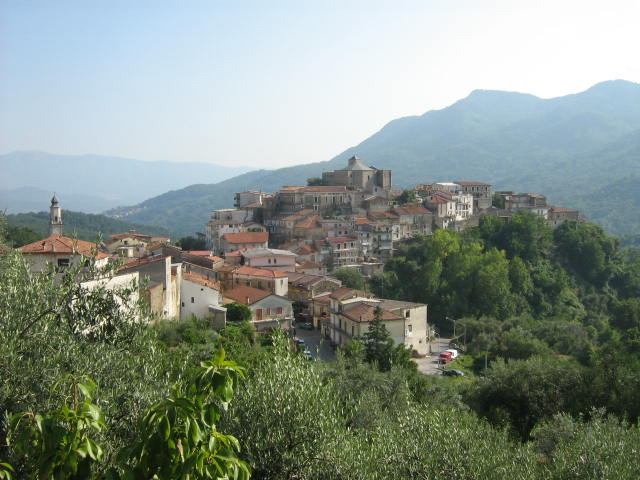
Valle dell'Angelo (Valle dell'Angelo)

- Italian comune
 Hiking in Valle dell'Angelo
Valle dell'Angelo is a beautiful and less-visited destination in the Campania region of Italy, known for its stunning landscapes, rich natural resources, and charming villages. The area offers a variety of hiking opportunities that allow you to explore its natural beauty, including hills, valleys, and pristine rivers.
Hiking Trails
-
Sentiero degli Dei (Path of the Gods): While this trail is not directly in Valle dell'Angelo, it is relatively close and worth mentioning. This renowned trail offers breathtaking views of the Amalfi Coast and is an excellent choice for hikers looking for a memorable experience.
-
Local Trails: Valle dell'Angelo has numerous local trails that vary in difficulty, some leading to panoramic viewpoints, while others traverse through ancient woodlands or follow river pathways. Be sure to seek local maps or guides to find the best routes suited for your hiking level.
-
Cerro di Valle dell'Angelo: A hike to the top of this hill provides a rewarding view of the surrounding valleys and mountains. The route is moderately challenging but manageable for most hikers.
Preparation and Tips
-
When to Go: The best time for hiking in Valle dell'Angelo is during spring (April to June) and fall (September to October), when temperatures are more mild and the landscape is vibrant.
-
Gear: Wear appropriate footwear, such as sturdy hiking boots, and dress in layers. A good backpack, enough water, snacks, and a first-aid kit are also advisable.
-
Guided Tours: Consider hiring a local guide if you're unfamiliar with the area. They can provide insights into the local flora and fauna and enhance your experience with their knowledge of the region.
-
Respect Nature: Always follow the Leave No Trace principles. Stay on marked trails, and be mindful of wildlife and vegetation.
Attractions Nearby
After a day of hiking, explore the local culture and cuisine in Valle dell'Angelo. Visit small restaurants serving traditional dishes made from local ingredients, and enjoy the warm hospitality of the locals.
In summary, hiking in Valle dell'Angelo is a rewarding experience for nature lovers and adventure seekers alike. With its scenic trails and picturesque settings, it provides an incredible opportunity to immerse yourself in the beauty of Southern Italy.
- Country:

- Postal Code: 84070
- Local Dialing Code: 0974
- Licence Plate Code: SA
- Coordinates: 40° 20' 41" N, 15° 22' 9" E


- GPS tracks (wikiloc): [Link]
- AboveSeaLevel: 620 м m
- Area: 36.6 sq km
- Population: 231
- Web site: http://www.comune.vallemosso.bi.it
- Wikipedia en: wiki(en)
- Wikipedia: wiki(it)
- Wikidata storage: Wikidata: Q81782
- Wikipedia Commons Category: [Link]
- Freebase ID: [/m/0frh24]
- GeoNames ID: Alt: [6542096]
- OSM relation ID: [40390]
- ISTAT ID: 065153
- Italian cadastre code: G540
Shares border with regions:


Laurino
- Italian comune
Hiking in Laurino
Laurino is a charming village located in the Cilento region of Campania, Italy, known for its stunning natural landscapes and rich cultural heritage. Hiking in and around Laurino offers a variety of beautiful trails that cater to different skill levels, allowing you to explore the diverse terrain, including valleys, hills, and forests....
- Country:
- Postal Code: 84057
- Local Dialing Code: 0974
- Licence Plate Code: SA
- Coordinates: 40° 20' 0" N, 15° 20' 0" E
- GPS tracks (wikiloc): [Link]
- AboveSeaLevel: 531 м m
- Area: 70.46 sq km
- Population: 1475
- Web site: [Link]


Piaggine
- Italian comune
Hiking in Piaggine
Piaggine is a charming town located in the Campania region of southern Italy, nestled in the heart of the Cilento and Vallo di Diano National Park. This area is known for its stunning natural beauty, rich biodiversity, and a variety of hiking trails suitable for different skill levels. Here are some key highlights and tips for hiking in and around Piaggine:...
- Country:
- Postal Code: 84065
- Local Dialing Code: 0974
- Licence Plate Code: SA
- Coordinates: 40° 21' 0" N, 15° 23' 0" E
- GPS tracks (wikiloc): [Link]
- AboveSeaLevel: 630 м m
- Area: 62.77 sq km
- Population: 1773
- Web site: [Link]

Rofrano
- Italian comune
Hiking in Rofrano
Rofrano, a picturesque village in the Campania region of southern Italy, is surrounded by the stunning landscapes of the Cilento and Vallo di Diano National Park. This area is rich in natural beauty, offering a variety of hiking opportunities suitable for different skill levels....
- Country:
- Postal Code: 84070
- Local Dialing Code: 0974
- Licence Plate Code: SA
- Coordinates: 40° 13' 0" N, 15° 26' 0" E
- GPS tracks (wikiloc): [Link]
- AboveSeaLevel: 450 м m
- Area: 63.59 sq km
- Population: 1509
- Web site: [Link]


Sanza
- Italian comune
Hiking in Sanza
Sanza is a beautiful destination for hiking enthusiasts, situated in the province of Salerno in southern Italy's Campania region. It offers a striking landscape with mountains, forests, and natural scenery that caters to a range of hiking abilities, from beginners to seasoned trekkers. Here are some highlights about hiking in Sanza:...
- Country:
- Postal Code: 84030
- Local Dialing Code: 0975
- Licence Plate Code: SA
- Coordinates: 40° 15' 0" N, 15° 33' 0" E
- GPS tracks (wikiloc): [Link]
- AboveSeaLevel: 558 м m
- Area: 128.75 sq km
- Population: 2565
- Web site: [Link]