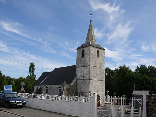
Vaudringhem (Vaudringhem)

- commune in Pas-de-Calais, France
- Country:

- Postal Code: 62380
- Coordinates: 50° 39' 44" N, 2° 1' 42" E


- GPS tracks (wikiloc): [Link]
- Area: 7.61 sq km
- Population: 533
- Web site: http://www.vaudringhem.fr/
- Wikipedia en: wiki(en)
- Wikipedia: wiki(fr)
- Wikidata storage: Wikidata: Q876709
- Wikipedia Commons Category: [Link]
- Freebase ID: [/m/03c3nb3]
- GeoNames ID: Alt: [6439931]
- SIREN number: [216208371]
- BnF ID: [152692783]
- OSM relation ID: [1216407]
- INSEE municipality code: 62837
Shares border with regions:


Nielles-lès-Bléquin
- commune in Pas-de-Calais, France
- Country:
- Postal Code: 62380
- Coordinates: 50° 40' 27" N, 2° 1' 55" E
- GPS tracks (wikiloc): [Link]
- Area: 12.72 sq km
- Population: 833
- Web site: [Link]
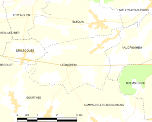
Ledinghem
- commune in Pas-de-Calais, France
- Country:
- Postal Code: 62380
- Coordinates: 50° 39' 13" N, 1° 59' 32" E
- GPS tracks (wikiloc): [Link]
- Area: 8.68 sq km
- Population: 332


Thiembronne
- commune in Pas-de-Calais, France
- Country:
- Postal Code: 62560
- Coordinates: 50° 37' 14" N, 2° 3' 27" E
- GPS tracks (wikiloc): [Link]
- Area: 22.82 sq km
- Population: 864
- Web site: [Link]


Wismes
- commune in Pas-de-Calais, France
- Country:
- Postal Code: 62380
- Coordinates: 50° 39' 15" N, 2° 4' 17" E
- GPS tracks (wikiloc): [Link]
- Area: 11.93 sq km
- Population: 475
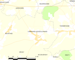
Campagne-lès-Boulonnais
- commune in Pas-de-Calais, France
- Country:
- Postal Code: 62650
- Coordinates: 50° 36' 46" N, 1° 59' 51" E
- GPS tracks (wikiloc): [Link]
- Area: 13.28 sq km
- Population: 595