Venette (Venette)

- commune in Oise, France
- Country:

- Postal Code: 60200
- Coordinates: 49° 24' 56" N, 2° 47' 59" E


- GPS tracks (wikiloc): [Link]
- AboveSeaLevel: 34 м m
- Area: 8.45 sq km
- Population: 2817
- Web site: http://www.venette.fr/
- Wikipedia en: wiki(en)
- Wikipedia: wiki(fr)
- Wikidata storage: Wikidata: Q1332487
- Wikipedia Commons Category: [Link]
- Freebase ID: [/m/03qg90h]
- GeoNames ID: Alt: [6439022]
- SIREN number: [216006569]
- BnF ID: [15267898w]
- INSEE municipality code: 60665
Shares border with regions:


Lachelle
- commune in Oise, France
- Country:
- Postal Code: 60190
- Coordinates: 49° 26' 39" N, 2° 44' 5" E
- GPS tracks (wikiloc): [Link]
- Area: 9.07 sq km
- Population: 639
- Web site: [Link]


Jaux
- commune in Oise, France
- Country:
- Postal Code: 60880
- Coordinates: 49° 23' 22" N, 2° 46' 34" E
- GPS tracks (wikiloc): [Link]
- Area: 8.63 sq km
- Population: 2564
- Web site: [Link]
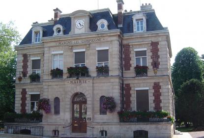

Margny-lès-Compiègne
- commune in Oise, France
- Country:
- Postal Code: 60280
- Coordinates: 49° 25' 34" N, 2° 49' 15" E
- GPS tracks (wikiloc): [Link]
- Area: 6.66 sq km
- Population: 8109
- Web site: [Link]

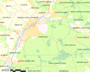
Compiègne
- commune in Oise, France
- Country:
- Postal Code: 60200
- Coordinates: 49° 24' 51" N, 2° 49' 20" E
- GPS tracks (wikiloc): [Link]
- AboveSeaLevel: 41 м m
- Area: 53.1 sq km
- Population: 40200
- Web site: [Link]