Vergezac (Vergezac)

- commune in Haute-Loire, France
- Country:

- Postal Code: 43320
- Coordinates: 45° 2' 0" N, 3° 43' 36" E


- GPS tracks (wikiloc): [Link]
- Area: 20.31 sq km
- Population: 475
- Wikipedia en: wiki(en)
- Wikipedia: wiki(fr)
- Wikidata storage: Wikidata: Q1322941
- Wikipedia Commons Category: [Link]
- Freebase ID: [/m/03ntpwk]
- GeoNames ID: Alt: [6434467]
- SIREN number: [214302572]
- BnF ID: [152601581]
- PACTOLS thesaurus ID: [pcrtFwmUjznLbm]
- INSEE municipality code: 43257
Shares border with regions:


Chaspuzac
- commune in Haute-Loire, France
- Country:
- Postal Code: 43320
- Coordinates: 45° 4' 5" N, 3° 44' 57" E
- GPS tracks (wikiloc): [Link]
- Area: 9.77 sq km
- Population: 767


Sanssac-l'Église
- commune in Haute-Loire, France
- Country:
- Postal Code: 43320
- Coordinates: 45° 3' 6" N, 3° 46' 44" E
- GPS tracks (wikiloc): [Link]
- Area: 15.28 sq km
- Population: 1155

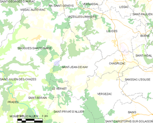
Saint-Jean-de-Nay
- commune in Haute-Loire, France
- Country:
- Postal Code: 43320
- Coordinates: 45° 4' 8" N, 3° 41' 47" E
- GPS tracks (wikiloc): [Link]
- Area: 28.26 sq km
- Population: 361


Bains
- commune in Haute-Loire, France
- Country:
- Postal Code: 43370
- Coordinates: 45° 0' 34" N, 3° 46' 30" E
- GPS tracks (wikiloc): [Link]
- Area: 37.56 sq km
- Population: 1328


Saint-Privat-d'Allier
- former commune in Haute-Loire, France
- Country:
- Postal Code: 43580
- Coordinates: 44° 59' 25" N, 3° 40' 44" E
- GPS tracks (wikiloc): [Link]
- Area: 29.96 sq km
- Population: 383