Veyrac (Veyrac)

- commune in Haute-Vienne, France
- Country:

- Postal Code: 87520
- Coordinates: 45° 53' 46" N, 1° 6' 21" E


- GPS tracks (wikiloc): [Link]
- Area: 33.7 sq km
- Population: 2043
- Web site: http://www.veyrac.fr
- Wikipedia en: wiki(en)
- Wikipedia: wiki(fr)
- Wikidata storage: Wikidata: Q595032
- Wikipedia Commons Category: [Link]
- Freebase ID: [/m/03nv1jq]
- GeoNames ID: Alt: [6445480]
- SIREN number: [218720209]
- BnF ID: [15278925d]
- WOEID: [631018]
- INSEE municipality code: 87202
Shares border with regions:


Saint-Gence
- commune in Haute-Vienne, France
- Country:
- Postal Code: 87510
- Coordinates: 45° 55' 18" N, 1° 8' 16" E
- GPS tracks (wikiloc): [Link]
- Area: 21.77 sq km
- Population: 2093

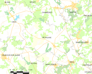
Peyrilhac
- commune in Haute-Vienne, France
- Country:
- Postal Code: 87510
- Coordinates: 45° 56' 59" N, 1° 8' 9" E
- GPS tracks (wikiloc): [Link]
- Area: 38.63 sq km
- Population: 1257


Oradour-sur-Glane
- commune in Haute-Vienne, France
- Country:
- Postal Code: 87520
- Coordinates: 45° 55' 55" N, 1° 1' 54" E
- GPS tracks (wikiloc): [Link]
- AboveSeaLevel: 285 м m
- Area: 38.16 sq km
- Population: 2516
- Web site: [Link]


Verneuil-sur-Vienne
- commune in Haute-Vienne, France
- Country:
- Postal Code: 87430
- Coordinates: 45° 50' 56" N, 1° 7' 36" E
- GPS tracks (wikiloc): [Link]
- Area: 34.52 sq km
- Population: 4790
- Web site: [Link]


Saint-Victurnien
- commune in Haute-Vienne, France
- Country:
- Postal Code: 87420
- Coordinates: 45° 52' 40" N, 1° 0' 48" E
- GPS tracks (wikiloc): [Link]
- Area: 21.04 sq km
- Population: 1739