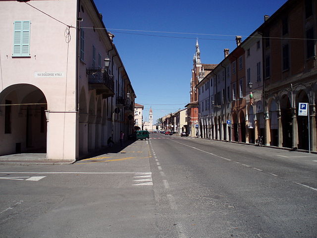
Villanova sull'Arda (Villanova sull'Arda)
.svg)
- Italian comune
 Hiking in Villanova sull'Arda
Villanova sull'Arda is a small town located in the Emilia-Romagna region of northern Italy, and while it may not be as widely recognized as some other hiking destinations, it offers opportunities for those looking to explore the beautiful Italian countryside. Here’s a guide to help you enjoy hiking in the area:
Scenic Trails
-
Local Countryside: The landscape around Villanova sull'Arda features rolling hills, farmland, and picturesque views typical of the Emilia-Romagna region. Hiking through these areas can provide you with serene environments and a glimpse into rural Italian life.
-
Nature Reserves: Explore nearby nature reserves or parks, as these areas may have designated trails for hikers of all levels. Check local resources for maps and information on any trails that might be available.
-
Historical Trails: The area is rich in history, so keep an eye out for trails that also take you past historical sites such as old castles, churches, and other landmarks.
Preparation
- Footwear: Wear sturdy hiking boots to navigate uneven terrain.
- Weather: Check local weather conditions before heading out, as they can change rapidly.
- Gear: Bring a backpack with water, snacks, a first-aid kit, and a map or GPS for navigation.
- Local Guidelines: Be mindful of any local regulations or guidelines, as some areas may have restrictions on where you can hike.
Recommendations
- Local Guides: If you're unfamiliar with the area, consider hiring a local guide who can provide insights into the best trails and hidden gems.
- Cultural Experience: After your hike, make sure to sample local cuisine in Villanova sull'Arda. The region is known for its delicious food, and enjoying a meal can be a rewarding way to conclude your hiking adventure.
Tips
- Always inform someone about your hiking plans.
- Stay on marked trails to avoid getting lost and to protect the environment.
- Take your time to enjoy the natural beauty and unique scenery that the region has to offer.
With careful planning and consideration of the area’s natural beauty, your hiking experience in Villanova sull'Arda can be both enjoyable and memorable!
- Country:

- Postal Code: 29010
- Local Dialing Code: 0523
- Licence Plate Code: PC
- Coordinates: 45° 2' 0" N, 10° 0' 0" E


- GPS tracks (wikiloc): [Link]
- AboveSeaLevel: 42 м m
- Area: 36.57 sq km
- Population: 1728
- Web site: http://www.comune.villanovatulo.ca.it
- Wikipedia en: wiki(en)
- Wikipedia: wiki(it)
- Wikidata storage: Wikidata: Q103015
- Wikipedia Commons Category: [Link]
- Freebase ID: [/m/0gkdb4]
- GeoNames ID: Alt: [6540246]
- VIAF ID: Alt: [247829780]
- OSM relation ID: [43973]
- UN/LOCODE: [ITVSA]
- ISTAT ID: 033046
- Italian cadastre code: L980
Shares border with regions:


Busseto
- Italian comune
Hiking in Busseto
Busseto, a charming town in the Emilia-Romagna region of Italy, is known for its rich musical heritage, particularly associated with the composer Giuseppe Verdi. While Busseto itself is not primarily recognized as a hiking destination, it is surrounded by beautiful landscapes that offer opportunities for outdoor activities, including hiking....
- Country:
- Postal Code: 43011
- Local Dialing Code: 0524
- Licence Plate Code: PR
- Coordinates: 44° 58' 46" N, 10° 2' 36" E
- GPS tracks (wikiloc): [Link]
- AboveSeaLevel: 40 м m
- Area: 76.59 sq km
- Population: 6939
- Web site: [Link]
Besenzone
- Italian comune
Hiking in Besenzone
Besenzone is a small town in the province of Piacenza, located in the Emilia-Romagna region of Italy. The surrounding area is characterized by beautiful landscapes, rolling hills, and a mix of agricultural land and natural beauty, making it an appealing destination for hiking enthusiasts....
- Country:
- Postal Code: 29010
- Local Dialing Code: 0523
- Licence Plate Code: PC
- Coordinates: 44° 59' 0" N, 9° 57' 0" E
- GPS tracks (wikiloc): [Link]
- AboveSeaLevel: 48 м m
- Area: 23.95 sq km
- Population: 953
- Web site: [Link]


Castelvetro Piacentino
- Italian comune
Hiking in Castelvetro Piacentino
Castelvetro Piacentino is a charming town located in the Emilia-Romagna region of Italy, and it offers a variety of outdoor activities, including hiking. The surrounding area features scenic landscapes with rolling hills, vineyards, and beautiful countryside views that make for a pleasant hiking experience. Here are some highlights for hiking in and around Castelvetro Piacentino:...
- Country:
- Postal Code: 29010
- Local Dialing Code: 0523
- Licence Plate Code: PC
- Coordinates: 45° 6' 0" N, 9° 59' 0" E
- GPS tracks (wikiloc): [Link]
- AboveSeaLevel: 39 м m
- Area: 35.06 sq km
- Population: 5331
- Web site: [Link]

Cortemaggiore
- Italian comune
Hiking in Cortemaggiore
Cortemaggiore, a charming town in Italy's Emilia-Romagna region, offers a unique blend of history and natural beauty, though it may not be as widely recognized as some other hiking destinations. Here are some insights about hiking in and around Cortemaggiore:...
- Country:
- Postal Code: 29016
- Local Dialing Code: 0523
- Licence Plate Code: PC
- Coordinates: 45° 0' 0" N, 9° 56' 0" E
- GPS tracks (wikiloc): [Link]
- AboveSeaLevel: 50 м m
- Area: 36.47 sq km
- Population: 4679
- Web site: [Link]
Monticelli d'Ongina
- Italian comune
Hiking in Monticelli d'Ongina
Monticelli d'Ongina, located in the Emilia-Romagna region of Italy, is a charming small town that is not primarily known as a hiking destination. However, it is situated near the beautiful Po River and surrounded by a picturesque landscape that offers opportunities for outdoor activities, including hiking....
- Country:
- Postal Code: 29010
- Local Dialing Code: 0523
- Licence Plate Code: PC
- Coordinates: 45° 5' 0" N, 9° 56' 0" E
- GPS tracks (wikiloc): [Link]
- AboveSeaLevel: 40 м m
- Area: 46.33 sq km
- Population: 5287
- Web site: [Link]
San Pietro in Cerro
- Italian comune
Hiking in San Pietro in Cerro
San Pietro in Cerro is a charming little area in the Emilia-Romagna region of Italy, surrounded by beautiful landscapes that can make for some delightful hiking experiences. While it may not be as famous as some Italian hiking destinations, it does offer opportunities for those looking to explore rural Italy, enjoy nature, and discover local culture....
- Country:
- Postal Code: 29010
- Local Dialing Code: 0523
- Licence Plate Code: PC
- Coordinates: 45° 1' 0" N, 9° 57' 0" E
- GPS tracks (wikiloc): [Link]
- AboveSeaLevel: 44 м m
- Area: 27.35 sq km
- Population: 835
- Web site: [Link]
Stagno Lombardo
- Italian comune
Hiking in Stagno Lombardo
Stagno Lombardo, located in the Lombardy region of northern Italy, offers a variety of outdoor activities, including hiking, thanks to its scenic landscapes and rich natural beauty. While it might not be as famous as some other hiking destinations in Lombardy, it can still provide a great experience for those looking to explore the countryside and enjoy nature....
- Country:
- Postal Code: 26049
- Local Dialing Code: 0372
- Licence Plate Code: CR
- Coordinates: 45° 4' 0" N, 10° 5' 0" E
- GPS tracks (wikiloc): [Link]
- AboveSeaLevel: 36 м m
- Area: 40.2 sq km
- Population: 1550
- Web site: [Link]