Voingt (Voingt)

- commune in Puy-de-Dôme, France
- Country:

- Postal Code: 63620
- Coordinates: 45° 48' 23" N, 2° 32' 12" E


- GPS tracks (wikiloc): [Link]
- Area: 6.48 sq km
- Population: 38
- Wikipedia en: wiki(en)
- Wikipedia: wiki(fr)
- Wikidata storage: Wikidata: Q540806
- Wikipedia Commons Category: [Link]
- Freebase ID: [/m/03ql5r9]
- GeoNames ID: Alt: [6440277]
- SIREN number: [216304675]
- BnF ID: [15269817j]
- PACTOLS thesaurus ID: [pcrt1r0RRKmoc4]
- INSEE municipality code: 63467
Shares border with regions:

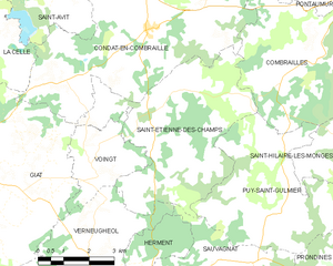
Saint-Étienne-des-Champs
- commune in Puy-de-Dôme, France
- Country:
- Postal Code: 63380
- Coordinates: 45° 49' 49" N, 2° 34' 34" E
- GPS tracks (wikiloc): [Link]
- Area: 23.74 sq km
- Population: 140


Giat
- commune in Puy-de-Dôme, France
- Country:
- Postal Code: 63620
- Coordinates: 45° 48' 7" N, 2° 28' 3" E
- GPS tracks (wikiloc): [Link]
- Area: 47.95 sq km
- Population: 829


Verneugheol
- commune in Puy-de-Dôme, France
- Country:
- Postal Code: 63470
- Coordinates: 45° 46' 7" N, 2° 32' 10" E
- GPS tracks (wikiloc): [Link]
- Area: 34.14 sq km
- Population: 244