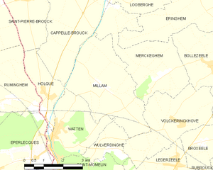
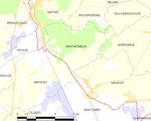
Watten (Watten)
- commune in Nord, France
- Country:

- Postal Code: 59143
- Coordinates: 50° 49' 59" N, 2° 12' 45" E


- GPS tracks (wikiloc): [Link]
- Area: 7.32 sq km
- Population: 2549
- Web site: http://www.watten.fr
- Wikipedia en: wiki(en)
- Wikipedia: wiki(fr)
- Wikidata storage: Wikidata: Q742424
- Wikipedia Commons Category: [Link]
- Freebase ID: [/m/06w8c5]
- Freebase ID: [/m/06w8c5]
- GeoNames ID: Alt: [6438567]
- GeoNames ID: Alt: [6438567]
- SIREN number: [215906470]
- SIREN number: [215906470]
- BnF ID: [15267217d]
- BnF ID: [15267217d]
- Twitter username: Alt: [VilleWatten]
- Twitter username: Alt: [VilleWatten]
- YouTube channel ID: [UCyoFGHa_nU4KNfRkT0Dy1QA]
- YouTube channel ID: [UCyoFGHa_nU4KNfRkT0Dy1QA]
- INSEE municipality code: 59647
- INSEE municipality code: 59647
Shares border with regions:


Serques
- commune in Pas-de-Calais, France
- Country:

- Postal Code: 62910
- Coordinates: 50° 47' 38" N, 2° 12' 4" E


- GPS tracks (wikiloc): [Link]
- Area: 10.43 sq km
- Population: 1146
- Web site: [Link]


Houlle
- commune in Pas-de-Calais, France
- Country:

- Postal Code: 62910
- Coordinates: 50° 47' 46" N, 2° 10' 22" E


- GPS tracks (wikiloc): [Link]
- Area: 6.52 sq km
- Population: 1087
- Web site: [Link]


Cappelle-Brouck
- commune in Nord, France
- Country:

- Postal Code: 59630
- Coordinates: 50° 54' 7" N, 2° 13' 20" E


- GPS tracks (wikiloc): [Link]
- Area: 17.55 sq km
- Population: 1155


Éperlecques
- commune in Pas-de-Calais, France
- Country:

- Postal Code: 62910
- Coordinates: 50° 48' 23" N, 2° 9' 6" E


- GPS tracks (wikiloc): [Link]
- Area: 25.56 sq km
- Population: 3524
- Web site: [Link]


Holque
- commune in Nord, France
- Country:

- Postal Code: 59143
- Coordinates: 50° 51' 15" N, 2° 12' 11" E


- GPS tracks (wikiloc): [Link]
- Area: 3.81 sq km
- Population: 901


Wulverdinghe
- commune in Nord, France
- Country:

- Postal Code: 59143
- Coordinates: 50° 49' 54" N, 2° 15' 20" E


- GPS tracks (wikiloc): [Link]
- Area: 2.92 sq km
- Population: 314


Millam
- commune in Nord, France
- Country:

- Postal Code: 59143
- Coordinates: 50° 51' 21" N, 2° 14' 54" E


- GPS tracks (wikiloc): [Link]
- Area: 12.44 sq km
- Population: 806


Saint-Momelin
- commune in Nord, France
- Country:

- Postal Code: 59143
- Coordinates: 50° 47' 37" N, 2° 15' 3" E


- GPS tracks (wikiloc): [Link]
- Area: 6 sq km
- Population: 474
