
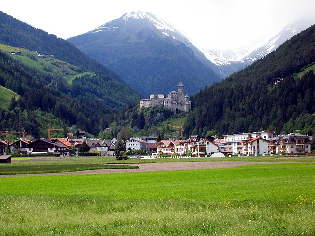
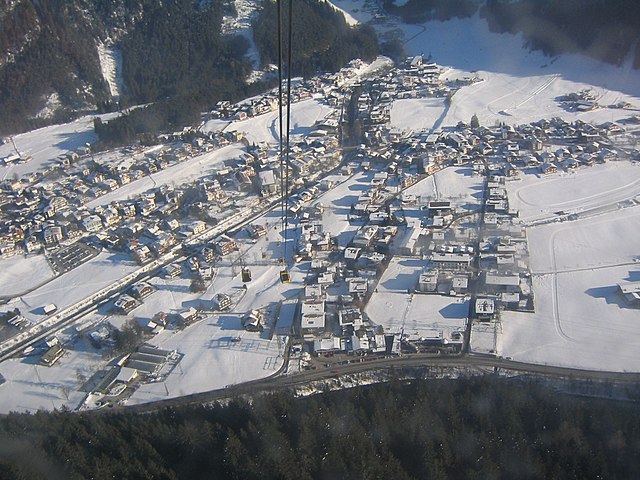
Валле-Аурина (Ahrntal, Valle Aurina)
.svg)
- коммуна в Италии
 Hiking in Валле-Аурина
Ahrntal, also known as the Aurina Valley, is a stunning destination for hiking enthusiasts located in the South Tyrol region of northern Italy. Nestled in the Zillertal Alps, this area is characterized by its breathtaking landscapes, towering peaks, lush meadows, and pristine valleys.
Key Features of Hiking in Ahrntal:
-
Diverse Trail Options: Ahrntal offers a wide range of hiking trails suitable for all levels, from gentle walks through meadows and forests to challenging alpine routes that lead to mountain summits. Popular hikes include the paths around the Klausberg and Speikboden ski areas.
-
Scenic Beauty: The region is renowned for its stunning natural scenery, including alpine lakes, waterfalls, and panoramic views of the surrounding mountains. The Ahr River flows through the valley, adding to the picturesque backdrop.
-
Cultural Landmarks: Along many hiking trails, you can discover traditional Tyrolean architecture, charming villages, and historic churches. The area is rich in culture and history, offering a glimpse into the local way of life.
-
Wildlife Observation: Ahrntal is home to a variety of wildlife, including chamois, marmots, and a rich diversity of bird species. Hikers often have opportunities to observe these animals in their natural habitats.
-
Alpine Huts and Refreshments: Many trails lead to alpine huts where you can enjoy traditional Tyrolean cuisine and local specialties. These stopovers are perfect for taking a break and enjoying the stunning vistas.
-
Seasonal Variations: Hiking is popular in the summer months, but the area also offers winter hiking options with snowshoeing trails and winter walks where the landscape transforms into a winter wonderland.
Essential Tips for Hiking in Ahrntal:
-
Check Trail Conditions: Before heading out, check the latest trail conditions and weather forecasts. Some trails may be affected by snow or maintenance.
-
Stay Hydrated: Always carry enough water and snacks to keep your energy up during hikes.
-
Proper Gear: Wear sturdy footwear suitable for the terrain, and dress in layers to adapt to changing weather conditions.
-
Respect Nature: Follow the Leave No Trace principles to preserve the natural beauty of this stunning valley.
-
Local Guides: If you're unfamiliar with mountain hiking, consider hiring a local guide who can provide insights and ensure safety while exploring the area.
Ahrntal is a hidden gem for hikers looking for a blend of adventure, natural beauty, and cultural experiences. Whether you're an experienced hiker or a beginner, you're sure to find an unforgettable experience in this beautiful alpine valley!
- Страна:

- Почтовый код: 39030
- Телефонный код: 0474
- Код автомобильного номера: BZ
- Координаты: 46° 59' 49" N, 11° 58' 49" E


- GPS треки (wikiloc): [Ссылка]
- Высота над уровнем моря: 1054 м m
- Площадь: 187.89 кв.км
- Население: 5991
- Веб сайт: http://www.gemeinde-ahrntal.net
- Википедия русская: wiki(ru)
- Википедия английская: wiki(en)
- Википедия национальная: wiki(it)
- Хранилище Wikidata: Wikidata: Q402903
- Галерея изображений в википедии: [Ссылка]
- Катеория в википедии: [Ссылка]
- код Freebase: [/m/0g9kws]
- код GeoNames: Альт: [6536019]
- код VIAF: Альт: [315528561]
- ID отношения в OpenStreetMap: [47338]
- код GND: Альт: [4079646-2]
- идентификатор местоположения ArchINFORM: [10189]
- UN/LOCODE: [ITVEU]
- код ISTAT: 021108
- кадастровый код Италии: L595
Граничит с регионами:

Кампо-Турес
- коммуна Италии
Hiking in Кампо-Турес
Sand in Taufers, or Campo Tures as it is known in Italian, is a picturesque village located in the Ahrntal Valley in South Tyrol, Italy. It's renowned for its stunning natural scenery, rich cultural heritage, and a variety of outdoor activities, particularly hiking. Here are some key points about hiking in this beautiful region:...
- Страна:
- Почтовый код: 39032
- Телефонный код: 0474
- Код автомобильного номера: BZ
- Координаты: 46° 54' 30" N, 11° 57' 37" E
- GPS треки (wikiloc): [Ссылка]
- Высота над уровнем моря: 864 м m
- Площадь: 163.98 кв.км
- Население: 5430
- Веб сайт: [Ссылка]


Предой
- коммуна в Италии
Hiking in Предой
Prettau, located in the Ahrntal Valley of South Tyrol, Italy, is a fantastic destination for hiking enthusiasts. The area offers breathtaking landscapes, including majestic mountains, lush valleys, and crystal-clear streams. Here are some highlights for hiking in Prettau:...
- Страна:
- Почтовый код: 39030
- Телефонный код: 0474
- Код автомобильного номера: BZ
- Координаты: 47° 2' 25" N, 12° 6' 24" E
- GPS треки (wikiloc): [Ссылка]
- Высота над уровнем моря: 1475 м m
- Площадь: 86.36 кв.км
- Население: 547
- Веб сайт: [Ссылка]

Сельва-дей-Молини
- коммуна в Италии
Hiking in Сельва-дей-Молини
Mühlwald, located in South Tyrol, Italy, offers beautiful hiking opportunities set against a stunning backdrop of the Eastern Alps. The region is known for its lush landscapes, diverse flora and fauna, and well-marked trails that cater to various skill levels, from easy walks to challenging mountain hikes. Here are some highlights of hiking in Mühlwald:...
- Страна:
- Почтовый код: 39030
- Телефонный код: 0474
- Код автомобильного номера: BZ
- Координаты: 46° 53' 25" N, 11° 51' 30" E
- GPS треки (wikiloc): [Ссылка]
- Высота над уровнем моря: 1229 м m
- Площадь: 104.79 кв.км
- Население: 1437
- Веб сайт: [Ссылка]
Майрхофен
Hiking in Майрхофен
Mayrhofen, located in the Zillertal Valley of Austria, is a fantastic destination for hiking enthusiasts. Nestled within the stunning Tyrolean Alps, it offers a wide variety of trails that cater to different skill levels, from beginners to experienced hikers. Here's what you can expect when hiking in and around Mayrhofen:...
- Страна:

- Почтовый код: 6290
- Телефонный код: 05285
- Код автомобильного номера: SZ
- Координаты: 47° 10' 0" N, 11° 52' 0" E
- GPS треки (wikiloc): [Ссылка]
- Высота над уровнем моря: 633 м m
- Площадь: 178.8 кв.км
- Население: 3858
- Веб сайт: [Ссылка]

Финкенберг
Hiking in Финкенберг
Finkenberg is a picturesque village located in the Zillertal Valley of Tyrol, Austria, known for its stunning alpine scenery and a variety of hiking opportunities. Here are some key points about hiking in Finkenberg:...
- Страна:
- Почтовый код: 6292
- Телефонный код: 05285
- Код автомобильного номера: SZ
- Координаты: 47° 9' 10" N, 11° 49' 18" E
- GPS треки (wikiloc): [Ссылка]
- Высота над уровнем моря: 839 м m
- Площадь: 171.6 кв.км
- Население: 1421
- Веб сайт: [Ссылка]

Брандберг
Hiking in Брандберг
Brandberg, located in the Tyrolean region of Austria, is known for its stunning landscapes and diverse hiking opportunities. This area is nestled within the majestic Alps, offering hikers a mix of alpine meadows, rugged mountains, and picturesque valleys. Here's what you can expect when hiking in Brandberg:...
- Страна:
- Почтовый код: 6290
- Телефонный код: 05285
- Код автомобильного номера: SZ
- Координаты: 47° 10' 0" N, 11° 54' 0" E
- GPS треки (wikiloc): [Ссылка]
- Высота над уровнем моря: 1082 м m
- Площадь: 156.5 кв.км
- Население: 354
- Веб сайт: [Ссылка]