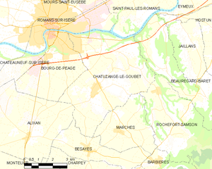
Alixan (Alixan)

- коммуна во Франции
 Hiking in Alixan
Alixan is a charming commune located in the Drôme department of southeastern France. While it may not be as well-known as some of the more prominent hiking destinations, it offers a serene landscape and opportunities for outdoor activities, including hiking.
Hiking in Alixan
-
Scenic Trails: The area around Alixan is characterized by beautiful rural landscapes, vineyards, and rolling hills, making it perfect for hiking. You can find a variety of trails ranging in difficulty, which can accommodate both novice and experienced hikers.
-
Natural Parks: Nearby, you may explore parts of the Vercors Regional Natural Park, which offers more challenging hikes and stunning vistas. The park is known for its dramatic cliffs, diverse wildlife, and extensive network of hiking trails.
-
Local Flora and Fauna: Hiking around Alixan provides a great opportunity to observe local wildlife and plant species. Keep an eye out for unique regional flora as well as birds and other animals that inhabit the area.
-
Cultural Sites: As you hike, you might encounter historical sites and picturesque villages, adding an enriching cultural element to your outdoor experience.
-
Recommendations:
- Trail Maps: It's advisable to obtain trail maps from local tourist offices or online resources to help navigate the area.
- Weather Conditions: Always check the weather forecast before heading out, as conditions can change rapidly in the region.
- Safety: Ensure you have the appropriate gear, sufficient water, and snacks, and let someone know your hiking plans for safety.
-
Best Times to Hike: The most favorable hiking seasons in Alixan are spring and fall, when the weather is usually mild, and the landscapes are at their most picturesque.
If you're planning a hiking trip to Alixan, consider combining hikes with visits to local wineries or cultural sites to enhance your experience. Enjoy your time in the great outdoors!
- Страна:

- Почтовый код: 26300
- Координаты: 44° 58' 30" N, 5° 1' 39" E


- GPS треки (wikiloc): [Ссылка]
- Площадь: 28.28 кв.км
- Население: 2484
- Википедия английская: wiki(en)
- Википедия национальная: wiki(fr)
- Хранилище Wikidata: Wikidata: Q326786
- Катеория в википедии: [Ссылка]
- код Freebase: [/m/03mgk75]
- код GeoNames: Альт: [3038186]
- номер SIREN: [212600043]
- код BNF: [15252865h]
- код VIAF: Альт: [246220811]
- код GND: Альт: [4294636-0]
- код муниципалитета INSEE: 26004
Граничит с регионами:
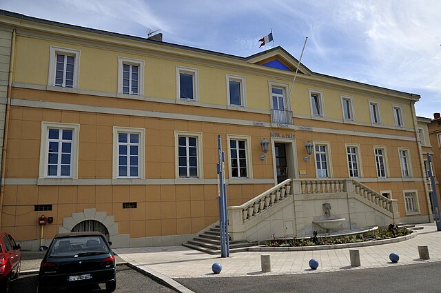
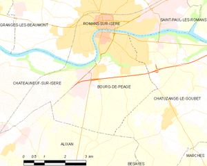
Бур-дё-Пеаж
- коммуна во Франции
Hiking in Бур-дё-Пеаж
Bourg-de-Péage is a charming commune located in the Drôme department of southeastern France, known for its picturesque landscapes and proximity to the Rhône Alps, making it a great base for hiking enthusiasts. Here are some highlights and tips for hiking in and around Bourg-de-Péage:...
- Страна:
- Почтовый код: 26300
- Координаты: 45° 2' 16" N, 5° 3' 0" E
- GPS треки (wikiloc): [Ссылка]
- Высота над уровнем моря: 135 м m
- Площадь: 13.71 кв.км
- Население: 10497
- Веб сайт: [Ссылка]


Bésayes
- коммуна во Франции
Hiking in Bésayes
Bésayes is a small commune in the Drôme department of southeastern France, known for its beautiful landscapes and rural charm. While it may not be a widely recognized hiking destination compared to more famous parks and trails, there are still opportunities for hiking and enjoying the natural beauty of the region....
- Страна:
- Почтовый код: 26300
- Координаты: 44° 57' 54" N, 5° 4' 45" E
- GPS треки (wikiloc): [Ссылка]
- Площадь: 9.53 кв.км
- Население: 1189
- Веб сайт: [Ссылка]

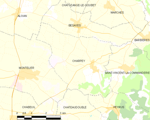
Charpey
- коммуна во Франции
Hiking in Charpey
Charpey is a small commune in the Drôme department in southeastern France, known for its beautiful natural surroundings and access to hiking trails. While it may not be as widely recognized as some other hiking destinations, it offers a peaceful and picturesque setting for outdoor enthusiasts....
- Страна:
- Почтовый код: 26300
- Координаты: 44° 56' 18" N, 5° 5' 34" E
- GPS треки (wikiloc): [Ссылка]
- Площадь: 15.48 кв.км
- Население: 1316
Chatuzange-le-Goubet
- коммуна во Франции
Hiking in Chatuzange-le-Goubet
Chatuzange-le-Goubet is a charming commune located in the Drôme department of southeastern France, nestled near the picturesque foothills of the Alps. While the area is not as widely recognized for hiking as some of its neighboring regions, it still offers beautiful landscapes and serene trails that can appeal to outdoor enthusiasts....
- Страна:
- Почтовый код: 26300
- Координаты: 45° 0' 24" N, 5° 5' 27" E
- GPS треки (wikiloc): [Ссылка]
- Высота над уровнем моря: 238 м m
- Площадь: 28.24 кв.км
- Население: 5311
- Веб сайт: [Ссылка]


Châteauneuf-sur-Isère
- коммуна во Франции
Hiking in Châteauneuf-sur-Isère
Châteauneuf-sur-Isère is a charming commune located in the Auvergne-Rhône-Alpes region of southeastern France, not far from the town of Valence. The area is characterized by its picturesque landscapes, rolling hills, and proximity to the Drôme River, making it an attractive spot for outdoor activities, including hiking....
- Страна:
- Почтовый код: 26300
- Координаты: 45° 0' 50" N, 4° 56' 5" E
- GPS треки (wikiloc): [Ссылка]
- Высота над уровнем моря: 155 м m
- Площадь: 45.57 кв.км
- Население: 3839
- Веб сайт: [Ссылка]

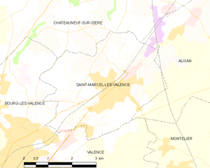
Сен-Марсель-ле-Валанс
- коммуна во Франции
Hiking in Сен-Марсель-ле-Валанс
Saint-Marcel-lès-Valence, located in the Auvergne-Rhône-Alpes region of France, offers a variety of hiking opportunities that showcase the beautiful landscapes of the Drôme department. Here are some key points about hiking in the area:...
- Страна:
- Почтовый код: 26320
- Координаты: 44° 58' 15" N, 4° 57' 24" E
- GPS треки (wikiloc): [Ссылка]
- Площадь: 15.05 кв.км
- Население: 6165


Валанс
- коммуна во Франции
Hiking in Валанс
Valence, located in the Rhône-Alpes region of France, offers a wonderful base for hiking enthusiasts. While the city itself is more urban, it is surrounded by natural attractions and landscapes perfect for hiking....
- Страна:
- Почтовый код: 26000
- Координаты: 44° 55' 57" N, 4° 53' 27" E
- GPS треки (wikiloc): [Ссылка]
- Площадь: 36.69 кв.км
- Население: 62479
- Веб сайт: [Ссылка]


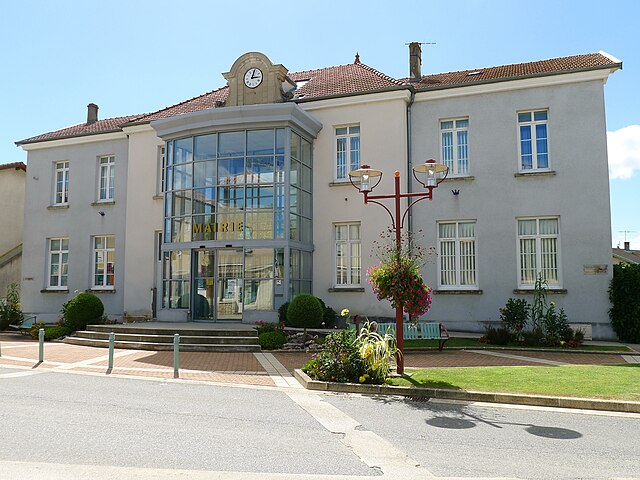
Montélier
Hiking in Montélier
Montélier, located in the Drôme department of southeastern France, is a charming village that provides access to beautiful hiking opportunities, particularly within the surrounding regions of the Vercors and the Col de la Machine. Here are some highlights for hiking in and around Montélier:...
- Страна:
- Почтовый код: 26120
- Координаты: 44° 56' 15" N, 5° 1' 52" E
- GPS треки (wikiloc): [Ссылка]
- Площадь: 24.76 кв.км
- Население: 4074