Прива (округ) (arrondissement of Privas, arrondissement de Privas)

 Hiking in Прива (округ)
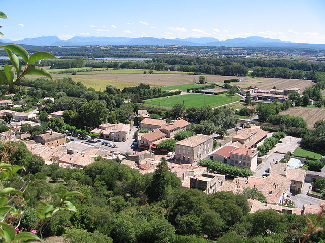
The Arrondissement of Privas, located in the Ardèche department of France, offers a variety of hiking opportunities that cater to different skill levels and preferences. The region is characterized by its stunning landscapes, including rolling hills, rocky gorges, and lush valleys, making it an attractive destination for outdoor enthusiasts.
Hiking Trails
-
Gorges de l'Ardèche: While technically just outside Privas, this area is known for its breathtaking canyons and river views. Hiking trails here can range from easy walks to more challenging routes, offering options for both beginners and seasoned hikers.
-
Monts d'Ardèche Regional Natural Park: This park offers numerous trails that showcase the area's diverse flora and fauna. Some popular trails include the GR7 and GR42, which run through beautiful meadows and forests and provide panoramic views of the surrounding landscape.
-
Sentier des Gorges de la Beaume: This trail offers a moderate hiking experience with opportunities to explore the scenic beauty of the Beaume River, featuring both rocky paths and lush greenery.
-
Trail of the Gorges du Doux: Suitable for various skill levels, this route offers stunning views of the Doux River and the surrounding mountainous terrain.
-
Local Vineyards and Villages: For those interested in cultural hikes, there are trails that connect local vineyards and picturesque villages in the region, allowing hikers to experience the region’s heritage while enjoying the natural scenery.
Tips for Hiking in Privas
- Check Weather Conditions: The weather can change rapidly in the region, so it’s essential to check forecasts before heading out.
- Stay Hydrated: Bring enough water and snacks, especially on longer hikes.
- Wear Appropriate Footwear: Good hiking boots are recommended due to rocky and uneven terrain.
- Wildlife Awareness: The area is home to various wildlife; be aware and respect their habitats.
Local Amenities
Privas has facilities such as shops and restaurants where hikers can refuel after a day of trekking. It’s also a good idea to visit local tourism offices for maps and current trail information.
Overall, hiking in the Arrondissement of Privas promises to be a rewarding experience with its blend of natural beauty, diverse trails, and cultural richness.
- Страна:

- Столица: Прива
- Координаты: 44° 38' 17" N, 4° 36' 49" E


- GPS треки (wikiloc): [Ссылка]
- Население: 84795
- Википедия русская: wiki(ru)
- Википедия английская: wiki(en)
- Википедия национальная: wiki(fr)
- Хранилище Wikidata: Wikidata: Q702130
- код Freebase: [/m/095hkt]
- код GeoNames: Альт: [2985289]
- код округа INSEE: [072]
Включает регионы:


Ла-Вульт-сюр-Рон (кантон)
Hiking in Ла-Вульт-сюр-Рон (кантон)
Hiking in the Canton of Rhône-Eyrieux, located in the Auvergne-Rhône-Alpes region of France, is a fantastic opportunity to experience the natural beauty of the area. This region is characterized by its diverse landscapes, which include rolling hills, forested areas, and scenic river valleys....
- Страна:
- Столица: Ла-Вульт-сюр-Рон
- Координаты: 44° 48' 1" N, 4° 46' 48" E
- GPS треки (wikiloc): [Ссылка]
- Население: 22352


Прива (кантон)
- Страна:
- Столица: Прива
- Координаты: 44° 44' 9" N, 4° 36' 0" E
- GPS треки (wikiloc): [Ссылка]
- Население: 20421

Сен-Пьервиль (кантон)
- Страна:
- Столица: Сен-Пьервиль
- Координаты: 44° 49' 0" N, 4° 29' 16" E
- GPS треки (wikiloc): [Ссылка]


Бур-Сент-Андеоль
- Страна:
- Столица: Бур-Сент-Андеоль
- Координаты: 44° 22' 24" N, 4° 38' 39" E
- GPS треки (wikiloc): [Ссылка]
- Население: 19013