Ла-Вульт-сюр-Рон (кантон) (canton of Rhône-Eyrieux, canton de Rhône-Eyrieux)

 Hiking in Ла-Вульт-сюр-Рон (кантон)
Hiking in the Canton of Rhône-Eyrieux, located in the Auvergne-Rhône-Alpes region of France, is a fantastic opportunity to experience the natural beauty of the area. This region is characterized by its diverse landscapes, which include rolling hills, forested areas, and scenic river valleys.
Highlights of Hiking in Rhône-Eyrieux:
-
Scenic Trails: The canton offers a variety of marked trails suitable for different skill levels, from easy walks for families to more challenging hikes for experienced adventurers. You can find trails that take you along the Eyrieux River, through lush forests, and up to panoramic viewpoints.
-
Wildlife and Flora: The region is rich in biodiversity. As you hike, keep an eye out for local wildlife and enjoy the vibrant flora, especially during spring and summer when wildflowers are in full bloom.
-
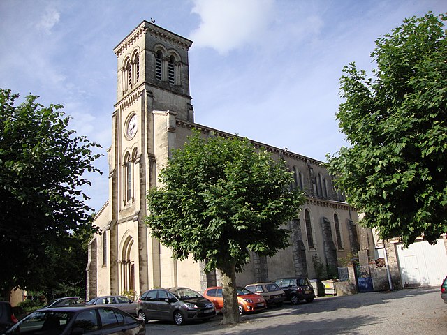
Cultural Heritage: Many hiking trails pass by historical and cultural sites, including quaint villages, old stone bridges, and ancient churches. These stops can provide a deeper understanding of the local history and culture.
-
Gorges and Valleys: The Eyrieux Valley features stunning gorges that create dramatic landscapes. Hiking in these areas can be both exhilarating and relaxing, offering refreshing views and the soothing sounds of water.
-
Organization and Maps: Local hiking clubs and associations often maintain the trails and provide valuable resources, including maps and guides. It's advisable to check for local hiking associations for trail conditions and any potential closures.
-
Safety and Preparedness: As with any hiking adventure, ensure that you're well-prepared. Wear appropriate footwear, bring plenty of water, snacks, and a first-aid kit. Familiarize yourself with the area and follow local guidelines for safety.
-
Best Times to Hike: The best times to explore the canton are spring and early autumn when temperatures are moderate, and the weather is generally stable. Summer can be quite warm, while winter might limit accessibility on certain trails due to snow.
-
Local Amenities: If you're hiking in the area, you can find local amenities in nearby towns such as shops, restaurants, and accommodations, making it easy to plan your hiking trips.
Whether you're looking for a leisurely day out or a more strenuous hike, the Canton of Rhône-Eyrieux provides a stunning backdrop with opportunities to connect with nature while enjoying the outdoors. Make sure to follow Leave No Trace principles to preserve the beauty of the area for future hikers.
- Страна:

- Столица: Ла-Вульт-сюр-Рон
- Координаты: 44° 48' 1" N, 4° 46' 48" E


- GPS треки (wikiloc): [Ссылка]
- Население: 22352
- Википедия русская: wiki(ru)
- Википедия английская: wiki(en)
- Википедия национальная: wiki(fr)
- Хранилище Wikidata: Wikidata: Q1725696
- код LCNAF: Альт: [n88155973]
- код кантона INSEE: [0717]
Включает регионы:

Бошастель
- коммуна во Франции
Hiking in Бошастель
Beauchastel is a charming village located in the Auvergne-Rhône-Alpes region of France, nestled along the Rhône River. The area surrounding Beauchastel offers a variety of hiking opportunities, allowing you to experience beautiful landscapes, enchanting natural scenery, and an array of flora and fauna....
- Страна:
- Почтовый код: 07800
- Координаты: 44° 49' 33" N, 4° 48' 11" E
- GPS треки (wikiloc): [Ссылка]
- Площадь: 8.46 кв.км
- Население: 1815
- Веб сайт: [Ссылка]

Шарм-сюр-Рон
- коммуна во Франции
Hiking in Шарм-сюр-Рон
Charmes-sur-Rhône is a charming village located in the Auvergne-Rhône-Alpes region of France, known for its scenic landscapes and natural beauty. Hiking in this area offers a mix of serene views, lovely trails, and a chance to immerse yourself in nature. Here are some aspects to consider if you're planning a hiking trip in Charmes-sur-Rhône:...
- Страна:
- Почтовый код: 07800
- Координаты: 44° 51' 49" N, 4° 50' 7" E
- GPS треки (wikiloc): [Ссылка]
- Площадь: 5.95 кв.км
- Население: 2806

Ла-Вульт-сюр-Рон
- Страна:
- Почтовый код: 07800
- Координаты: 44° 47' 58" N, 4° 46' 45" E
- GPS треки (wikiloc): [Ссылка]
- Высота над уровнем моря: 98 м m
- Площадь: 9.7 кв.км
- Население: 5109
- Веб сайт: [Ссылка]

Сен-Жорж-ле-Бен
- коммуна во Франции
Hiking in Сен-Жорж-ле-Бен
Saint-Georges-les-Bains is a picturesque commune located in the Auvergne-Rhône-Alpes region of France, nestled along the banks of the Rhone River. It's part of a broader area known for its natural beauty and outdoor recreational opportunities, making it a great spot for hiking enthusiasts....
- Страна:
- Почтовый код: 07800
- Координаты: 44° 51' 40" N, 4° 48' 33" E
- GPS треки (wikiloc): [Ссылка]
- Площадь: 14.11 кв.км
- Население: 2201
- Веб сайт: [Ссылка]

Ромпон
- коммуна во Франции
- Страна:
- Почтовый код: 07250
- Координаты: 44° 45' 41" N, 4° 43' 24" E
- GPS треки (wikiloc): [Ссылка]
- Площадь: 22.03 кв.км
- Население: 1053

Жильяк-э-Брюзак
- коммуна во Франции
- Страна:
- Почтовый код: 07800
- Координаты: 44° 51' 27" N, 4° 44' 2" E
- GPS треки (wikiloc): [Ссылка]
- Высота над уровнем моря: 600 м m
- Площадь: 30.94 кв.км
- Население: 170

Сен-Мишель-де-Шабрийану
- коммуна во Франции
- Страна:
- Почтовый код: 07360
- Координаты: 44° 50' 22" N, 4° 36' 9" E
- GPS треки (wikiloc): [Ссылка]
- Высота над уровнем моря: 540 м m
- Площадь: 12.14 кв.км
- Население: 364
- Веб сайт: [Ссылка]

Сен-Лоран-дю-Пап
- коммуна во Франции
- Страна:
- Почтовый код: 07800
- Координаты: 44° 49' 24" N, 4° 46' 0" E
- GPS треки (wikiloc): [Ссылка]
- Площадь: 20.1 кв.км
- Население: 1562
Сен-Фортюна-сюр-Эйрьё
- коммуна во Франции
- Страна:
- Почтовый код: 07360
- Координаты: 44° 49' 45" N, 4° 40' 32" E
- GPS треки (wikiloc): [Ссылка]
- Площадь: 22.07 кв.км
- Население: 762

Сен-Сьерж-ла-Сер
- коммуна во Франции
- Страна:
- Почтовый код: 07800
- Координаты: 44° 47' 37" N, 4° 41' 12" E
- GPS треки (wikiloc): [Ссылка]
- Площадь: 16.2 кв.км
- Население: 256