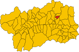
Аяс (Ayas, Aosta Valley, Ayas)
.svg)
- коммуна Италии
 Hiking in Аяс
Ayas, located in the Aosta Valley region of Italy, is a stunning area known for its picturesque landscapes, charming alpine villages, and a variety of hiking trails that cater to different experience levels. Here are some highlights and recommendations for hiking in Ayas:
Scenic Trails
-
Lago di Villa: This is a relatively easy hike leading to a beautiful lake surrounded by majestic mountains. The trail is suitable for families and beginners, offering stunning views of the surrounding landscape.
-
Col de Joux: This is a popular hiking route that provides panoramic views of the Monte Rosa massif. The trail offers moderate difficulty, making it ideal for those looking to challenge themselves while enjoying incredible vistas.
-
Refuge Cian de Jole: A moderately strenuous hike that rewards hikers with breathtaking views and the chance to experience local alpine flora and fauna. The refuge itself is a great place to stop for a meal or a rest.
-
Val d'Ayas: This valley offers various connected trails ranging from easy to challenging. You can choose routes that lead through stunning scenery featuring waterfalls, forests, and wildflower meadows.
Flora and Fauna
The Aosta Valley region is rich in biodiversity. Hikers may encounter a variety of wildlife, including ibex, chamois, and numerous bird species. The region is also known for its unique plant life, especially in the higher elevations.
Best Times to Hike
The best time for hiking in Ayas is from late spring to early autumn, typically from June to October. During these months, the weather is pleasant, and the trails are mostly clear of snow. Always check local conditions, as weather in the mountains can change quickly.
Safety Tips
- Navigation: Make sure to carry a map or GPS device, as some trails can be less marked than others.
- Gear: Wear appropriate hiking gear, including sturdy boots, layers for temperature changes, and a hat or sunscreen for sun protection.
- Water and Snacks: Always carry enough water and snacks, as some trails may be remote with limited access to supplies.
Local Culture
Don't miss the opportunity to enjoy local Aosta Valley cuisine after your hikes. The region is known for its hearty alpine dishes, including polenta, fontina cheese, and various mountain herbs.
Accommodations
Ayas offers a range of accommodations, from mountain huts and hotels to camping options, making it easy to find a place to stay nearby the hiking trails.
Whether you're seeking a leisurely walk in beautiful surroundings or a challenging trek with impressive vistas, hiking in Ayas is a rewarding experience that showcases the natural beauty of the Aosta Valley. Enjoy your adventure!
- Страна:

- Почтовый код: 11020
- Телефонный код: 0125
- Код автомобильного номера: AO
- Координаты: 45° 48' 41" N, 7° 41' 12" E


- GPS треки (wikiloc): [Ссылка]
- Высота над уровнем моря: 1698 м m
- Площадь: 129.42 кв.км
- Население: 1377
- Веб сайт: http://www.comune.ayas.ao.it
- Википедия русская: wiki(ru)
- Википедия английская: wiki(en)
- Википедия национальная: wiki(it)
- Хранилище Wikidata: Wikidata: Q34785
- Катеория в википедии: [Ссылка]
- Карты в википедии: [Ссылка]
- код Freebase: [/m/0fs_0w]
- код GeoNames: Альт: [6542488]
- код VIAF: Альт: [246285531]
- код ISTAT: 007007
- кадастровый код Италии: A094
Граничит с регионами:


Церматт
Hiking in Церматт
Zermatt, located in the Swiss Alps, is a stunning destination for hiking enthusiasts. This charming car-free village, nestled at the foot of the iconic Matterhorn, offers a range of hiking trails for all skill levels, providing breathtaking views and a chance to explore the unique Alpine landscape....
- Страна:

- Почтовый код: 3920
- Телефонный код: 027
- Код автомобильного номера: VS
- Координаты: 45° 59' 23" N, 7° 45' 10" E
- GPS треки (wikiloc): [Ссылка]
- Высота над уровнем моря: 2621 м m
- Площадь: 242.67 кв.км
- Население: 5643
- Веб сайт: [Ссылка]


Брюссон
- коммуна Италии
Hiking in Брюссон
Brusson is a charming village located in the Aosta Valley region of Italy, known for its stunning natural scenery and excellent hiking opportunities. Nestled in the midst of the Alps, Brusson offers a mix of challenging trails and easier walks suitable for hikers of all levels. Here’s what you need to know about hiking in Brusson:...
- Страна:
- Почтовый код: 11022
- Телефонный код: 0125
- Код автомобильного номера: AO
- Координаты: 45° 46' 0" N, 7° 44' 0" E
- GPS треки (wikiloc): [Ссылка]
- Высота над уровнем моря: 1338 м m
- Площадь: 55.26 кв.км
- Население: 887
- Веб сайт: [Ссылка]


Шамуа
- коммуна Италии
Hiking in Шамуа
Chamois is a charming village located in the Aosta Valley region of Italy. It is known for its stunning natural scenery, making it a fantastic destination for hiking enthusiasts. Here are some key points about hiking in Chamois:...
- Страна:
- Почтовый код: 11020
- Телефонный код: 0166
- Код автомобильного номера: AO
- Координаты: 45° 50' 0" N, 7° 37' 0" E
- GPS треки (wikiloc): [Ссылка]
- Высота над уровнем моря: 1800 м m
- Площадь: 14.53 кв.км
- Население: 95
- Веб сайт: [Ссылка]


Шатийон
- коммуна Италии
Hiking in Шатийон
Châtillon is a charming town located in the Aosta Valley region of Italy, surrounded by stunning mountainous landscapes that make it a great starting point for hiking enthusiasts. Here’s what you should know about hiking in and around Châtillon:...
- Страна:
- Почтовый код: 11024
- Телефонный код: 0166
- Код автомобильного номера: AO
- Координаты: 45° 45' 0" N, 7° 37' 0" E
- GPS треки (wikiloc): [Ссылка]
- Высота над уровнем моря: 549 м m
- Площадь: 39.68 кв.км
- Население: 4654
- Веб сайт: [Ссылка]


Грессоне-Ла-Трините
- коммуна Италии
Hiking in Грессоне-Ла-Трините
Gressoney-La-Trinité is a charming village located in the Aosta Valley region of Italy, known for its stunning alpine scenery and a rich mix of Italian and Walser culture. It serves as a perfect base for hiking enthusiasts, offering a variety of trails suitable for different skill levels, from easy walks to more challenging hikes....
- Страна:
- Почтовый код: 11020
- Телефонный код: 0125
- Код автомобильного номера: AO
- Координаты: 45° 50' 0" N, 7° 50' 0" E
- GPS треки (wikiloc): [Ссылка]
- Высота над уровнем моря: 1635 м m
- Площадь: 66.52 кв.км
- Население: 300
- Веб сайт: [Ссылка]


Грессоне-Сен-Жан
- коммуна Италии
Hiking in Грессоне-Сен-Жан
Gressoney-Saint-Jean, located in the Aosta Valley of Italy, is a beautiful mountain village that offers excellent hiking opportunities in the scenic backdrop of the Alps. The area is particularly known for its stunning landscapes, featuring majestic peaks, lush valleys, and picturesque forests....
- Страна:
- Почтовый код: 11025
- Телефонный код: 0125
- Код автомобильного номера: AO
- Координаты: 45° 47' 0" N, 7° 49' 0" E
- GPS треки (wikiloc): [Ссылка]
- Высота над уровнем моря: 1385 м m
- Площадь: 69.65 кв.км
- Население: 818
- Веб сайт: [Ссылка]

Ла-Магделен
- коммуна Италии
Hiking in Ла-Магделен
La Magdeleine is a beautiful area located in the Aosta Valley region of Italy, known for its stunning landscapes, rich culture, and outdoor activities. While it might not be as widely recognized as some other hiking destinations in the Alps, it offers a range of hiking opportunities for both beginners and experienced hikers....
- Страна:
- Почтовый код: 11020
- Телефонный код: 0166
- Код автомобильного номера: AO
- Координаты: 45° 49' 0" N, 7° 37' 0" E
- GPS треки (wikiloc): [Ссылка]
- Высота над уровнем моря: 1644 м m
- Площадь: 8.94 кв.км
- Население: 108
- Веб сайт: [Ссылка]


Сен-Венсан
- коммуна Италии
Hiking in Сен-Венсан
Saint-Vincent is a charming town located in the Aosta Valley region of Italy, nestled in the beautiful mountains of the Alps. The area is known not only for its rich history and thermal baths but also for its excellent hiking opportunities. Here are some key points about hiking in and around Saint-Vincent:...
- Страна:
- Почтовый код: 11027
- Телефонный код: 0166
- Код автомобильного номера: AO
- Координаты: 45° 45' 0" N, 7° 39' 0" E
- GPS треки (wikiloc): [Ссылка]
- Высота над уровнем моря: 550 м m
- Площадь: 20.57 кв.км
- Население: 4584
- Веб сайт: [Ссылка]


Вальтурнанш
- коммуна Италии
Hiking in Вальтурнанш
Valtournenche, located in the Aosta Valley of Italy near the Swiss border, is a stunning destination for hiking enthusiasts. It's well-known for its breathtaking mountain scenery, including views of the iconic Matterhorn, which is particularly visible from the valley and its surrounding areas. Here are some highlights about hiking in Valtournenche:...
- Страна:
- Почтовый код: 11028
- Телефонный код: 0166
- Код автомобильного номера: AO
- Координаты: 45° 53' 0" N, 7° 37' 0" E
- GPS треки (wikiloc): [Ссылка]
- Высота над уровнем моря: 1528 м m
- Площадь: 116.15 кв.км
- Население: 2294
- Веб сайт: [Ссылка]