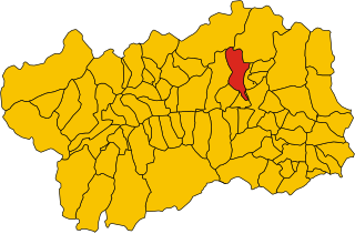
Вальтурнанш (Valtournenche, Valtournenche)
.svg)
- коммуна Италии
 Hiking in Вальтурнанш
Valtournenche, located in the Aosta Valley of Italy near the Swiss border, is a stunning destination for hiking enthusiasts. It's well-known for its breathtaking mountain scenery, including views of the iconic Matterhorn, which is particularly visible from the valley and its surrounding areas. Here are some highlights about hiking in Valtournenche:
Trails and Routes
-
Beginner Trails: There are several easy trails suitable for beginners and families. Paths around the village and nearby lakes provide gentle slopes and beautiful scenery.
-
Intermediate Trails: For those looking for more of a challenge, there are numerous intermediate trails that offer rewarding views and moderate elevation gains. The trails leading to the Rifugio Carpano or the Lago di Cignana are popular options.
-
Advanced Routes: Experienced hikers can tackle more demanding routes, such as the trail towards the Breuil-Cervinia area. Trails leading towards the Matterhorn or routes that connect with the Tour de Monte Rosa are also available but require good fitness and experience.
Scenic Highlights
- Matterhorn Views: Hiking in Valtournenche provides some of the best views of the Matterhorn, especially from high vantage points.
- Lakes and Waterfalls: Many trails lead to beautiful alpine lakes and waterfalls, which are perfect for resting and enjoying a picnic.
- Flora and Fauna: The region is rich in biodiversity, offering opportunities to see local wildlife, including ibex, chamois, and a variety of alpine plants.
Practical Considerations
- Best Time to Hike: The ideal hiking season generally runs from late June to early September when the trails are free of snow and accessible. July and August are the most popular months.
- Weather Conditions: Be prepared for rapidly changing weather, and always check forecasts before heading out. Mountain weather can be unpredictable.
- Gear: Proper hiking gear is essential. Wear sturdy hiking boots, bring layers for changing temperatures, and pack plenty of water and snacks.
Local Amenities
Valtournenche is equipped with various facilities for hikers, including restaurants and shops for gear rental. Local guides are also available, offering valuable insight into the best trails, safety tips, and natural history of the region.
Conclusion
Hiking in Valtournenche is an unforgettable experience, marked by spectacular landscapes, diverse trails, and rich cultural heritage. Whether you're a novice or an experienced hiker, the area has something to offer for everyone. Always remember to respect nature, follow Leave No Trace principles, and enjoy the journey!
- Страна:

- Почтовый код: 11028
- Телефонный код: 0166
- Код автомобильного номера: AO
- Координаты: 45° 53' 0" N, 7° 37' 0" E


- GPS треки (wikiloc): [Ссылка]
- Высота над уровнем моря: 1528 м m
- Площадь: 116.15 кв.км
- Население: 2294
- Веб сайт: http://www.comune.valtournenche.ao.it
- Википедия русская: wiki(ru)
- Википедия английская: wiki(en)
- Википедия национальная: wiki(it)
- Хранилище Wikidata: Wikidata: Q35538
- Галерея изображений в википедии: [Ссылка]
- Катеория в википедии: [Ссылка]
- Карты в википедии: [Ссылка]
- код Freebase: [/m/0fwzdf]
- код GeoNames: Альт: [6542791]
- код VIAF: Альт: [241124722]
- ID отношения в OpenStreetMap: [2531]
- идентификатор местоположения ArchINFORM: [46499]
- код темы Quora: [Valtournenche]
- код BabelNet: [03460600n]
- код ISTAT: 007071
- кадастровый код Италии: L654
Граничит с регионами:


Церматт
Hiking in Церматт
Zermatt, located in the Swiss Alps, is a stunning destination for hiking enthusiasts. This charming car-free village, nestled at the foot of the iconic Matterhorn, offers a range of hiking trails for all skill levels, providing breathtaking views and a chance to explore the unique Alpine landscape....
- Страна:

- Почтовый код: 3920
- Телефонный код: 027
- Код автомобильного номера: VS
- Координаты: 45° 59' 23" N, 7° 45' 10" E
- GPS треки (wikiloc): [Ссылка]
- Высота над уровнем моря: 2621 м m
- Площадь: 242.67 кв.км
- Население: 5643
- Веб сайт: [Ссылка]


Анте-Сент-Андре
- коммуна Италии
Hiking in Анте-Сент-Андре
Antey-Saint-André is a charming commune located in the Aosta Valley region of Italy, surrounded by stunning Alpine scenery, making it a great destination for hiking enthusiasts. Here are some key points to consider for hiking in this area:...
- Страна:
- Почтовый код: 11020
- Телефонный код: 0166
- Код автомобильного номера: AO
- Координаты: 45° 48' 0" N, 7° 36' 0" E
- GPS треки (wikiloc): [Ссылка]
- Высота над уровнем моря: 1074 м m
- Площадь: 11.81 кв.км
- Население: 573
- Веб сайт: [Ссылка]


Аяс
- коммуна Италии
Hiking in Аяс
Ayas, located in the Aosta Valley region of Italy, is a stunning area known for its picturesque landscapes, charming alpine villages, and a variety of hiking trails that cater to different experience levels. Here are some highlights and recommendations for hiking in Ayas:...
- Страна:
- Почтовый код: 11020
- Телефонный код: 0125
- Код автомобильного номера: AO
- Координаты: 45° 48' 41" N, 7° 41' 12" E
- GPS треки (wikiloc): [Ссылка]
- Высота над уровнем моря: 1698 м m
- Площадь: 129.42 кв.км
- Население: 1377
- Веб сайт: [Ссылка]


Бьона
- коммуна Италии
Hiking in Бьона
Bionaz is a picturesque valley located in the Aosta Valley region of Italy, offering stunning landscapes, charming scenery, and a variety of hiking opportunities. Here’s what you need to know about hiking in Bionaz:...
- Страна:
- Почтовый код: 11010
- Телефонный код: 0165
- Код автомобильного номера: AO
- Координаты: 45° 52' 0" N, 7° 25' 0" E
- GPS треки (wikiloc): [Ссылка]
- Высота над уровнем моря: 1606 м m
- Площадь: 142.09 кв.км
- Население: 235
- Веб сайт: [Ссылка]


Шамуа
- коммуна Италии
Hiking in Шамуа
Chamois is a charming village located in the Aosta Valley region of Italy. It is known for its stunning natural scenery, making it a fantastic destination for hiking enthusiasts. Here are some key points about hiking in Chamois:...
- Страна:
- Почтовый код: 11020
- Телефонный код: 0166
- Код автомобильного номера: AO
- Координаты: 45° 50' 0" N, 7° 37' 0" E
- GPS треки (wikiloc): [Ссылка]
- Высота над уровнем моря: 1800 м m
- Площадь: 14.53 кв.км
- Население: 95
- Веб сайт: [Ссылка]

Торньон
- коммуна Италии
Hiking in Торньон
Torgnon is a beautiful village located in the Aosta Valley region of Italy, nestled in the Italian Alps. It's known for its stunning landscapes, lush valleys, and pristine nature, making it an ideal destination for hiking enthusiasts. Here are some key points about hiking in Torgnon:...
- Страна:
- Почтовый код: 11020
- Телефонный код: 0166
- Код автомобильного номера: AO
- Координаты: 45° 48' 0" N, 7° 34' 0" E
- GPS треки (wikiloc): [Ссылка]
- Высота над уровнем моря: 1489 м m
- Площадь: 42.46 кв.км
- Население: 587
- Веб сайт: [Ссылка]