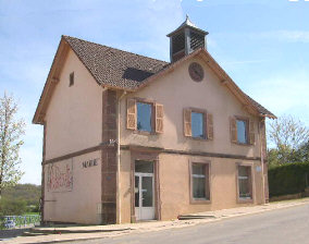
Urcerey (Urcerey)

- коммуна во Франции
 Hiking in Urcerey
Urcerey is not a widely recognized hiking destination, so it might refer to a specific area with local interest or a less-known name. However, if you meant a popular hiking area or trail with a name similar to Urcerey, please clarify.
If you are looking for general information on hiking in lesser-known areas or advice on local trails, I can provide tips on what to consider when hiking in new areas, including safety, navigation, and preparation.
For popular hiking regions, I'd recommend checking trail apps, local hiking groups, or forest service resources for updated trail conditions, maps, and recommendations. Always ensure you're equipped with the right gear, stay hydrated, and inform someone of your hiking plans for safety.
Feel free to provide more details, and I'll do my best to assist you!
- Страна:

- Почтовый код: 90800
- Координаты: 47° 36' 29" N, 6° 48' 33" E


- GPS треки (wikiloc): [Ссылка]
- Площадь: 3.39 кв.км
- Население: 215
- Википедия английская: wiki(en)
- Википедия национальная: wiki(fr)
- Хранилище Wikidata: Wikidata: Q843566
- Катеория в википедии: [Ссылка]
- код Freebase: [/m/03mhh4y]
- код Freebase: [/m/03mhh4y]
- код Freebase: [/m/03mhh4y]
- код GeoNames: Альт: [6613131]
- код GeoNames: Альт: [6613131]
- код GeoNames: Альт: [6613131]
- номер SIREN: [219000981]
- номер SIREN: [219000981]
- номер SIREN: [219000981]
- код BNF: [15280039w]
- код BNF: [15280039w]
- код BNF: [15280039w]
- код муниципалитета INSEE: 90098
- код муниципалитета INSEE: 90098
- код муниципалитета INSEE: 90098
Граничит с регионами:


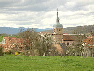
Эшнан-су-Мон-Водуа
- коммуна во Франции
Hiking in Эшнан-су-Мон-Водуа
Échenans-sous-Mont-Vaudois, located in the Bourgogne-Franche-Comté region of France, offers a serene and scenic environment for hiking enthusiasts. While it may not be one of the most prominent hiking destinations, it provides a peaceful escape into nature, particularly for those who enjoy exploring less crowded trails....
- Страна:
- Почтовый код: 70400
- Координаты: 47° 36' 10" N, 6° 46' 18" E
- GPS треки (wikiloc): [Ссылка]
- Высота над уровнем моря: 381 м m
- Площадь: 5.44 кв.км
- Население: 499

Argiésans
- коммуна во Франции
Hiking in Argiésans
Argiésans is a picturesque region known for its stunning natural landscapes, making it an excellent destination for hiking enthusiasts. Nestled in the heart of the Pyrenees, this area offers a variety of trails that cater to different skill levels, from gentle walks to challenging climbs....
- Страна:
- Почтовый код: 90800
- Координаты: 47° 36' 14" N, 6° 49' 22" E
- GPS треки (wikiloc): [Ссылка]
- Площадь: 2.73 кв.км
- Население: 433


Banvillars
- коммуна во Франции
Hiking in Banvillars
Banvillars is a small village located in the Bourgogne-Franche-Comté region of France, known for its picturesque countryside and natural beauty. While it may not be as famous as some of the larger hiking destinations, it offers a unique and charming experience for hikers looking to explore the serene landscapes of eastern France....
- Страна:
- Почтовый код: 90800
- Координаты: 47° 35' 32" N, 6° 48' 53" E
- GPS треки (wikiloc): [Ссылка]
- Площадь: 4.67 кв.км
- Население: 283
- Веб сайт: [Ссылка]


Bavilliers
- коммуна во Франции
Hiking in Bavilliers
Bavilliers, a small commune located in the Bourgogne-Franche-Comté region of France, offers a charming backdrop for those interested in hiking. While it may not be as renowned as some larger hiking locales, it provides a unique opportunity to explore the surrounding natural landscapes....
- Страна:
- Почтовый код: 90800
- Координаты: 47° 37' 10" N, 6° 49' 50" E
- GPS треки (wikiloc): [Ссылка]
- Площадь: 4.8 кв.км
- Население: 4826
- Веб сайт: [Ссылка]

Buc
- коммуна во Франции
Hiking in Buc
Buc, located in the Territoire de Belfort department in the Bourgogne-Franche-Comté region of France, offers varying hiking opportunities that showcase the beautiful natural landscapes of the area. While Buc itself may not be a well-known hiking destination, its proximity to the Vosges Mountains and the Ballons des Vosges Regional Natural Park provides many trails ideal for hiking enthusiasts....
- Страна:
- Почтовый код: 90800
- Координаты: 47° 36' 53" N, 6° 47' 7" E
- GPS треки (wikiloc): [Ссылка]
- Площадь: 2.44 кв.км
- Население: 294


Essert
- коммуна во Франции
Hiking in Essert
Hiking in Essert, located in the Territoire de Belfort region of France, offers a delightful combination of natural beauty, picturesque landscapes, and accessibility for outdoor enthusiasts. Here are some highlights and tips for hiking in this area:...
- Страна:
- Почтовый код: 90850
- Координаты: 47° 37' 55" N, 6° 48' 59" E
- GPS треки (wikiloc): [Ссылка]
- Площадь: 7.01 кв.км
- Население: 3268
- Веб сайт: [Ссылка]