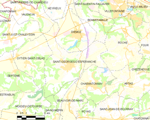
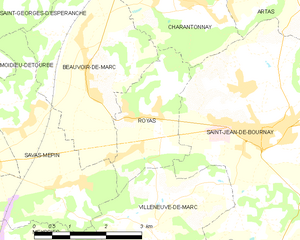
Бовуар-де-Марк (Beauvoir-de-Marc, Beauvoir-de-Marc)

- коммуна во Франции
 Hiking in Бовуар-де-Марк
Beauvoir-de-Marc is a charming commune located in the Isère department of the Auvergne-Rhône-Alpes region in southeastern France. While it may not be as widely recognized as some other hiking destinations, it offers a variety of scenic trails and outdoor activities that can be enjoyed by hikers of all levels.
Hiking Trails
-
Local Trails: There are several local paths and trails surrounding Beauvoir-de-Marc that meander through beautiful landscapes, including forests, fields, and rivers. Look for marked routes that can take you deeper into the countryside.
-
Regional Hiking: The nearby Vercors Regional Natural Park and Chartreuse Mountains offer a plethora of hiking opportunities. You can find more challenging hikes with breathtaking views, as well as easier strolls suitable for families.
-
Wildlife Watching: The natural areas around Beauvoir-de-Marc are home to diverse flora and fauna, making hiking not just an exercise but also an opportunity for birdwatching and appreciating local wildlife.
Tips for Hiking in Beauvoir-de-Marc
- Maps and Guides: Make sure to carry a map or download hiking apps that can provide you with trail information.
- Seasonal Considerations: The best times for hiking are usually spring and autumn when temperatures are mild. Summer hikes can be enjoyable as well but may require early starts to avoid the heat.
- Gear: Wear sturdy hiking shoes and dress in layers. Depending on the season, be prepared for changes in weather.
- Local Knowledge: Consider looking for local hiking clubs or guides who can offer insights into the trails and the area.
Safety Considerations
- Always let someone know your hiking plans and expected return time.
- Carry sufficient water, snacks, and a first aid kit.
- Be aware of your physical limits, especially on more challenging trails.
Whether you're a seasoned hiker or looking for a leisurely walk in nature, Beauvoir-de-Marc can offer a lovely escape into the beautiful landscapes of southeastern France.
- Страна:

- Почтовый код: 38440
- Координаты: 45° 31' 7" N, 5° 4' 45" E


- GPS треки (wikiloc): [Ссылка]
- Площадь: 11.27 кв.км
- Население: 1140
- Веб сайт: http://www.beauvoir-de-marc.com
- Википедия русская: wiki(ru)
- Википедия английская: wiki(en)
- Википедия национальная: wiki(fr)
- Хранилище Wikidata: Wikidata: Q674084
- Катеория в википедии: [Ссылка]
- код Freebase: [/m/03g_73m]
- код GeoNames: Альт: [6448725]
- номер SIREN: [213800352]
- код BNF: [15257864c]
- код муниципалитета INSEE: 38035
Граничит с регионами:


Сава-Мепен
- коммуна во Франции
Hiking in Сава-Мепен
Savas-Mépin is a small commune located in the Auvergne-Rhône-Alpes region of southeastern France, known for its scenic natural landscapes and outdoor activities, including hiking. While being less well-known than some major hiking destinations in the Alps or the Vercors region, Savas-Mépin offers a peaceful environment for outdoor enthusiasts....
- Страна:
- Почтовый код: 38440
- Координаты: 45° 29' 22" N, 5° 4' 16" E
- GPS треки (wikiloc): [Ссылка]
- Площадь: 10.43 кв.км
- Население: 869
- Веб сайт: [Ссылка]

Сен-Жорж-д'Эсперанш
- коммуна во Франции
Hiking in Сен-Жорж-д'Эсперанш
Saint-Georges-d'Espéranche is a charming commune located in the Isère department of the Auvergne-Rhône-Alpes region in southeastern France. While it may not be as widely known as some other hiking destinations in the region, it offers a range of outdoor activities and scenic landscapes that are perfect for hiking enthusiasts....
- Страна:
- Почтовый код: 38790
- Координаты: 45° 33' 21" N, 5° 4' 39" E
- GPS треки (wikiloc): [Ссылка]
- Площадь: 24.65 кв.км
- Население: 3321
- Веб сайт: [Ссылка]


Шарантонне
Hiking in Шарантонне
Charantonnay is a charming municipality located in the Auvergne-Rhône-Alpes region of France, which is known for its beautiful landscapes and outdoor activities. Although it's a smaller village, it offers access to some lovely hiking opportunities in the surrounding areas. Here are some key points to consider for hiking in and around Charantonnay:...
- Страна:
- Почтовый код: 38790
- Координаты: 45° 32' 13" N, 5° 6' 29" E
- GPS треки (wikiloc): [Ссылка]
- Площадь: 11 кв.км
- Население: 1853
- Веб сайт: [Ссылка]

Руая
- коммуна во Франции
Hiking in Руая
Royas is a beautiful yet lesser-known hiking destination, perfect for those looking to explore nature away from the more crowded trails. Although it might not be as famous as other hiking spots, it offers stunning landscapes, diverse wildlife, and a peaceful atmosphere....
- Страна:
- Почтовый код: 38440
- Координаты: 45° 30' 21" N, 5° 6' 16" E
- GPS треки (wikiloc): [Ссылка]
- Площадь: 5.48 кв.км
- Население: 389
- Веб сайт: [Ссылка]