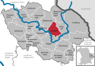
Боденмайс (Bodenmais, Bodenmais)

 Hiking in Боденмайс
Bodenmais is a charming village located in the Bavarian Forest region of Germany, known for its stunning natural landscapes and extensive hiking trails. Here are some key details about hiking in Bodenmais:
Trail Options
-
Zwercheck: This is the highest peak in the Bavarian Forest at 1,450 meters (4,757 feet). The trail to Zwercheck offers breathtaking views of the surrounding mountains and valleys.
-
Silberberg: A popular hiking destination, the Silberberg mountain features well-marked trails suitable for various skill levels. You can also enjoy panoramic views and visit a toboggan run in the summer.
-
Bodenmais Trail: This circular route takes you through the picturesque landscape surrounding Bodenmais, offering a mix of forested areas and open fields.
-
Goldsteig Trail: Part of a long-distance hiking route that runs through the Bavarian Forest, this trail offers various segments around Bodenmais for those interested in multi-day hikes.
Difficulty Levels
Bodenmais has trails that cater to all experience levels, from easy walks suitable for families to challenging hikes for experienced trekkers. Be sure to check trail maps and signage before setting out.
Nature and Scenery
The area is known for its rich biodiversity, including various flora and fauna. You’ll encounter beautiful alpine meadows, dense forests, and stunning viewpoints along the hiking trails.
Best Time to Hike
The hiking season in Bodenmais typically runs from spring to autumn. Late spring and early autumn are particularly beautiful times to hike, with blooming wildflowers and vibrant fall colors.
Equipment and Tips
- Footwear: Wear sturdy hiking boots for the best support and traction.
- Navigation: Carry a map or use a hiking app. Trails are generally well-marked, but it helps to have a guide.
- Weather: Be prepared for changing weather conditions, especially at higher elevations. Layer your clothing and pack rain gear if necessary.
- Hydration and Snacks: Bring enough water and snacks to maintain your energy during hikes.
Local Attractions
After a day of hiking, you can explore Bodenmais' charming village center, enjoy local Bavarian cuisine, or relax at one of the wellness centers in the area.
Overall, hiking in Bodenmais offers a fantastic combination of natural beauty, well-maintained trails, and the chance to experience Bavarian culture.
- Страна:

- Почтовый код: 94249
- Телефонный код: 09924
- Код автомобильного номера: REG
- Координаты: 49° 4' 0" N, 13° 6' 0" E


- GPS треки (wikiloc): [Ссылка]
- Высота над уровнем моря: 689 м m
- Площадь: 45.29 кв.км
- Население: 3397
- Веб сайт: http://www.bodenmais.de
- Википедия русская: wiki(ru)
- Википедия английская: wiki(en)
- Википедия национальная: wiki(de)
- Хранилище Wikidata: Wikidata: Q513654
- Катеория в википедии: [Ссылка]
- код Freebase: [/m/02q78lj]
- код GeoNames: Альт: [2947120]
- код VIAF: Альт: [123793150]
- ID отношения в OpenStreetMap: [959154]
- код GND: Альт: [4087868-5]
- WOEID: [639819]
- код TGN: [1038576]
- код Historical Gazetteer: [BODAI1JN69NB]
- Bavarikon ID: [ODB_A00001589]
- идентификатор муниципалитетов в Германии: 09276117
Граничит с регионами:


Цвизель
- община Германии
Hiking in Цвизель
Zwiesel, located in Bavaria, Germany, is a beautiful town nestled at the edge of the Bavarian Forest National Park. It offers a variety of hiking opportunities that cater to different skill levels, making it a great destination for both novice and experienced hikers....
- Страна:
- Почтовый код: 94227
- Телефонный код: 9922
- Код автомобильного номера: REG
- Координаты: 49° 1' 0" N, 13° 14' 0" E
- GPS треки (wikiloc): [Ссылка]
- Высота над уровнем моря: 750 м m
- Площадь: 41.16 кв.км
- Население: 9407
- Веб сайт: [Ссылка]

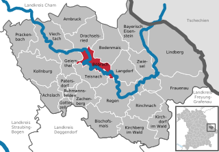
Лангдорф
Hiking in Лангдорф
Langdorf, located in Bavaria, Germany, is surrounded by beautiful natural landscapes that make it an excellent destination for hiking enthusiasts. Here are some key points to consider if you're planning to hike in and around Langdorf:...
- Страна:
- Почтовый код: 94264
- Телефонный код: 09921
- Код автомобильного номера: REG
- Координаты: 49° 1' 0" N, 13° 9' 0" E
- GPS треки (wikiloc): [Ссылка]
- Высота над уровнем моря: 645 м m
- Площадь: 34.35 кв.км
- Население: 1779
- Веб сайт: [Ссылка]


Драксельсрид
Hiking in Драксельсрид
Drachselsried is a picturesque village located in the Bavarian Forest of Germany, known for its stunning natural landscapes and excellent hiking opportunities. Here are some key points about hiking in Drachselsried:...
- Страна:
- Почтовый код: 94256
- Телефонный код: 09945
- Код автомобильного номера: REG
- Координаты: 49° 6' 0" N, 13° 1' 0" E
- GPS треки (wikiloc): [Ссылка]
- Высота над уровнем моря: 648 м m
- Площадь: 41.72 кв.км
- Население: 2270
- Веб сайт: [Ссылка]


Байериш-Айзенштайн
Hiking in Байериш-Айзенштайн
Bayerisch Eisenstein, located in the Bavarian Forest National Park in Germany, is a fantastic destination for hiking enthusiasts. The area is known for its stunning landscapes, diverse flora and fauna, and a wide range of hiking trails suitable for different skill levels....
- Страна:
- Почтовый код: 94252
- Телефонный код: 09925
- Код автомобильного номера: REG
- Координаты: 49° 7' 12" N, 13° 12' 0" E
- GPS треки (wikiloc): [Ссылка]
- Высота над уровнем моря: 724 м m
- Площадь: 47.32 кв.км
- Население: 1007
- Веб сайт: [Ссылка]

Бёбрах
Hiking in Бёбрах
Böbrach, a charming village located in Bavaria, Germany, offers a serene setting for outdoor enthusiasts, particularly hikers. Surrounded by the picturesque landscapes of the Bavarian Forest, Böbrach provides access to numerous trails that cater to different skill levels....
- Страна:
- Почтовый код: 94255
- Телефонный код: 09923
- Код автомобильного номера: REG
- Координаты: 49° 4' 0" N, 13° 2' 0" E
- GPS треки (wikiloc): [Ссылка]
- Высота над уровнем моря: 576 м m
- Площадь: 27.55 кв.км
- Население: 1518
- Веб сайт: [Ссылка]

Лоберг
Hiking in Лоберг
Lohberg is a beautiful area located in Bavaria, Germany, known for its stunning natural landscapes and outdoor recreational opportunities, including hiking. Nestled in the foothills of the Bavarian Forest, Lohberg offers a variety of trails suitable for different skill levels and preferences. Here are some highlights for hiking in the area:...
- Страна:
- Почтовый код: 93470
- Телефонный код: 09943
- Код автомобильного номера: CHA
- Координаты: 49° 11' 0" N, 13° 6' 0" E
- GPS треки (wikiloc): [Ссылка]
- Высота над уровнем моря: 636 м m
- Площадь: 59.25 кв.км
- Население: 2051
- Веб сайт: [Ссылка]