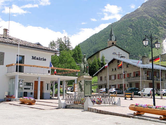
Bonneval-sur-Arc (Bonneval-sur-Arc)

- коммуна во Франции
 Hiking in Bonneval-sur-Arc
Bonneval-sur-Arc is a stunning location for hiking, situated in the French Alps within the Vanoise National Park. Known for its picturesque landscapes, high peaks, and well-preserved alpine environment, it offers a range of trails suitable for different levels of hikers.
Hiking Highlights:
-
Scenic Views: The area boasts breathtaking views of glaciers, alpine meadows, and rugged mountain terrain. Many trails offer panoramic vistas that are especially beautiful during summer when wildflowers bloom.
-
Variety of Trails: There are numerous hiking trails in and around Bonneval-sur-Arc, catering to all fitness levels. Whether you're looking for an easy walk or a more challenging trek, you'll find suitable options.
-
Wildlife Spotting: The region is home to diverse wildlife, including ibex, chamois, and various bird species. Hiking here can provide opportunities for nature observation.
-
Vanoise National Park: Being part of this national park, hikers can explore and appreciate the important natural habitats. The park features marked trails, which are well-maintained and clearly signposted.
-
Local Culture: The traditional architecture and culture of Bonneval-sur-Arc enhance the hiking experience. You might find charming hamlets and local eateries where you can enjoy regional dishes.
Popular Hiking Routes:
-
Col de l’Eléphant: This is a moderate hike offering stunning views and a chance to see a variety of wildlife. The trail leads to a high pass, providing vistas of the surrounding peaks.
-
Lacs de la Partie: A beautiful hike that takes you to several alpine lakes. The trail is relatively easy and suitable for families, with plenty of spots to rest and enjoy the scenery.
-
Refuge de l’Entrebase: A more challenging hike leads to this refuge, which offers meals and overnight accommodations. The route is scenic and features both rocky terrains and lush meadows.
Tips for Hiking in Bonneval-sur-Arc:
-
Check the Weather: Conditions in the mountains can change rapidly. Always check the weather forecast before heading out.
-
Stay Hydrated and Nourished: Bring sufficient water and snacks to keep your energy up during hikes.
-
Dress Appropriately: Wear layers to prepare for temperature changes and ensure you have proper footwear.
-
Wildlife Respect: Observe wildlife from a distance and do not feed animals.
-
Maps and Navigation: Having a map or a GPS app can be helpful as some trails may not have signals. Consider downloading offline maps.
-
Respect the Environment: Stay on marked paths to minimize your impact on the natural landscape.
Hiking in Bonneval-sur-Arc can be an unforgettable experience, surrounded by the beauty of the French Alps and fulfilling fresh air. Make sure to plan your trip according to your abilities and interests, and enjoy the adventure!
- Страна:

- Почтовый код: 73480
- Координаты: 45° 22' 16" N, 7° 2' 47" E


- GPS треки (wikiloc): [Ссылка]
- Площадь: 82.72 кв.км
- Население: 255
- Веб сайт: http://www.bonneval-sur-arc.com
- Википедия английская: wiki(en)
- Википедия национальная: wiki(fr)
- Хранилище Wikidata: Wikidata: Q736370
- Катеория в википедии: [Ссылка]
- код Freebase: [/m/03g_ht1]
- код GeoNames: Альт: [6450979]
- номер SIREN: [217300474]
- код BNF: [152739821]
- код VIAF: Альт: [147815724]
- код GND: Альт: [4548760-1]
- код LCNAF: Альт: [n85201344]
- WOEID: [12657349]
- код муниципалитета INSEE: 73047
Граничит с регионами:


Валь-д'Изер
- коммуна во Франции
Hiking in Валь-д'Изер
Val-d'Isère, located in the French Alps, is a renowned ski resort that also offers spectacular hiking opportunities during the summer months. The area is known for its breathtaking mountain scenery, alpine meadows, and a variety of hiking trails suitable for different skill levels. Here are some highlights to consider if you plan to hike in Val-d'Isère:...
- Страна:
- Почтовый код: 73150
- Координаты: 45° 26' 59" N, 6° 58' 38" E
- GPS треки (wikiloc): [Ссылка]
- Высота над уровнем моря: 1850 м m
- Площадь: 94.39 кв.км
- Население: 1583
- Веб сайт: [Ссылка]

Bessans
- коммуна во Франции
Hiking in Bessans
Bessans is a picturesque village located in the Savoie region of the French Alps, known for its stunning landscapes and outdoor activities, including hiking. Nestled at an altitude of about 1,740 meters, it offers a range of trails suitable for various skill levels, making it a great destination for both experienced hikers and families....
- Страна:
- Почтовый код: 73480
- Координаты: 45° 19' 12" N, 6° 59' 37" E
- GPS треки (wikiloc): [Ссылка]
- Высота над уровнем моря: 1750 м m
- Площадь: 128.08 кв.км
- Население: 338
- Веб сайт: [Ссылка]

Бальме
- коммуна Италии
Hiking in Бальме
Balme is a charming village located in the Susa Valley of the Piedmont region in Italy. It's known for its breathtaking natural scenery, rugged terrain, and as a gateway to various hiking opportunities. Here are some key points about hiking in Balme:...
- Страна:

- Почтовый код: 10070
- Телефонный код: 0123
- Код автомобильного номера: TO
- Координаты: 45° 18' 0" N, 7° 13' 0" E
- GPS треки (wikiloc): [Ссылка]
- Высота над уровнем моря: 1432 м m
- Площадь: 62.71 кв.км
- Население: 111
- Веб сайт: [Ссылка]


Черезоле-Реале
- коммуна Италии
Hiking in Черезоле-Реале
Ceresole Reale is a stunning area located in the Italian Piedmont region, within the Gran Paradiso National Park. It's a fantastic destination for hiking enthusiasts, offering a combination of breathtaking landscapes, diverse flora and fauna, and a variety of trails suitable for different skill levels....
- Страна:
- Почтовый код: 10080
- Телефонный код: 0124
- Код автомобильного номера: TO
- Координаты: 45° 26' 0" N, 7° 14' 0" E
- GPS треки (wikiloc): [Ссылка]
- Высота над уровнем моря: 1620 м m
- Площадь: 99.82 кв.км
- Население: 164
- Веб сайт: [Ссылка]


Гроскавалло
- коммуна Италии
Hiking in Гроскавалло
Groscavallo is a beautiful area located in the Piedmont region of Italy, nestled in the Alps. Known for its stunning landscapes and natural beauty, it offers a variety of hiking opportunities for both beginners and experienced hikers....
- Страна:
- Почтовый код: 10070
- Телефонный код: 0123
- Код автомобильного номера: TO
- Координаты: 45° 22' 0" N, 7° 16' 0" E
- GPS треки (wikiloc): [Ссылка]
- Высота над уровнем моря: 1110 м m
- Площадь: 92.09 кв.км
- Население: 204
- Веб сайт: [Ссылка]