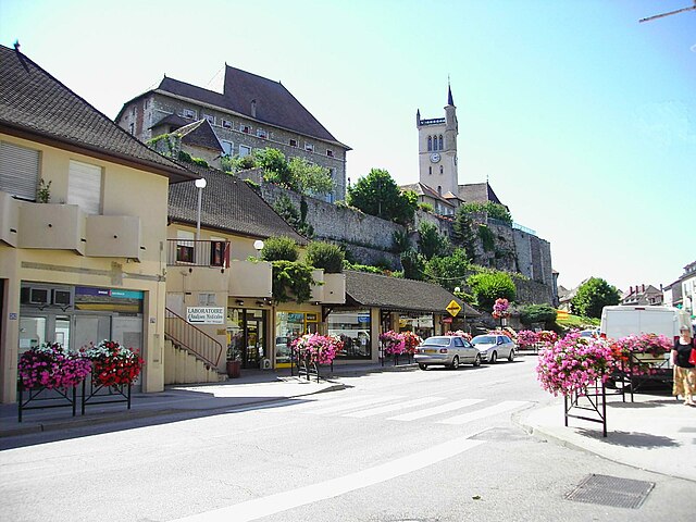
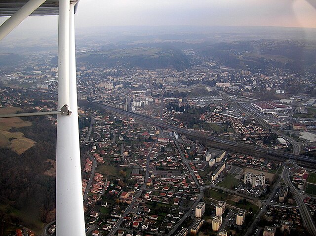
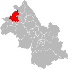
Ла-Тур-дю-Пен (arrondissement of La Tour-du-Pin, arrondissement de La Tour-du-Pin)
.svg)
- округ Франции
 Hiking in Ла-Тур-дю-Пен
The Arrondissement of La Tour-du-Pin, located in the Isère department of the Auvergne-Rhône-Alpes region in southeastern France, offers several opportunities for hiking enthusiasts. This area is characterized by its diverse landscapes, including rolling hills, dense forests, and scenic river valleys, making it a suitable destination for various types of hikes.
Popular Hiking Areas
-
Chartreuse Mountains: Just a short distance from La Tour-du-Pin, the Chartreuse Mountains offer numerous trails ranging from easy walks to more challenging hikes. The views from the summits are spectacular, with panoramic vistas of the surrounding valleys and mountain ranges.
-
Vercors Regional Natural Park: A bit further but easily accessible, the Vercors has a network of trails that cater to all skill levels. The park is known for its stunning cliffs, deep gorges, and rich biodiversity. It’s a great place for extended hikes and even multi-day treks.
-
Local Trails: Around La Tour-du-Pin itself, you can find several local trails that allow you to explore the countryside. These often meander through charming villages and agricultural lands, providing a glimpse into rural life.
Key Considerations
-
Trail Markings: Many paths are well marked with the standard French hiking trail signs (GR for long-distance paths and PR for shorter local trails). Always carry a map or a reliable GPS device.
-
Weather: The weather can change quickly in the mountains, so dress in layers and be prepared for varying conditions. Check forecasts before your hike.
-
Safety and Regulations: Respect wildlife and plant life, and stick to the marked trails. Always inform someone about your hiking plans and carry a basic first-aid kit.
Best Times to Hike
-
Spring and Fall: These seasons are ideal for hiking, as temperatures are generally mild and the landscapes are lush and colorful. Spring is especially beautiful with blooming flowers, while fall offers stunning foliage.
-
Summer: With warmer temperatures, summer is popular for hiking, but it's advisable to start earlier in the day to avoid the heat.
If you're new to hiking in this region, consider joining a guided group tour for your first outings, to familiarize yourself with the trails and local guidelines. Always remember to pack enough water and snacks, and enjoy the beautiful natural scenery that the Arrondissement of La Tour-du-Pin has to offer!
- Страна:

- Столица: Ла-Тур-дю-Пен
- Координаты: 45° 35' 0" N, 5° 25' 0" E


- GPS треки (wikiloc): [Ссылка]
- Площадь: 1479 кв.км
- Население: 299785
- Википедия русская: wiki(ru)
- Википедия английская: wiki(en)
- Википедия национальная: wiki(fr)
- Хранилище Wikidata: Wikidata: Q701368
- код Freebase: [/m/095hv5]
- код GeoNames: Альт: [3006201]
- код округа INSEE: [382]
- код GNS: -1439191
Включает регионы:

canton of Crémieu
Hiking in canton of Crémieu
Canton de Crémieu, located in the Isère department of the Auvergne-Rhône-Alpes region of France, offers a variety of hiking opportunities with beautiful landscapes, historical sites, and charming villages. Here are some highlights for those interested in hiking in the area:...

Морестель
Hiking in Морестель
The Canton of Morestel, located in the Auvergne-Rhône-Alpes region of southeastern France, offers a beautiful and varied landscape that is great for hiking enthusiasts. Here are some key highlights and tips for hiking in this picturesque area:...
- Страна:
- Столица: Морестель
- Координаты: 45° 42' 19" N, 5° 27' 34" E
- GPS треки (wikiloc): [Ссылка]
- Население: 38125


Л’Иль-д’Або
Hiking in Л’Иль-д’Або
The Canton of L'Isle-d'Abeau, located in the Auvergne-Rhône-Alpes region of France, offers a range of outdoor activities, including hiking. This area features a mix of natural landscapes, from rolling hills to forests, making it a great location for hikers of all experience levels....
- Страна:
- Столица: Л’Иль-д’Або
- Координаты: 45° 36' 40" N, 5° 10' 8" E
- GPS треки (wikiloc): [Ссылка]
- Население: 51722
canton of Bourgoin-Jallieu-Nord
Hiking in canton of Bourgoin-Jallieu-Nord
Canton de Bourgoin-Jallieu-Nord, located in the Isère department of France, offers a variety of hiking opportunities set against a backdrop of stunning natural scenery, rolling hills, and rich cultural history. The region is characterized by its diverse landscapes, ranging from flat agricultural land to the foothills of the Alps....
- Страна:
- Столица: Бургуэн-Жальё
- Координаты: 45° 37' 30" N, 5° 18' 33" E
- GPS треки (wikiloc): [Ссылка]
canton of Bourgoin-Jallieu-Sud
Hiking in canton of Bourgoin-Jallieu-Sud
Canton de Bourgoin-Jallieu-Sud, located in the Isère department in the Auvergne-Rhône-Alpes region of France, offers a variety of hiking opportunities for both beginners and seasoned hikers. The landscape is characterized by rolling hills, forests, and picturesque countryside, making it an inviting area for outdoor exploration....
- Страна:
- Столица: Бургуэн-Жальё
- Координаты: 45° 33' 14" N, 5° 17' 11" E
- GPS треки (wikiloc): [Ссылка]


Ле-Гран-Лан
Hiking in Ле-Гран-Лан
The Canton of Le Grand-Lemps, located in the Isère department of the Auvergne-Rhône-Alpes region in France, offers picturesque landscapes and a variety of hiking opportunities for outdoor enthusiasts. Here are some key aspects of hiking in this area:...
- Страна:
- Столица: Ле-Гран-Лан
- Координаты: 45° 26' 14" N, 5° 23' 33" E
- GPS треки (wikiloc): [Ссылка]
- Население: 35622

canton of Saint-Geoire-en-Valdaine
Hiking in canton of Saint-Geoire-en-Valdaine
Canton de Saint-Geoire-en-Valdaine, located in the Isère department of the Auvergne-Rhône-Alpes region in southeastern France, offers a variety of hiking opportunities for outdoor enthusiasts. The terrain features a mix of rolling hills, forests, and picturesque landscapes that characterize the region....
- Страна:
- Столица: Сен-Жуар-ан-Вальден
- Координаты: 45° 28' 39" N, 5° 37' 29" E
- GPS треки (wikiloc): [Ссылка]

canton of Virieu
Hiking in canton of Virieu
Canton de Virieu, located in the Isère department in the Auvergne-Rhône-Alpes region of France, offers a variety of hiking opportunities set against a backdrop of stunning natural scenery. The landscape is characterized by rolling hills, lush forests, and beautiful valleys, making it a fantastic destination for hikers of all skill levels....


Ла-Тур-дю-Пен
Hiking in Ла-Тур-дю-Пен
The Canton of La Tour-du-Pin, located in the Isère department of the Auvergne-Rhône-Alpes region in southeastern France, is a beautiful area for hiking enthusiasts. The region features a mix of varied landscapes, including rolling hills, forests, and the foothills of the Alps, making it suitable for hikers of all levels....
- Страна:
- Столица: Ла-Тур-дю-Пен
- Координаты: 45° 34' 18" N, 5° 26' 30" E
- GPS треки (wikiloc): [Ссылка]
- Население: 35955

Ла-Верпийер
Hiking in Ла-Верпийер
The Canton of La Verpillière, located in the Auvergne-Rhône-Alpes region of France, offers a range of beautiful hiking opportunities characterized by its scenic landscapes and cultural heritage. Here are some key points to consider when hiking in this area:...
- Страна:
- Столица: Ла-Верпийер
- Координаты: 45° 36' 49" N, 5° 9' 24" E
- GPS треки (wikiloc): [Ссылка]
- Население: 44729