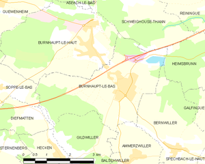
Бюрно-ле-О (Burnhaupt-le-Haut, Burnhaupt-le-Haut)

- коммуна во Франции
 Hiking in Бюрно-ле-О
Burnhaupt-le-Haut is a small commune located in the Alsace region of northeastern France. It offers picturesque landscapes and opportunities for hiking enthusiasts to explore the surrounding natural beauty.
Hiking Trails and Nature
Although Burnhaupt-le-Haut itself might not have extensive marked trails, it is situated near several natural reserves and scenic areas in Alsace. Key features include:
-
Nearby Nature Reserves: The Vosges mountains are not far away, offering numerous trails that vary in difficulty. The region is characterized by rolling hills, forests, and charming villages.
-
Scenic Views: The area provides beautiful views of both the Vosges and the Jura mountains. Hikers can often enjoy picturesque vistas, especially during clear weather.
-
Flora and Fauna: Alsace is known for its diverse wildlife and plant species. While hiking, you might encounter various birds, deer, and an array of local flora.
Suggested Hiking Areas Nearby
-
The Vosges Mountains: A short drive from Burnhaupt-le-Haut, the Vosges offers well-marked trails ranging from easy walks to more challenging hikes that lead to higher altitudes and stunning panoramas.
-
The Parc Naturel Régional des Ballons des Vosges: This regional park features numerous trails for hiking and is a popular destination for outdoor enthusiasts, featuring diverse landscapes and viewpoints.
-
Local Trails: Check local information centers for lesser-known paths that may lead through forests, vineyards, or to historical sites.
Hiking Tips
- Local Maps: Always have a detailed map of the area, which can often be found at local hiking shops or tourist information centers.
- Weather Preparedness: The weather can change rapidly, so dress in layers and carry rain gear, especially in the mountains.
- Footwear: Proper hiking boots are essential, as some trails may be rocky or uneven.
- Hydration and Food: Carry enough water and snacks, especially for longer hikes or those you may not be familiar with.
Conclusion
Hiking in and around Burnhaupt-le-Haut can be a rewarding experience, offering a mix of natural beauty and cultural richness characteristic of the Alsace region. Whether you're a beginner or an experienced hiker, you'll find paths that suit your level. Always check local resources for trail conditions and recommendations before heading out!
- Страна:

- Почтовый код: 68520
- Координаты: 47° 43' 49" N, 7° 8' 43" E


- GPS треки (wikiloc): [Ссылка]
- Площадь: 12.49 кв.км
- Население: 1807
- Википедия русская: wiki(ru)
- Википедия английская: wiki(en)
- Википедия национальная: wiki(fr)
- Хранилище Wikidata: Wikidata: Q370352
- Катеория в википедии: [Ссылка]
- код Freebase: [/m/03nss33]
- код Freebase: [/m/03nss33]
- код GeoNames: Альт: [3029498]
- код GeoNames: Альт: [3029498]
- номер SIREN: [216800607]
- номер SIREN: [216800607]
- код BNF: [15271762c]
- код BNF: [15271762c]
- код муниципалитета INSEE: 68060
- код муниципалитета INSEE: 68060
Граничит с регионами:

Рененг
- коммуна во Франции
Hiking in Рененг
Reiningue is a small commune in the Grand Est region of France, close to the border with Germany. While it may not be as widely recognized as a hiking destination, the surrounding region offers some beautiful natural landscapes and hiking opportunities....
- Страна:
- Почтовый код: 68950
- Координаты: 47° 45' 2" N, 7° 13' 53" E
- GPS треки (wikiloc): [Ссылка]
- Площадь: 18.54 кв.км
- Население: 1965
- Веб сайт: [Ссылка]


Аспак-ле-Ба
- коммуна во Франции
- Страна:
- Почтовый код: 68700
- Координаты: 47° 45' 42" N, 7° 9' 2" E
- GPS треки (wikiloc): [Ссылка]
- Площадь: 8.01 кв.км
- Население: 1323

Бюрно-ле-Ба
- коммуна во Франции
Hiking in Бюрно-ле-Ба
Burnhaupt-le-Bas is a charming village located in the Alsace region of northeastern France, known for its rich natural scenery and beautiful hiking opportunities. While it may not be as widely recognized as some of the larger hiking destinations in the region, it offers several attractive trails and is a great starting point for outdoor activities....
- Страна:
- Почтовый код: 68520
- Координаты: 47° 43' 4" N, 7° 9' 42" E
- GPS треки (wikiloc): [Ссылка]
- Площадь: 11.77 кв.км
- Население: 1849
- Веб сайт: [Ссылка]


Гевенайм
- коммуна во Франции
- Страна:
- Почтовый код: 68116
- Координаты: 47° 45' 11" N, 7° 5' 32" E
- GPS треки (wikiloc): [Ссылка]
- Площадь: 8.55 кв.км
- Население: 1321


Сопп-ле-Ба
- коммуна во Франции
Hiking in Сопп-ле-Ба
Soppe-le-Bas is a small commune located in the Haute-Saône department in the Bourgogne-Franche-Comté region of eastern France. While it may not be one of the most famous hiking destinations in France, it offers opportunities for outdoor enthusiasts to explore the beautiful rural landscapes of the region....
- Страна:
- Почтовый код: 68780
- Координаты: 47° 43' 2" N, 7° 5' 22" E
- GPS треки (wikiloc): [Ссылка]
- Площадь: 5.68 кв.км
- Население: 770


Швегуз-Тан
- коммуна во Франции
Hiking in Швегуз-Тан
Schweighouse-Thann is located in the Alsace region of France, near the Vosges Mountains. It's a beautiful area that offers a variety of hiking opportunities catering to different skill levels, from leisurely walks to more challenging hikes....
- Страна:
- Почтовый код: 68520
- Координаты: 47° 45' 10" N, 7° 10' 15" E
- GPS треки (wikiloc): [Ссылка]
- Высота над уровнем моря: 380 м m
- Площадь: 10.78 кв.км
- Население: 778