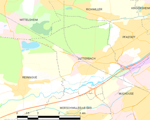
Рененг (Reiningue, Reiningue)

- коммуна во Франции
 Hiking in Рененг
Reiningue is a small commune in the Grand Est region of France, close to the border with Germany. While it may not be as widely recognized as a hiking destination, the surrounding region offers some beautiful natural landscapes and hiking opportunities.
Nearby Hiking Opportunities:
-
Hiking Trails:
- There are various trails in the vicinity that can cater to different skill levels. Look for paths that lead through forests, fields, and scenic villages.
- The Île du Rhin, located nearby, offers natural beauty with its wetlands, making it a great spot for longer hikes while enjoying wildlife observation.
-
Haut-Rhin Region:
- Exploring further into the Haut-Rhin department can reveal stunning hikes through the Vosges Mountains, with trails offering breathtaking views, such as on the Grand Ballon, the highest peak in the Vosges.
- The Alsatian Wine Route is also nearby, where you can combine hiking with wine tasting by exploring vineyards and charming towns.
-
Nature Reserves:
- Look for nature reserves and parks around Reiningue, which may have designated walking paths. The Parc Naturel Régional des Ballons des Vosges is an excellent nearby destination worth exploring if you're up for a scenic drive.
Suggested Preparations:
- Maps and Guides: Consider bringing a local hiking map or using a GPS-enabled hiking app to navigate the less traveled paths.
- Appropriate Gear: Wear sturdy hiking boots and dress in layers, as temperatures can change significantly, especially in higher altitudes.
- Essentials: Carry water and snacks, and don’t forget a first aid kit. It’s always better to be prepared.
Safety Tips:
- Inform someone about your hiking plan, especially if you venture into less populated areas.
- Be mindful of weather conditions and check the forecast before heading out.
- Stay on marked trails to protect the local ecosystem and ensure your safety.
Enjoy the natural beauty and enjoy your hiking adventures around Reiningue and the beautiful Alsace region!
- Страна:

- Почтовый код: 68950
- Координаты: 47° 45' 2" N, 7° 13' 53" E


- GPS треки (wikiloc): [Ссылка]
- Площадь: 18.54 кв.км
- Население: 1965
- Веб сайт: http://www.mairie-reiningue.fr/
- Википедия русская: wiki(ru)
- Википедия английская: wiki(en)
- Википедия национальная: wiki(fr)
- Хранилище Wikidata: Wikidata: Q148780
- Катеория в википедии: [Ссылка]
- код Freebase: [/m/03m4lp8]
- код Freebase: [/m/03m4lp8]
- код GeoNames: Альт: [2984107]
- код GeoNames: Альт: [2984107]
- номер SIREN: [216802678]
- номер SIREN: [216802678]
- код BNF: [15271969b]
- код BNF: [15271969b]
- код VIAF: Альт: [233888900]
- код VIAF: Альт: [233888900]
- код GND: Альт: [4651381-4]
- код GND: Альт: [4651381-4]
- код муниципалитета INSEE: 68267
- код муниципалитета INSEE: 68267
Граничит с регионами:

Люттербак
- коммуна во Франции
Hiking in Люттербак
Lutterbach, a small town in the Grand Est region of France, is not widely known for hiking but can serve as a good base for exploring nearby natural areas and trails. Here’s what you might expect and some recommendations for hiking in and around Lutterbach:...
- Страна:
- Почтовый код: 68460
- Координаты: 47° 45' 35" N, 7° 16' 50" E
- GPS треки (wikiloc): [Ссылка]
- Площадь: 8.56 кв.км
- Население: 6331
- Веб сайт: [Ссылка]

Моршвиллер-ле-Ба
- коммуна во Франции
Hiking in Моршвиллер-ле-Ба
Morschwiller-le-Bas, located in the Alsace region of France, offers a variety of hiking opportunities for nature lovers and outdoor enthusiasts. While it may be a small town, it has access to beautiful landscapes and trails in the surrounding areas....
- Страна:
- Почтовый код: 68790
- Координаты: 47° 44' 9" N, 7° 16' 14" E
- GPS треки (wikiloc): [Ссылка]
- Площадь: 7.55 кв.км
- Население: 3667


Серне
- Страна:
- Почтовый код: 68700
- Координаты: 47° 48' 24" N, 7° 10' 33" E
- GPS треки (wikiloc): [Ссылка]
- Площадь: 18.04 кв.км
- Население: 11608
- Веб сайт: [Ссылка]


Аспак-ле-Ба
- коммуна во Франции
- Страна:
- Почтовый код: 68700
- Координаты: 47° 45' 42" N, 7° 9' 2" E
- GPS треки (wikiloc): [Ссылка]
- Площадь: 8.01 кв.км
- Население: 1323

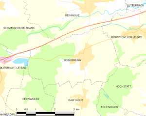
Эмсбрюн
- коммуна во Франции
Hiking in Эмсбрюн
Heimsbrunn is a small commune located in the Grand Est region of France, specifically in the Haut-Rhin department. It offers some beautiful hiking opportunities, particularly for those looking to explore the scenic landscapes of the Vosges region. While Heimsbrunn itself is a quieter area, it is well-situated near more extensive hiking trails and natural attractions....
- Страна:
- Почтовый код: 68990
- Координаты: 47° 43' 35" N, 7° 13' 35" E
- GPS треки (wikiloc): [Ссылка]
- Площадь: 10.59 кв.км
- Население: 1302

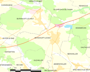
Бюрно-ле-Ба
- коммуна во Франции
Hiking in Бюрно-ле-Ба
Burnhaupt-le-Bas is a charming village located in the Alsace region of northeastern France, known for its rich natural scenery and beautiful hiking opportunities. While it may not be as widely recognized as some of the larger hiking destinations in the region, it offers several attractive trails and is a great starting point for outdoor activities....
- Страна:
- Почтовый код: 68520
- Координаты: 47° 43' 4" N, 7° 9' 42" E
- GPS треки (wikiloc): [Ссылка]
- Площадь: 11.77 кв.км
- Население: 1849
- Веб сайт: [Ссылка]


Бюрно-ле-О
- коммуна во Франции
Hiking in Бюрно-ле-О
Burnhaupt-le-Haut is a small commune located in the Alsace region of northeastern France. It offers picturesque landscapes and opportunities for hiking enthusiasts to explore the surrounding natural beauty....
- Страна:
- Почтовый код: 68520
- Координаты: 47° 43' 49" N, 7° 8' 43" E
- GPS треки (wikiloc): [Ссылка]
- Площадь: 12.49 кв.км
- Население: 1807

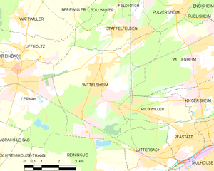
Виттельсайм
- коммуна во Франции
- Страна:
- Почтовый код: 68310
- Координаты: 47° 48' 19" N, 7° 14' 15" E
- GPS треки (wikiloc): [Ссылка]
- Площадь: 23.63 кв.км
- Население: 10384
- Веб сайт: [Ссылка]


Швегуз-Тан
- коммуна во Франции
Hiking in Швегуз-Тан
Schweighouse-Thann is located in the Alsace region of France, near the Vosges Mountains. It's a beautiful area that offers a variety of hiking opportunities catering to different skill levels, from leisurely walks to more challenging hikes....
- Страна:
- Почтовый код: 68520
- Координаты: 47° 45' 10" N, 7° 10' 15" E
- GPS треки (wikiloc): [Ссылка]
- Высота над уровнем моря: 380 м m
- Площадь: 10.78 кв.км
- Население: 778