canton of Monestier-de-Clermont (canton de Monestier-de-Clermont)
 Hiking in canton of Monestier-de-Clermont
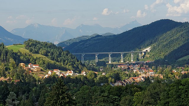
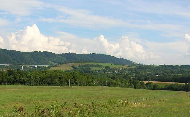
Canton de Monestier-de-Clermont, located in the Isère department of the Auvergne-Rhône-Alpes region in southeastern France, offers a variety of hiking opportunities that showcase the stunning natural landscapes of the French Alps. This area is characterized by its diverse terrain, which includes rolling hills, rugged mountains, and picturesque valleys.
Key Hiking Areas and Trails:
-
Belledonne Range: This mountain range to the east of Monestier-de-Clermont is popular for its dramatic alpine scenery. Trails here vary from moderate day hikes to challenging routes that may require some mountaineering skills. Look for paths that lead to summits like Le Grand Colon or Le Crêt du Poulet.
-
La Chartreuse: To the north, the Chartreuse Mountains provide an alternate hiking option. The national park features many well-marked trails, offering routes that pass through dense forests, past limestone cliffs, and onto spectacular viewpoints. The trek to the Chamechaude summit is a favorite among hikers.
-
Vercors Regional Natural Park: To the west, you can explore the Vercors area, known for its dramatic cliffs, deep gorges, and vast plateaus. Hikes here can be more strenuous due to the elevation changes, but the panoramic views are worth it.
-
Local Circuits: Many local circuits and shorter trails are accessible right from Monestier-de-Clermont, providing routes suitable for families and casual hikers. These often weave through charming villages and offer insights into local flora and fauna.
Hiking Tips:
-
Seasonal Considerations: The best hiking seasons are from late spring to early autumn (May to October). Winter hiking is also possible, but be aware of snow and avalanche conditions.
-
Weather Preparedness: Mountain weather can change rapidly. It’s wise to check the weather forecast beforehand and dress in layers.
-
Equipment: Proper hiking boots, a map or GPS device, sufficient water, and snacks are essential. Depending on the hike, trekking poles can also be beneficial.
-
Wildlife Awareness: The region is home to various wildlife, including chamois and marmots, so hiking quietly increases your chances of spotting them.
-
Respect Nature: Stay on marked trails, pack out what you bring in, and respect any local guidelines to preserve the natural beauty.
Hiking in Canton de Monestier-de-Clermont offers a fantastic mix of natural beauty and outdoor adventure, making it a great destination for hikers of all skill levels.
- Страна:

- Столица: Монестье-де-Клермон
- Координаты: 44° 56' 32" N, 5° 37' 9" E


- GPS треки (wikiloc): [Ссылка]
- Хранилище Wikidata: Wikidata: Q1726265
- код кантона INSEE: [3818]
Включает регионы:

Монестье-де-Клермон
- коммуна во Франции
Hiking in Монестье-де-Клермон
Monestier-de-Clermont, located in the picturesque Isère department in the Auvergne-Rhône-Alpes region of France, offers a variety of hiking opportunities that showcase the stunning natural beauty of the French Alps. Here are some highlights and tips for hiking in this area:...
- Страна:
- Почтовый код: 38650
- Координаты: 44° 55' 1" N, 5° 38' 7" E
- GPS треки (wikiloc): [Ссылка]
- Площадь: 5.45 кв.км
- Население: 1426
- Веб сайт: [Ссылка]


Авиньоне
- коммуна во Франции
Hiking in Авиньоне
Avignonet is a charming locality that offers beautiful hiking opportunities, especially for those who appreciate scenic landscapes and historical surroundings. Here are some key highlights about hiking in and around Avignonet:...
- Страна:
- Почтовый код: 38650
- Координаты: 44° 57' 32" N, 5° 39' 25" E
- GPS треки (wikiloc): [Ссылка]
- Площадь: 8.41 кв.км
- Население: 189
- Веб сайт: [Ссылка]

Сен-Поль-ле-Монестье
- коммуна во Франции
Hiking in Сен-Поль-ле-Монестье
Saint-Paul-lès-Monestier is a picturesque village located in the Isère department in the Auvergne-Rhône-Alpes region of southeastern France. It serves as an excellent base for hiking enthusiasts who want to explore the beautiful landscapes of the Vercors Massif....
- Страна:
- Почтовый код: 38650
- Координаты: 44° 55' 46" N, 5° 37' 40" E
- GPS треки (wikiloc): [Ссылка]
- Площадь: 13.88 кв.км
- Население: 257

Треффор
- коммуна во Франции
Hiking in Треффор
Treffort is a charming village located in the Auvergne-Rhône-Alpes region of southeastern France. It is surrounded by picturesque landscapes that offer a variety of hiking opportunities. Here’s what you can expect when hiking in and around Treffort:...
- Страна:
- Почтовый код: 38650
- Координаты: 44° 54' 56" N, 5° 39' 29" E
- GPS треки (wikiloc): [Ссылка]
- Высота над уровнем моря: 618 м m
- Площадь: 10.99 кв.км
- Население: 276


Сен-Гийом
- коммуна во Франции
Hiking in Сен-Гийом
Saint-Guillaume, located in Quebec, Canada, offers a variety of hiking opportunities amidst beautiful natural landscapes. The area is characterized by its lush forests, rolling hills, and scenic views, making it an appealing destination for both novice and experienced hikers....
- Страна:
- Почтовый код: 38650
- Координаты: 44° 57' 18" N, 5° 35' 21" E
- GPS треки (wikiloc): [Ссылка]
- Площадь: 13.33 кв.км
- Население: 265


Мирибель-Ланшатр
- коммуна во Франции
Hiking in Мирибель-Ланшатр
Miribel-Lanchâtre is a charming destination in the department of Isère, in the Auvergne-Rhône-Alpes region of France. It offers beautiful landscapes, rich biodiversity, and various hiking opportunities that cater to different skill levels, making it an excellent spot for hiking enthusiasts....
- Страна:
- Почтовый код: 38450
- Координаты: 44° 58' 28" N, 5° 37' 13" E
- GPS треки (wikiloc): [Ссылка]
- Площадь: 9.65 кв.км
- Население: 415
- Веб сайт: [Ссылка]


Грес-ан-Веркор
- коммуна во Франции
Hiking in Грес-ан-Веркор
Gresse-en-Vercors is a charming village located in the Vercors Regional Natural Park in the French Alps. It’s an exceptional area for hiking, offering a variety of trails that cater to a range of skill levels, from beginners to experienced hikers. Here are some highlights and things to consider when hiking in Gresse-en-Vercors:...
- Страна:
- Почтовый код: 38650
- Координаты: 44° 54' 8" N, 5° 34' 0" E
- GPS треки (wikiloc): [Ссылка]
- Площадь: 81.13 кв.км
- Население: 395
- Веб сайт: [Ссылка]


Сент-Андеоль
- коммуна во Франции
Hiking in Сент-Андеоль
Saint-Andéol, located in the Isère department in the Auvergne-Rhône-Alpes region of France, is a wonderful destination for hiking enthusiasts. The area is characterized by its stunning natural landscapes, including picturesque valleys, forests, and views of the surrounding mountains....
- Страна:
- Почтовый код: 38650
- Координаты: 44° 57' 40" N, 5° 33' 9" E
- GPS треки (wikiloc): [Ссылка]
- Площадь: 29.7 кв.км
- Население: 125


Руасар
- коммуна во Франции
Hiking in Руасар
Roissard is a charming village located in the French Alps, specifically in the Isère department, offering stunning natural beauty and a variety of hiking opportunities for outdoor enthusiasts. Here are some key points to consider if you’re looking to hike in and around Roissard:...
- Страна:
- Почтовый код: 38650
- Координаты: 44° 52' 56" N, 5° 38' 23" E
- GPS треки (wikiloc): [Ссылка]
- Площадь: 14.25 кв.км
- Население: 298
- Веб сайт: [Ссылка]


Шато-Бернар
- коммуна во Франции
Hiking in Шато-Бернар
Hiking in Château-Bernard offers a delightful opportunity to explore the natural beauty of the area, characterized by picturesque landscapes, diverse flora and fauna, and a rich cultural history. While Château-Bernard itself is a small commune in the Auvergne region of France, there are several hikes and trails in the surrounding areas that cater to various skill levels....
- Страна:
- Почтовый код: 38650
- Координаты: 44° 58' 30" N, 5° 34' 35" E
- GPS треки (wikiloc): [Ссылка]
- Площадь: 18.27 кв.км
- Население: 276
- Веб сайт: [Ссылка]


Сен-Мартен-де-ла-Клюз
- коммуна во Франции
Hiking in Сен-Мартен-де-ла-Клюз
Saint-Martin-de-la-Cluze is a picturesque village located in the French Alps, specifically in the Isère department. Its stunning natural scenery and diverse topography make it a fantastic destination for hiking enthusiasts....
- Страна:
- Почтовый код: 38650
- Координаты: 44° 58' 58" N, 5° 39' 31" E
- GPS треки (wikiloc): [Ссылка]
- Высота над уровнем моря: 760 м m
- Площадь: 16.26 кв.км
- Население: 705
- Веб сайт: [Ссылка]


Синар
- коммуна во Франции
Hiking in Синар
Sinard is a beautiful area that offers various hiking opportunities, though it’s less widely known compared to some other hiking destinations. The region is characterized by stunning landscapes, including mountains, forests, and possibly bodies of water, making it an excellent choice for nature enthusiasts....
- Страна:
- Почтовый код: 38650
- Координаты: 44° 56' 44" N, 5° 39' 25" E
- GPS треки (wikiloc): [Ссылка]
- Площадь: 10.44 кв.км
- Население: 662