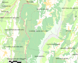
canton of Villard-de-Lans (canton de Villard-de-Lans)
 Hiking in canton of Villard-de-Lans
Canton de Villard-de-Lans, located in the Vercors Regional Natural Park in the French Alps, offers a fantastic range of hiking options for all experience levels. The area is renowned for its stunning landscapes, including dramatic cliffs, lush forests, and beautiful alpine meadows. Here are some highlights and tips for hiking in this region:
Trails and Routes
-
Villard-de-Lans to Méaudre: This scenic hike offers beautiful views of the surrounding mountains and is suitable for families. The terrain is relatively easy, making it accessible for beginners.
-
Col de la Bataille: For a more challenging hike, the trail to Col de la Bataille takes you through varied terrain and provides spectacular views from the top. It’s suitable for more experienced hikers.
-
Belvédère de l'Herbouilly: This shorter hike offers stunning panoramic views of the Vercors range and is perfect for a half-day excursion. It’s also a great spot for a picnic.
-
Ski slopes in summer: In the warmer months, many ski resorts in the area open their trails for hiking. You can often take lifts partway up the mountain for a less strenuous ascent.
Flora and Fauna
The Vercors region is rich in biodiversity. As you hike, you might encounter a variety of flora, including wild orchids and various alpine plants. It's also a good idea to keep an eye out for wildlife such as chamois, deer, and a range of bird species.
Best Time to Hike
The best time for hiking in the Canton de Villard-de-Lans is generally from late spring to early autumn (May to October) when the weather is mild, and the trails are clear of snow. Be sure to check the conditions as spring melts and autumn can still bring unexpected weather changes.
Equipment and Preparation
- Footwear: Wear sturdy hiking boots with good grip.
- Layered Clothing: The weather can change quickly in the mountains, so dress in layers to adjust to changing conditions.
- Map and Compass/GPS: While many trails are well-marked, it’s always good to have a map or a GPS device.
- Water and Snacks: Stay hydrated and bring energy-boosting snacks.
Guided Hiking
If you’re new to the area or prefer to have a knowledgeable guide, consider joining a guided hiking tour. Local hiking companies often offer group or private tours, which can enhance your experience and provide safety on the trails.
Whether you are an experienced hiker or just looking for a leisurely walk, the trails in and around Canton de Villard-de-Lans offer breathtaking views and unforgettable memories. Enjoy your hikes!
- Страна:

- Столица: Виллар-де-Лан
- Координаты: 45° 7' 38" N, 5° 34' 10" E


- GPS треки (wikiloc): [Ссылка]
- Хранилище Wikidata: Wikidata: Q1441860
- код кантона INSEE: [3841]
Включает регионы:

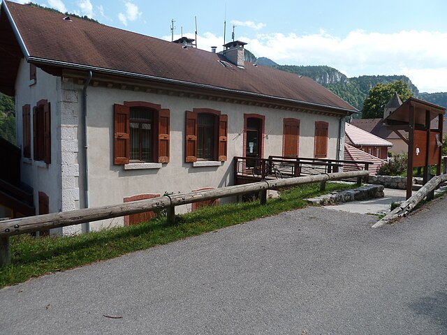
Коррансон-ан-Веркор
- коммуна во Франции
Hiking in Коррансон-ан-Веркор
Corrençon-en-Vercors is a charming alpine village located in the Vercors Regional Natural Park in the French Alps. It offers a variety of hiking opportunities that cater to different skill levels and preferences. Here are some highlights and tips for hiking in and around Corrençon-en-Vercors:...
- Страна:
- Почтовый код: 38250
- Координаты: 45° 1' 53" N, 5° 31' 35" E
- GPS треки (wikiloc): [Ссылка]
- Площадь: 39.34 кв.км
- Население: 353
- Веб сайт: [Ссылка]
Анжен
- коммуна во Франции
Hiking in Анжен
Hiking in the Écrins National Park, located in the French Alps, offers stunning landscapes, diverse wildlife, and a variety of trails suitable for all levels of hikers. The park features high alpine peaks, glaciers, valleys, and lush meadows, making it a paradise for outdoor enthusiasts....
- Страна:
- Почтовый код: 38360
- Координаты: 45° 10' 52" N, 5° 37' 0" E
- GPS треки (wikiloc): [Ссылка]
- Площадь: 20.64 кв.км
- Население: 473
- Веб сайт: [Ссылка]


Меодр
- коммуна во Франции
Hiking in Меодр
Méaudre is a beautiful alpine village located in the Vercors Regional Natural Park in the French Alps. It's a popular destination for outdoor enthusiasts, offering a variety of hiking opportunities that cater to different skill levels....
- Страна:
- Почтовый код: 38112
- Координаты: 45° 7' 37" N, 5° 31' 37" E
- GPS треки (wikiloc): [Ссылка]
- Площадь: 33.87 кв.км
- Население: 1345
- Веб сайт: [Ссылка]

Отран
- коммуна во Франции
Hiking in Отран
Autrans is a picturesque village located in the Vercors Regional Natural Park in France, renowned for its stunning landscapes and extensive network of hiking trails. The area is perfect for both casual walkers and seasoned hikers, offering a variety of routes catering to different skill levels and preferences....
- Страна:
- Почтовый код: 38880
- Координаты: 45° 10' 30" N, 5° 32' 32" E
- GPS треки (wikiloc): [Ссылка]
- Площадь: 44.02 кв.км
- Население: 1589
- Веб сайт: [Ссылка]


Виллар-де-Лан
- коммуна во Франции
Hiking in Виллар-де-Лан
Villard-de-Lans is a charming village located in the Vercors region of the French Alps, known for its stunning landscapes, diverse trails, and outdoor activities, making it a fantastic destination for hiking enthusiasts. Here are some key points about hiking in Villard-de-Lans:...
- Страна:
- Почтовый код: 38250
- Координаты: 45° 4' 12" N, 5° 33' 2" E
- GPS треки (wikiloc): [Ссылка]
- Площадь: 67.2 кв.км
- Население: 4175
- Веб сайт: [Ссылка]

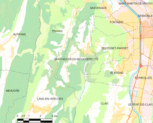
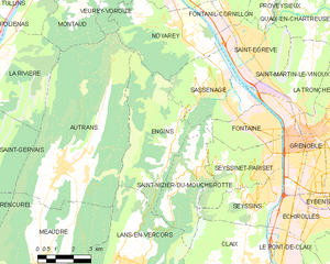
Сен-Низье-дю-Мушрот
- коммуна во Франции
Hiking in Сен-Низье-дю-Мушрот
Saint-Nizier-du-Moucherotte is a picturesque village located in the French Alps, near Grenoble. It serves as an excellent starting point for various hiking trails that offer stunning views of the surrounding mountains, particularly the iconic Moucherotte peak. Here’s what you need to know about hiking in this area:...
- Страна:
- Почтовый код: 38250
- Координаты: 45° 10' 15" N, 5° 37' 49" E
- GPS треки (wikiloc): [Ссылка]
- Площадь: 11.26 кв.км
- Население: 1112
- Веб сайт: [Ссылка]


Ланс-ан-Веркор
- коммуна во Франции
Hiking in Ланс-ан-Веркор
Lans-en-Vercors is a charming village located in the French Alps, within the Vercors Massif. It is well-known for its stunning natural scenery, offering a range of outdoor activities, particularly hiking. Here are some highlights and tips for hiking in Lans-en-Vercors:...
- Страна:
- Почтовый код: 38250
- Координаты: 45° 7' 41" N, 5° 35' 19" E
- GPS треки (wikiloc): [Ссылка]
- Площадь: 38.67 кв.км
- Население: 2649
- Веб сайт: [Ссылка]