canton of Le Grand-Serre (canton du Grand-Serre)
 Hiking in canton of Le Grand-Serre
Canton du Grand-Serre, located in the Auvergne-Rhône-Alpes region of France, offers some stunning opportunities for hiking enthusiasts. The area is characterized by its diverse terrain, which includes rolling hills, forests, and panoramic views of the surrounding mountains. Here are a few highlights to consider when hiking in this region:
Trail Options
-
Local Trails: There are a variety of well-marked hiking trails ranging from easy walks to more challenging hikes. These can take you through picturesque landscapes and provide opportunities to observe local wildlife.
-
GR (Grande Randonnée) Routes: The region is part of larger GR hiking routes, such as the GR 965, which pass through beautiful areas and connect different regions.
-
Forest Trails: The forests around Canton du Grand-Serre are ideal for nature walks, with trails that allow you to explore the biodiversity of the area.
Best Time to Hike
- Spring and Fall: These seasons are particularly beautiful, as you can enjoy mild weather and see vibrant colors in the foliage.
- Summer: While summer can be warmer, it’s a great time for exploring higher elevations where temperatures are cooler.
Preparation Tips
- Maps and Navigation: Always carry a detailed map of the area or download trail maps to your phone. Mobile signal can be spotty in remote areas.
- Gear: Invest in good hiking shoes, weather-appropriate clothing, and carry plenty of water and snacks. A first aid kit is also advisable.
- Weather Awareness: Check the weather forecast before heading out, as conditions can change quickly in mountainous areas.
Environmental Considerations
- Leave No Trace: Be sure to follow Leave No Trace principles, such as packing out what you bring in and staying on designated trails to protect the natural environment.
- Wildlife: Respect local wildlife and observe from a distance.
Cultural Aspects
Canton du Grand-Serre is also rich in local culture and history. As you explore, take the time to appreciate the local architecture, villages, and perhaps sample the regional cuisine.
Conclusion
Hiking in Canton du Grand-Serre can be a rewarding experience, offering both natural beauty and cultural immersion. Whether you're a seasoned hiker or just starting, the region has something to offer everyone. Be sure to plan ahead, stay safe, and enjoy your adventure in this beautiful area of France!
- Страна:

- Столица: Le Grand-Serre
- Координаты: 45° 16' 16" N, 5° 1' 23" E


- GPS треки (wikiloc): [Ссылка]
- Хранилище Wikidata: Wikidata: Q1725803
- код кантона INSEE: [2611]
Включает регионы:

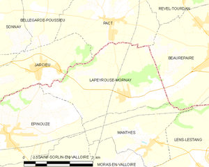
Lapeyrouse-Mornay
- коммуна во Франции
Hiking in Lapeyrouse-Mornay
Lapeyrouse-Mornay is a charming commune located in the Auvergne-Rhône-Alpes region of France, known for its picturesque landscapes and natural beauty. While it might not be as widely recognized as some of the larger hiking destinations in the region, there are still opportunities for exploring the surrounding countryside....
- Страна:
- Почтовый код: 26210
- Координаты: 45° 19' 23" N, 4° 59' 42" E
- GPS треки (wikiloc): [Ссылка]
- Площадь: 11.45 кв.км
- Население: 1214
- Веб сайт: [Ссылка]

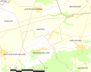
Manthes
- коммуна во Франции
Hiking in Manthes
It seems there might be a typo or misunderstanding regarding "Manthes," as it's not a well-known hiking destination based on the common references. However, if you're referring to a specific location that has a different spelling or context, please provide more details....
- Страна:
- Почтовый код: 26210
- Координаты: 45° 18' 10" N, 5° 0' 26" E
- GPS треки (wikiloc): [Ссылка]
- Площадь: 6.83 кв.км
- Население: 668
- Веб сайт: [Ссылка]


Montrigaud
- коммуна во Франции
Hiking in Montrigaud
Montrigaud is a charming commune located in the Isère department in the Auvergne-Rhône-Alpes region of southeastern France. This area offers various hiking opportunities, particularly for those looking to enjoy scenic views and natural landscapes....
- Страна:
- Почтовый код: 26350
- Координаты: 45° 13' 8" N, 5° 7' 52" E
- GPS треки (wikiloc): [Ссылка]
- Площадь: 28.73 кв.км
- Население: 482

Épinouze
- коммуна во Франции
Hiking in Épinouze
Épinouze is a charming commune located in the Drôme department of southeastern France. It is surrounded by picturesque landscapes, making it a great spot for hiking enthusiasts. Here are some highlights and tips for hiking in the Épinouze area:...
- Страна:
- Почтовый код: 26210
- Координаты: 45° 18' 33" N, 4° 55' 40" E
- GPS треки (wikiloc): [Ссылка]
- Площадь: 11.21 кв.км
- Население: 1594
- Веб сайт: [Ссылка]


Saint-Christophe-et-le-Laris
- коммуна во Франции
Hiking in Saint-Christophe-et-le-Laris
Saint-Christophe-et-le-Laris is a picturesque commune located in the Drôme department in southeastern France. While it may not be as widely known as some larger hiking areas, it offers beautiful landscapes and opportunities for outdoor activities in a serene environment....
- Страна:
- Почтовый код: 26350
- Координаты: 45° 12' 36" N, 5° 4' 19" E
- GPS треки (wikiloc): [Ссылка]
- Площадь: 11.35 кв.км
- Население: 413


Saint-Sorlin-en-Valloire
- коммуна во Франции
Hiking in Saint-Sorlin-en-Valloire
Saint-Sorlin-en-Valloire is a picturesque village located in the French Alps, known for its stunning natural beauty and an array of outdoor activities, especially hiking. Here are some highlights and tips for hiking in this beautiful area:...
- Страна:
- Почтовый код: 26210
- Координаты: 45° 17' 21" N, 4° 57' 5" E
- GPS треки (wikiloc): [Ссылка]
- Площадь: 26.5 кв.км
- Население: 2233

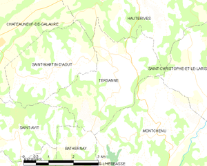
Tersanne
- коммуна во Франции
Hiking in Tersanne
Tersanne is a picturesque region in the French Alps, known for its stunning landscapes, diverse wildlife, and a variety of hiking trails catering to different skill levels. Hiking in this area offers a unique opportunity to experience the natural beauty of the Alps, from lush valleys and meandering rivers to towering mountain peaks....
- Страна:
- Почтовый код: 26390
- Координаты: 45° 13' 34" N, 5° 1' 2" E
- GPS треки (wikiloc): [Ссылка]
- Площадь: 9.49 кв.км
- Население: 359


Lens-Lestang
- коммуна во Франции
Hiking in Lens-Lestang
Lens-Lestang is a charming commune located in the Drôme department of southeastern France. It offers a wonderful opportunity for hiking enthusiasts to explore scenic landscapes, picturesque villages, and diverse ecosystems. Here are some key points to consider when planning a hike in and around Lens-Lestang:...
- Страна:
- Почтовый код: 26210
- Координаты: 45° 17' 30" N, 5° 2' 33" E
- GPS треки (wikiloc): [Ссылка]
- Площадь: 16.41 кв.км
- Население: 837
- Веб сайт: [Ссылка]


Hauterives
- коммуна во Франции
Hiking in Hauterives
Hauterives is a charming village located in the Drôme department of southeastern France, known for its scenic landscapes and rich cultural heritage. While it might not be as well-known as some major hiking destinations, it offers several opportunities for those looking to explore nature and enjoy the outdoors....
- Страна:
- Почтовый код: 26390
- Координаты: 45° 15' 20" N, 5° 1' 35" E
- GPS треки (wikiloc): [Ссылка]
- Площадь: 30.51 кв.км
- Население: 1904


Moras-en-Valloire
- коммуна во Франции
Hiking in Moras-en-Valloire
Moras-en-Valloire, located in the Auvergne-Rhône-Alpes region of France, offers a beautiful setting for hiking enthusiasts. The area is known for its picturesque landscapes, rolling hills, and scenic views typical of the Rhône valley....
- Страна:
- Почтовый код: 26210
- Координаты: 45° 17' 25" N, 4° 59' 36" E
- GPS треки (wikiloc): [Ссылка]
- Площадь: 8.58 кв.км
- Население: 646
- Веб сайт: [Ссылка]


Le Grand-Serre
- коммуна во Франции
Hiking in Le Grand-Serre
Le Grand-Serre is a beautiful hiking destination located in the French Alps, specifically in the department of Isère. This area offers stunning mountain scenery, diverse wildlife, and a variety of trails suitable for different skill levels. Here are some key points to consider when planning a hike in Le Grand-Serre:...
- Страна:
- Почтовый код: 26530
- Координаты: 45° 16' 12" N, 5° 6' 12" E
- GPS треки (wikiloc): [Ссылка]
- Площадь: 24.74 кв.км
- Население: 902