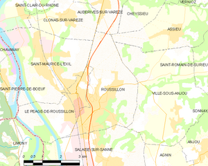
canton of Roussillon (canton de Roussillon)

 Hiking in canton of Roussillon
The Canton of Roussillon, located in the Vaucluse department of the Provence-Alpes-Côte d'Azur region in southeastern France, offers a beautiful and varied landscape for hiking enthusiasts. Known for its stunning natural beauty, cultural heritage, and picturesque villages, Roussillon is particularly famous for its ochre cliffs and vibrant colors, which create a unique setting for outdoor activities.
Hiking Trails:
-
Ochre Trail (Sentier des Ocres): This is a popular trail that takes you through the ochre quarries of Roussillon. The path winds through striking landscapes colored by red, yellow, and orange ochre, providing spectacular views and opportunities for photography. The trail is relatively easy, making it suitable for families.
-
Sentier de la Calancière: This trail offers a more rugged adventure through pine forests and rocky outcrops, leading to stunning viewpoints of the surrounding area. It's moderately challenging and perfect for those looking for a bit more of a workout.
-
Gorges de la Nesque: Just a short drive from Roussillon, these gorges offer beautiful trails with breathtaking views of the canyon and the Nesque river. The paths vary in difficulty, with some requiring more experience and fitness.
-
Plenty of Circular Routes: The region has multiple circular hiking routes of varying lengths, allowing hikers to customize their experiences based on their time and endurance. Many trails showcase the local flora and fauna, as well as historical landmarks.
Best Time to Hike:
The ideal times to hike in Roussillon are during the spring (April to June) and fall (September to October), when the weather is mild, and the landscapes are vibrant. Summer can be hot, so early morning hikes are recommended to avoid the heat.
Safety Tips:
- Stay Hydrated: Always carry enough water, especially during warmer months.
- Appropriate Gear: Wear sturdy hiking shoes and comfortable clothing suitable for the weather.
- Check Trail Conditions: Some trails may be subject to closures or changes due to weather or maintenance, so verify the conditions beforehand.
- Wildlife Awareness: Be mindful of local wildlife and stay on marked trails to protect the natural habitat.
Local Attractions:
After hiking, consider visiting the charming village of Roussillon, famous for its ochre buildings, art galleries, and shops. Enjoy the local cuisine in one of the many restaurants or stop by the small markets for regional specialties.
Overall, hiking in the Canton of Roussillon provides an excellent way to experience both natural beauty and cultural richness in a stunning part of France. Enjoy your adventure!
- Страна:

- Столица: Русильон
- Координаты: 45° 23' 3" N, 4° 50' 0" E


- GPS треки (wikiloc): [Ссылка]
- Население: 46571
- Википедия английская: wiki(en)
- Википедия национальная: wiki(fr)
- Хранилище Wikidata: Wikidata: Q1483159
- код кантона INSEE: [3821]
Включает регионы:


Ла-Шапель-де-Сюрье
- коммуна во Франции
Hiking in Ла-Шапель-де-Сюрье
La Chapelle-de-Surieu is a charming commune located in the Isère department in the Auvergne-Rhône-Alpes region of southeastern France. It offers a beautiful setting for hiking enthusiasts, with picturesque landscapes, rolling hills, and scenic views of the surrounding mountains....
- Страна:
- Почтовый код: 38150
- Координаты: 45° 23' 28" N, 4° 54' 36" E
- GPS треки (wikiloc): [Ссылка]
- Площадь: 11.22 кв.км
- Население: 752
- Веб сайт: [Ссылка]
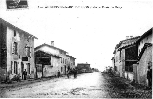

Оберив-сюр-Варез
- коммуна во Франции
- Страна:
- Почтовый код: 38550
- Координаты: 45° 25' 28" N, 4° 49' 5" E
- GPS треки (wikiloc): [Ссылка]
- Площадь: 7.05 кв.км
- Население: 1488


Асьё
- коммуна во Франции
- Страна:
- Почтовый код: 38150
- Координаты: 45° 24' 26" N, 4° 52' 5" E
- GPS треки (wikiloc): [Ссылка]
- Площадь: 12.34 кв.км
- Население: 1376
- Веб сайт: [Ссылка]


Буже-Шамбалю
- коммуна во Франции
Hiking in Буже-Шамбалю
Bougé-Chambalud is a picturesque village located in the Auvergne-Rhône-Alpes region of France, specifically within the department of Drôme. Its setting offers several opportunities for hiking and enjoying the natural beauty of the area....
- Страна:
- Почтовый код: 38150
- Координаты: 45° 19' 49" N, 4° 54' 5" E
- GPS треки (wikiloc): [Ссылка]
- Площадь: 15.85 кв.км
- Население: 1395
- Веб сайт: [Ссылка]


Вернио
- коммуна во Франции
Hiking in Вернио
Vernioz, located in the Auvergne-Rhône-Alpes region of France, is a charming destination for hikers. Nestled in the foothills of the Massif Central, it offers a scenic landscape with various trails suited for different skill levels and preferences....
- Страна:
- Почтовый код: 38150
- Координаты: 45° 25' 19" N, 4° 54' 19" E
- GPS треки (wikiloc): [Ссылка]
- Площадь: 11.32 кв.км
- Население: 1236
- Веб сайт: [Ссылка]

Салез-сюр-Санн
- коммуна во Франции
- Страна:
- Почтовый код: 38150
- Координаты: 45° 20' 40" N, 4° 49' 9" E
- GPS треки (wikiloc): [Ссылка]
- Площадь: 16.15 кв.км
- Население: 4551
- Веб сайт: [Ссылка]
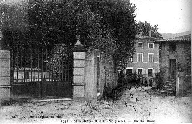
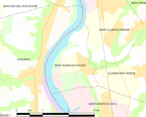
Сент-Альбан-дю-Рон
- коммуна во Франции
- Страна:
- Почтовый код: 38370
- Координаты: 45° 25' 36" N, 4° 45' 19" E
- GPS треки (wikiloc): [Ссылка]
- Площадь: 3.56 кв.км
- Население: 849


Сен-Клер-дю-Рон
- коммуна во Франции
- Страна:
- Почтовый код: 38370
- Координаты: 45° 26' 24" N, 4° 46' 23" E
- GPS треки (wikiloc): [Ссылка]
- Площадь: 7.16 кв.км
- Население: 3889
- Веб сайт: [Ссылка]


Сен-Прем
- коммуна во Франции
- Страна:
- Почтовый код: 38370
- Координаты: 45° 26' 37" N, 4° 47' 36" E
- GPS треки (wikiloc): [Ссылка]
- Площадь: 7.3 кв.км
- Население: 1335
- Веб сайт: [Ссылка]

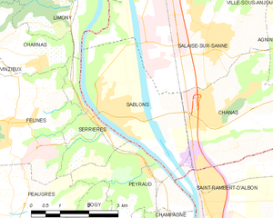
Саблон
- Страна:
- Почтовый код: 38550
- Координаты: 45° 19' 5" N, 4° 46' 23" E
- GPS треки (wikiloc): [Ссылка]
- Площадь: 10.23 кв.км
- Население: 2244
- Веб сайт: [Ссылка]
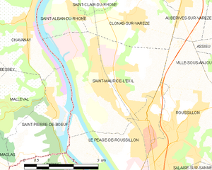
Сен-Морис-л'Эгзиль
- коммуна во Франции
- Страна:
- Почтовый код: 38550
- Координаты: 45° 23' 49" N, 4° 46' 29" E
- GPS треки (wikiloc): [Ссылка]
- Площадь: 12.82 кв.км
- Население: 6044
- Веб сайт: [Ссылка]


Сен-Ромен-де-Сюрьё
- коммуна во Франции
Hiking in Сен-Ромен-де-Сюрьё
Saint-Romain-de-Surieu is a picturesque village located in the Auvergne-Rhône-Alpes region of France, nestled in the Isère department. The area is characterized by its beautiful landscapes, rolling hills, and proximity to the French Alps, making it a great destination for hiking enthusiasts. Here are some highlights about hiking in this region:...
- Страна:
- Почтовый код: 38150
- Координаты: 45° 23' 11" N, 4° 53' 0" E
- GPS треки (wikiloc): [Ссылка]
- Площадь: 4.71 кв.км
- Население: 346
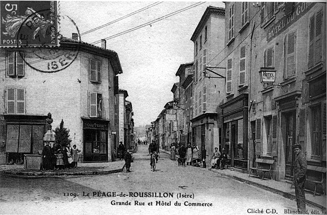

Ле-Пеаж-де-Русильон
- коммуна во Франции
- Страна:
- Почтовый код: 38550
- Координаты: 45° 22' 23" N, 4° 47' 51" E
- GPS треки (wikiloc): [Ссылка]
- Площадь: 7.41 кв.км
- Население: 6622
- Веб сайт: [Ссылка]

Аньен
- коммуна во Франции
- Страна:
- Почтовый код: 38150
- Координаты: 45° 20' 24" N, 4° 51' 26" E
- GPS треки (wikiloc): [Ссылка]
- Площадь: 7.96 кв.км
- Население: 1091
- Веб сайт: [Ссылка]


Виль-су-Анжу
- коммуна во Франции
Hiking in Виль-су-Анжу
Ville-sous-Anjou, located in the Auvergne-Rhône-Alpes region of France, offers a variety of beautiful hiking trails that showcase the natural beauty of the surrounding landscape. While specific trails in Ville-sous-Anjou may not be widely documented, the region is known for its picturesque countryside, rolling hills, and proximity to national parks and natural reserves. Here are some key points to consider when hiking in this area:...
- Страна:
- Почтовый код: 38150
- Координаты: 45° 21' 43" N, 4° 51' 49" E
- GPS треки (wikiloc): [Ссылка]
- Площадь: 18.25 кв.км
- Население: 1203


Шесьё
- коммуна во Франции
- Страна:
- Почтовый код: 38550
- Координаты: 45° 25' 44" N, 4° 50' 23" E
- GPS треки (wikiloc): [Ссылка]
- Площадь: 8.55 кв.км
- Население: 1034
- Веб сайт: [Ссылка]


Клона-сюр-Варез
- коммуна во Франции
- Страна:
- Почтовый код: 38550
- Координаты: 45° 24' 51" N, 4° 47' 27" E
- GPS треки (wikiloc): [Ссылка]
- Площадь: 6.83 кв.км
- Население: 1482

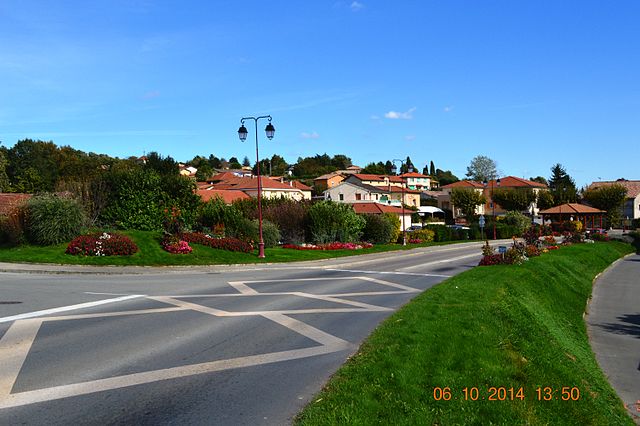
Русильон
- коммуна во Франции
- Страна:
- Почтовый код: 38150
- Координаты: 45° 22' 19" N, 4° 48' 42" E
- GPS треки (wikiloc): [Ссылка]
- Площадь: 11.62 кв.км
- Население: 8272
- Веб сайт: [Ссылка]


Сонне
- коммуна во Франции
Hiking in Сонне
Sonnay is a charming village located in the Isère department of the Auvergne-Rhône-Alpes region in southeastern France. While Sonnay itself may not be as well-known as some other hiking destinations, it serves as a great starting point for exploring the surrounding natural beauty of the region....
- Страна:
- Почтовый код: 38150
- Координаты: 45° 21' 17" N, 4° 54' 25" E
- GPS треки (wikiloc): [Ссылка]
- Площадь: 14.17 кв.км
- Население: 1236
- Веб сайт: [Ссылка]
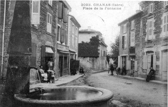
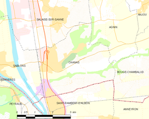
Шанас
- коммуна во Франции
- Страна:
- Почтовый код: 38150
- Координаты: 45° 19' 6" N, 4° 49' 9" E
- GPS треки (wikiloc): [Ссылка]
- Площадь: 11.65 кв.км
- Население: 2524
- Веб сайт: [Ссылка]


Анжу
- коммуна во Франции
Hiking in Анжу
Anjou, located in the Isère department in the Auvergne-Rhône-Alpes region of southeastern France, offers a variety of beautiful landscapes and hiking opportunities. The area is known for its picturesque scenery, mixed forests, rolling hills, and views of the surrounding mountains, including the Alps....
- Страна:
- Почтовый код: 38150
- Координаты: 45° 20' 49" N, 4° 52' 55" E
- GPS треки (wikiloc): [Ссылка]
- Высота над уровнем моря: 182 м m
- Площадь: 5.03 кв.км
- Население: 1012
- Веб сайт: [Ссылка]