
Карпантра (Carpentras, Carpentras)

- коммуна во Франции
 Hiking in Карпантра
Carpentras, located in the Vaucluse department of the Provence-Alpes-Côte d'Azur region in southeastern France, offers a variety of hiking opportunities amidst stunning landscapes. Here are some highlights:
Scenic Trails:
-
Mont Ventoux - Just a short drive from Carpentras, the iconic Mont Ventoux is a must-visit for hikers. There are several trails of varying difficulty, leading through beautiful forests and offering panoramic views from the summit.
-
Luberon Regional Park - A bit further afield, this park features a network of trails weaving through charming villages, vineyards, and diverse ecosystems. The trails range from easy strolls to more challenging routes, making it suitable for all experience levels.
-
The Dentelles de Montmirail - A stunning range of limestone peaks near Carpentras, known for their jagged silhouettes. The area has several marked trails, offering both challenging hikes and easier options that reward hikers with breathtaking views.
Local Flora and Fauna:
The region is rich in biodiversity, with typical Provençal flora such as lavender fields, olive groves, and vineyards. Wildlife enthusiasts may spot various birds, deer, and other native species while on the trails.
Cultural Highlights:
Hiking in Carpentras provides a chance to explore the local history and culture, with many trails leading to ancient ruins, charming villages, and local markets. Be sure to stop by the historic center of Carpentras, where you can enjoy local cuisine and traditional crafts.
Tips for Hiking in Carpentras:
- Season: Spring and early autumn are ideal for hiking, as the weather is mild and the landscapes are vibrant.
- Gear: Wear sturdy hiking boots and bring plenty of water, snacks, and sun protection. A map or a GPS device is also advisable.
- Safety: Always let someone know your hiking plans and check the weather before setting out.
Discovering the trails around Carpentras will provide not just a great physical workout but also an enriching experience filled with natural beauty and cultural insights. Happy hiking!
- Страна:

- Почтовый код: 84200
- Координаты: 44° 3' 18" N, 5° 2' 53" E


- GPS треки (wikiloc): [Ссылка]
- Высота над уровнем моря: 95 м m
- Площадь: 37.92 кв.км
- Население: 28699
- Веб сайт: http://www.carpentras.fr
- Википедия русская: wiki(ru)
- Википедия английская: wiki(en)
- Википедия национальная: wiki(fr)
- Хранилище Wikidata: Wikidata: Q202560
- Катеория в википедии: [Ссылка]
- Карты в википедии: [Ссылка]
- код Freebase: [/m/02hp0w]
- код Freebase: [/m/02hp0w]
- код GeoNames: Альт: [3028542]
- код GeoNames: Альт: [3028542]
- номер SIREN: [218400315]
- номер SIREN: [218400315]
- код BNF: [152780117]
- код BNF: [152780117]
- код VIAF: Альт: [137842037]
- код VIAF: Альт: [137842037]
- ID отношения в OpenStreetMap: [148157]
- ID отношения в OpenStreetMap: [148157]
- код GND: Альт: [4229605-5]
- код GND: Альт: [4229605-5]
- идентификатор местоположения ArchINFORM: [8865]
- идентификатор местоположения ArchINFORM: [8865]
- код LCNAF: Альт: [n81118473]
- код LCNAF: Альт: [n81118473]
- место в MusicBrainz: [5cfe4a84-0951-40be-a5fb-b29d6a9a1532]
- место в MusicBrainz: [5cfe4a84-0951-40be-a5fb-b29d6a9a1532]
- код в энциклопедии «Британника онлайн»: [place/Carpentras]
- код в энциклопедии «Британника онлайн»: [place/Carpentras]
- EMLO location ID: [2dbe6167-1bf4-40d5-a095-83a9b3b1e4f7]
- EMLO location ID: [2dbe6167-1bf4-40d5-a095-83a9b3b1e4f7]
- код Цифрового атласа Римской империи: [169]
- код Цифрового атласа Римской империи: [169]
- код муниципалитета INSEE: 84031
- код муниципалитета INSEE: 84031
Граничит с регионами:

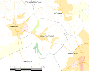
Лориоль-дю-Конта
- коммуна во Франции
Hiking in Лориоль-дю-Конта
Loriol-du-Comtat is a charming village in southeastern France, located in the Vaucluse department of the Provence-Alpes-Côte d'Azur region. This area is known for its beautiful landscapes, picturesque vineyards, and proximity to the southern Rhône Valley. Hiking in and around Loriol-du-Comtat offers a range of scenic trails that cater to different skill levels....
- Страна:
- Почтовый код: 84870
- Координаты: 44° 4' 35" N, 5° 0' 2" E
- GPS треки (wikiloc): [Ссылка]
- Площадь: 11.29 кв.км
- Население: 2570
- Веб сайт: [Ссылка]


Мазан
- коммуна во Франции
Hiking in Мазан
Mazan, located in the Vaucluse department in the Provence-Alpes-Côte d'Azur region of France, offers a charming backdrop for hiking enthusiasts. The area is characterized by picturesque landscapes, including vineyards, oak forests, and stunning views of the Mont Ventoux mountain....
- Страна:
- Почтовый код: 84380
- Координаты: 44° 3' 24" N, 5° 7' 41" E
- GPS треки (wikiloc): [Ссылка]
- Площадь: 37.92 кв.км
- Население: 5842


Монтё
- коммуна во Франции
Hiking in Монтё
Monteux, located in the Vaucluse department of the Provence-Alpes-Côte d'Azur region in southern France, is known for its picturesque landscapes and outdoor activities, including hiking. The area is characterized by its beautiful natural surroundings, including vineyards, olive groves, and nearby hills....
- Страна:
- Почтовый код: 84170
- Координаты: 44° 2' 8" N, 4° 59' 50" E
- GPS треки (wikiloc): [Ссылка]
- Площадь: 39.02 кв.км
- Население: 12671
- Веб сайт: [Ссылка]


Перн-ле-Фонтен
- коммуна во Франции
Hiking in Перн-ле-Фонтен
Pernes-les-Fontaines, located in the Vaucluse department in the Provence region of France, offers a variety of hiking opportunities. The area is characterized by its stunning natural landscapes, picturesque scenery, and rich cultural heritage. Here are some highlights for hiking in and around Pernes-les-Fontaines:...
- Страна:
- Почтовый код: 84210
- Координаты: 43° 59' 52" N, 5° 3' 33" E
- GPS треки (wikiloc): [Ссылка]
- Площадь: 51.12 кв.км
- Население: 9556
- Веб сайт: [Ссылка]


Обиньян
- коммуна во Франции
Hiking in Обиньян
Aubignan, located in the Vaucluse department in the Provence-Alpes-Côte d'Azur region of southern France, offers a picturesque setting for hiking enthusiasts. The area is characterized by its beautiful landscapes, vineyards, and the backdrop of the majestic Mont Ventoux....
- Страна:
- Почтовый код: 84810
- Координаты: 44° 5' 59" N, 5° 1' 31" E
- GPS треки (wikiloc): [Ссылка]
- Площадь: 15.7 кв.км
- Население: 5533
- Веб сайт: [Ссылка]

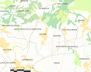
Каромб
- коммуна во Франции
Hiking in Каромб
Caromb is a charming village located in the Vaucluse region of Provence, France, surrounded by a stunning natural landscape that makes it a great spot for hiking enthusiasts. The area offers a mix of gentle slopes, vineyards, and breathtaking views of the Mont Ventoux mountain, which is a popular destination for outdoor activities....
- Страна:
- Почтовый код: 84330
- Координаты: 44° 6' 40" N, 5° 6' 28" E
- GPS треки (wikiloc): [Ссылка]
- Площадь: 17.98 кв.км
- Население: 3249
- Веб сайт: [Ссылка]

Сен-Ипполит-ле-Гравейрон
- коммуна во Франции
Hiking in Сен-Ипполит-ле-Гравейрон
Saint-Hippolyte-le-Graveyron is a charming commune located in the Vaucluse department of the Provence-Alpes-Côte d'Azur region in southeastern France. It is known for its beautiful landscapes, serene atmosphere, and proximity to several natural and cultural attractions, making it an appealing destination for hikers and outdoor enthusiasts....
- Страна:
- Почтовый код: 84330
- Координаты: 44° 7' 22" N, 5° 4' 28" E
- GPS треки (wikiloc): [Ссылка]
- Высота над уровнем моря: 170 м m
- Площадь: 4.94 кв.км
- Население: 182