Валлемаджа (Vallemaggia District, Bezirk Vallemaggia)

 Hiking in Валлемаджа
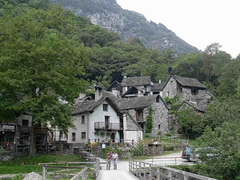
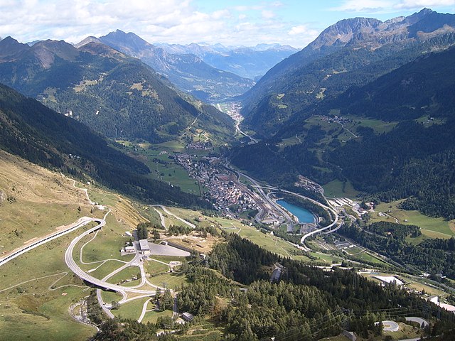
Vallemaggia District, located in the southern part of Switzerland in the Canton of Ticino, boasts stunning landscapes, rich cultural heritage, and a variety of hiking opportunities. The district is characterized by its picturesque valleys, charming villages, and the majestic backdrop of the Alps. Here are some highlights and tips for hiking in the Vallemaggia District:
Hiking Trails
-
Vallemaggia Valley Trail: This trail follows the river Maggia, passing through lush forests, quaint hamlets, and beautiful waterfalls. It offers various sections suitable for different skill levels.
-
Monte Verità: A hike to Monte Verità provides breathtaking panoramic views over Lake Maggiore and the surrounding mountains. The trail is moderate in difficulty and can be a rewarding outing.
-
Cascate del Pissond: This hike leads you to the beautiful waterfall of Pissond. The trail often involves some climbing and provides excellent opportunities for photography.
-
Cevio to Lavizzara: This route takes you through charming villages, historical sites, and stunning landscapes, featuring both easy and more challenging portions.
Season
-
Spring and Summer: The best time for hiking in Vallemaggia is typically from late spring to early autumn (May to October). During this time, the weather is usually mild, and trails are accessible.
-
Autumn: Fall foliage can make for a spectacular hiking experience, especially in October.
Preparation and Tips
-
Trail Conditions: Always check the trail conditions beforehand, as some paths can be challenging or subject to seasonal closures.
-
Equipment: Good hiking shoes, weather-appropriate clothing, and plenty of water are essential. Depending on your selected trail, trekking poles might also be helpful.
-
Maps and Signage: Most trails are well-marked, but having a good local map or a GPS device can enhance your experience and help you stay oriented.
-
Cultural Considerations: Vallemaggia is known for its local customs and traditions. Be respectful of the local flora and fauna, and consider taking part in any local events you might stumble upon during your hike.
Safety
-
Wildlife: Be aware of the local wildlife and keep a respectful distance. Avoid leaving food scraps on the trails to minimize attracting animals.
-
Weather Awareness: The weather can change quickly in the mountains. Always check forecasts and be prepared for sudden changes, especially if you are hiking at higher elevations.
Conclusion
Hiking in the Vallemaggia District is a fantastic way to explore the natural beauty of Switzerland while immersing yourself in its unique culture. With various trails catering to all levels of hikers, it is an ideal destination whether you're looking for a serene stroll or a challenging adventure. Enjoy your hike!
- Страна:

- Столица: Севио
- Телефонный код: 091
- Код автомобильного номера: TI
- Координаты: 46° 21' 0" N, 8° 35' 0" E


- GPS треки (wikiloc): [Ссылка]
- Высота над уровнем моря: 1263 м m
- Площадь: 569.3 кв.км
- Википедия русская: wiki(ru)
- Википедия английская: wiki(en)
- Википедия национальная: wiki(de)
- Хранилище Wikidata: Wikidata: Q660418
- код Freebase: [/m/0grwpg]
- код GeoNames: Альт: [2658196]
- идентификатор местоположения ArchINFORM: [42229]
Включает регионы:
Kreis Maggia
Hiking in Kreis Maggia
Kreis Maggia, located in the Canton of Ticino in southern Switzerland, offers a stunning variety of hiking opportunities amidst picturesque landscapes, charming villages, and rich natural beauty. Here are some highlights and tips for hiking in the area:...
- Страна:


Kreis Lavizzara
Hiking in Kreis Lavizzara
Kreis Lavizzara, located in the beautiful region of Ticino in Switzerland, is renowned for its stunning natural landscapes, characterized by rugged mountains, lush valleys, and picturesque lakes. It's an ideal destination for hiking enthusiasts of all skill levels. Here are some key points to consider when hiking in this area:...
- Страна:

Kreis Rovana
Hiking in Kreis Rovana
Kreis Rovana, located in Romania, offers a variety of stunning hiking opportunities amidst its picturesque landscapes and rich natural diversity. Here are some key points about hiking in this region:...
- Страна:
Граничит с регионами:

Левентина
Hiking in Левентина
Leventina District, located in the Swiss canton of Ticino, is a fantastic destination for hiking enthusiasts. This valley is known for its stunning landscapes, charming villages, and rich cultural heritage. Here are some key features and highlights of hiking in the Leventina District:...
- Страна:
- Код автомобильного номера: TI
- Координаты: 46° 29' 0" N, 8° 48' 0" E
- GPS треки (wikiloc): [Ссылка]
- Высота над уровнем моря: 1753 м m
- Площадь: 479.7 кв.км


Локарно
- округ кантона Тичино (Швейцария)
Hiking in Локарно
The Locarno District, located in the Italian-speaking part of Switzerland, is renowned for its stunning natural landscapes, scenic views, and a variety of hiking trails suitable for all levels of hikers. Here are some highlights and tips for hiking in the Locarno District:...
- Страна:
- Столица: Локарно
- Код автомобильного номера: TI
- Координаты: 46° 10' 0" N, 8° 48' 0" E
- GPS треки (wikiloc): [Ссылка]
- Высота над уровнем моря: 247 м m
- Площадь: 550.9 кв.км