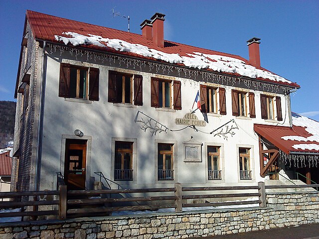
Шезери-Форан (Chézery-Forens, Chézery-Forens)
- коммуна во Франции
 Hiking in Шезери-Форан
Chézery-Forens is a charming commune located in the Ain department in the Auvergne-Rhône-Alpes region of southeastern France. Known for its beautiful natural landscapes, it is a fantastic spot for hiking and exploring the great outdoors. Here are some key highlights about hiking in and around Chézery-Forens:
Scenic Trails
-
Varied Terrain: The area features a mix of terrains, including gentle hills, forest trails, and vistas that offer stunning views of the surrounding mountains and valleys. You can find trails suitable for all skill levels, from beginners to experienced hikers.
-
La Dombes and Jura Mountains: The proximity to both the Jura Mountains and the Dombes region allows hikers to experience diverse ecosystems and natural beauty. The varied landscapes provide opportunities for wildlife observation and photography.
Recommended Hiking Routes
-
Local Trails: Explore local trails that lead to points of interest such as nearby lakes, rivers, and panoramic viewpoints. Popular routes may include circular walks that start and end in Chézery-Forens.
-
GR Trails: The Grande Randonnée (GR) trails, which are long-distance hiking paths, may pass through or near the area, providing longer hiking opportunities for those looking for a multi-day trek.
Flora and Fauna
- The region is rich in biodiversity, making it an excellent place for nature enthusiasts. You may encounter various species of birds, small mammals, and unique plant life.
Practical Information
-
Best Season: The best time for hiking in Chézery-Forens is during the spring and fall when the weather is mild, and the scenery is particularly beautiful. Summer can be warm, while winters may bring snow, limiting some trails but offering opportunities for snowshoeing.
-
Preparation: Always check local conditions and maps before heading out, and carry adequate supplies such as water, snacks, suitable clothing, and a first aid kit. It’s also advisable to inform someone of your hiking plan.
-
Guided Tours: If you're new to hiking or unfamiliar with the area, consider joining a guided hiking tour for a more in-depth experience and to discover hidden gems.
Whether you're looking for a peaceful day hike or an adventurous multi-day trek, Chézery-Forens offers numerous opportunities to enjoy the beauty of the French countryside.
- Страна:

- Почтовый код: 01200
- Координаты: 46° 13' 18" N, 5° 51' 59" E


- GPS треки (wikiloc): [Ссылка]
- Площадь: 46.57 кв.км
- Население: 460
- Веб сайт: http://www.chezery.fr
- Википедия русская: wiki(ru)
- Википедия английская: wiki(en)
- Википедия национальная: wiki(fr)
- Хранилище Wikidata: Wikidata: Q272359
- Катеория в википедии: [Ссылка]
- Карты в википедии: [Ссылка]
- код Freebase: [/m/03cz0sk]
- код Freebase: [/m/03cz0sk]
- код GeoNames: Альт: [3025227]
- код GeoNames: Альт: [3025227]
- номер SIREN: [210101044]
- номер SIREN: [210101044]
- код BNF: [160411788]
- код BNF: [160411788]
- код VIAF: Альт: [236594252]
- код VIAF: Альт: [236594252]
- WOEID: [585807]
- WOEID: [585807]
- код муниципалитета INSEE: 01104
- код муниципалитета INSEE: 01104
Граничит с регионами:


Шанфромье
- коммуна во Франции
Hiking in Шанфромье
Champfromier is a charming village located in the Ain department of the Auvergne-Rhône-Alpes region in eastern France. It's a fantastic base for hikers looking to explore the beautiful landscapes of the Jura Mountains, which offer a variety of trails suited for different skill levels....
- Страна:
- Почтовый код: 01410
- Координаты: 46° 11' 38" N, 5° 49' 0" E
- GPS треки (wikiloc): [Ссылка]
- Площадь: 32.4 кв.км
- Население: 735

Монтанж
- коммуна во Франции
Hiking in Монтанж
It seems like you might be referring to the Montagnes region, which could refer to various mountainous areas around the world, such as the French Alps, the Swiss Alps, or even the Appalachian Mountains in the United States. Since I need a bit more context, I’ll provide a general overview of what you might find when hiking in mountainous regions, particularly focusing on popular areas like the Alps....
- Страна:
- Почтовый код: 01200
- Координаты: 46° 9' 51" N, 5° 48' 5" E
- GPS треки (wikiloc): [Ссылка]
- Площадь: 13.7 кв.км
- Население: 344
Леле
- коммуна во Франции
Hiking in Леле
Lélex is a charming mountain village located in the Jura region of France, known for its stunning natural landscapes and outdoor activities, particularly hiking. Here are some key points about hiking in Lélex:...
- Страна:
- Почтовый код: 01410
- Координаты: 46° 18' 12" N, 5° 56' 32" E
- GPS треки (wikiloc): [Ссылка]
- Площадь: 17.63 кв.км
- Население: 227
- Веб сайт: [Ссылка]

Конфор
- коммуна во Франции
Hiking in Конфор
Confort is a charming village located in the Rhône-Alpes region of France, known for its picturesque landscapes and outdoor activities, including hiking. Here are some highlights and tips for hiking in and around Confort:...
- Страна:
- Почтовый код: 01200
- Координаты: 46° 9' 0" N, 5° 49' 23" E
- GPS треки (wikiloc): [Ссылка]
- Площадь: 11.66 кв.км
- Население: 591
- Веб сайт: [Ссылка]
Сен-Жан-де-Гонвиль
- коммуна во Франции
Hiking in Сен-Жан-де-Гонвиль
Saint-Jean-de-Gonville is a charming commune located in the Auvergne-Rhône-Alpes region of France, not far from the larger city of Geneva. While it may not be as renowned for hiking as some larger national parks or mountain ranges, there are still plenty of opportunities to explore the beautiful natural surroundings....
- Страна:
- Почтовый код: 01630
- Координаты: 46° 12' 46" N, 5° 57' 7" E
- GPS треки (wikiloc): [Ссылка]
- Площадь: 12.36 кв.км
- Население: 1653
- Веб сайт: [Ссылка]

Перон
- коммуна во Франции
Hiking in Перон
Péron, located in the Ain department of France near the Swiss border, offers stunning landscapes and a variety of hiking opportunities. Here are some key highlights for those looking to explore the hiking trails in and around Péron:...
- Страна:
- Почтовый код: 01630
- Координаты: 46° 11' 24" N, 5° 55' 35" E
- GPS треки (wikiloc): [Ссылка]
- Площадь: 26.01 кв.км
- Население: 2537
- Веб сайт: [Ссылка]

Фарж
- коммуна во Франции
Hiking in Фарж
Farges, located in the Auvergne-Rhône-Alpes region of France, offers beautiful hiking opportunities for outdoor enthusiasts. The region is characterized by rolling hills, lush forests, and scenic landscapes, making it an excellent destination for both novice and experienced hikers....
- Страна:
- Почтовый код: 01550
- Координаты: 46° 10' 4" N, 5° 54' 19" E
- GPS треки (wikiloc): [Ссылка]
- Площадь: 14.28 кв.км
- Население: 999
- Веб сайт: [Ссылка]

Туари
- коммуна во Франции, департамент Эн
Hiking in Туари
Thoiry, located in the Ain department of France, is a beautiful area that offers various hiking opportunities, particularly due to its picturesque landscapes that blend mountains, forests, and countryside. Here are some highlights and tips for hiking in this region:...
- Страна:
- Почтовый код: 01710
- Координаты: 46° 14' 11" N, 5° 58' 47" E
- GPS треки (wikiloc): [Ссылка]
- Площадь: 28.93 кв.км
- Население: 6161
- Веб сайт: [Ссылка]


La Pesse
- коммуна во Франции
Hiking in La Pesse
La Pesse is a charming village located in the Jura Mountains of France, known for its scenic landscapes and natural beauty, making it a great destination for hiking enthusiasts. Here are some details you might find helpful if you're considering hiking in this area:...
- Страна:
- Почтовый код: 39370
- Координаты: 46° 17' 8" N, 5° 50' 52" E
- GPS треки (wikiloc): [Ссылка]
- Площадь: 24.26 кв.км
- Население: 356
- Веб сайт: [Ссылка]


Bellecombe
- коммуна во Франции
Hiking in Bellecombe
Bellecombe is a picturesque area in the Alps, offering a range of hiking opportunities for all levels of experience. Nestled in stunning natural scenery, it provides a great backdrop for outdoor activities. Here are some key details about hiking in Bellecombe:...
- Страна:
- Почтовый код: 39310
- Координаты: 46° 19' 27" N, 5° 55' 20" E
- GPS треки (wikiloc): [Ссылка]
- Высота над уровнем моря: 1200 м m
- Площадь: 12.17 кв.км
- Население: 65
- Веб сайт: [Ссылка]