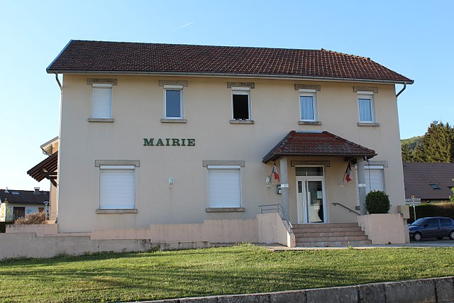
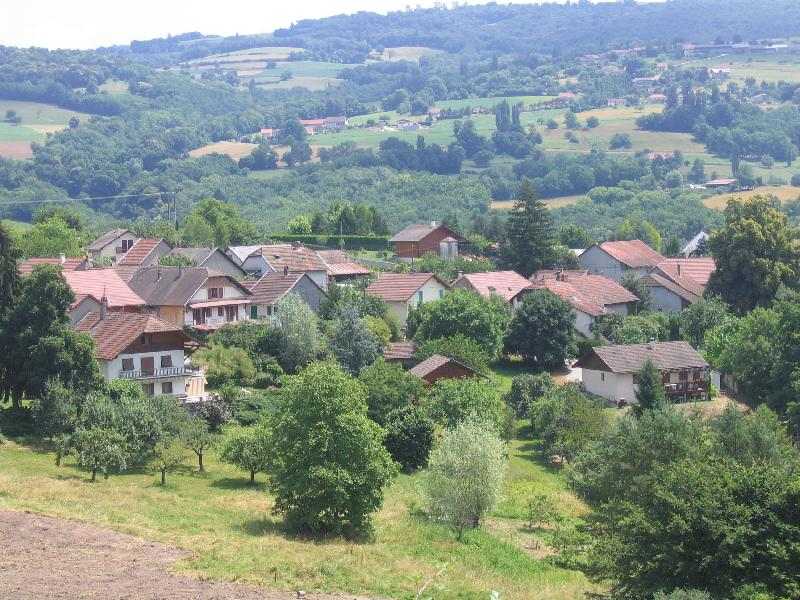
Шане (Chanay, Chanay)

- коммуна во Франции, департамент Эн
 Hiking in Шане
Hiking in Chanay, a picturesque destination in the Auvergne-Rhône-Alpes region of France, offers a variety of trails that cater to different skill levels, from easy walks suitable for families to more challenging hikes for experienced adventurers. The area is characterized by its stunning landscapes, featuring rolling hills, dense forests, and breathtaking views of the surrounding mountains.
Popular Hiking Trails:
-
Sentier des Pèlerins: A moderately challenging trail that takes you through scenic forests and offers beautiful vistas of the countryside. Ideal for those looking to enjoy nature while getting a good workout.
-
Circuit de la Cascade: A shorter, easier hike perfect for families. This loop trail leads to a lovely waterfall, providing a serene spot to relax and enjoy the sounds of nature.
-
Col de la Goutte: For more experienced hikers, this challenging route offers steep climbs and rewarding panoramic views at the summit. It's a great way to experience the rugged terrain and diverse wildlife of the area.
Things to Keep in Mind:
- Weather: Always check the weather forecast before heading out, as conditions can change rapidly in mountainous areas.
- Equipment: Wear appropriate hiking boots and clothing. Carry enough water, snacks, and a first-aid kit, especially on longer hikes.
- Maps and Guides: Consider using local trail maps or guided hiking services for the best experience and to ensure you stay on track.
- Leave No Trace: Respect the environment by staying on marked trails and cleaning up after yourself.
Local Attractions:
Besides hiking, Chanay offers other outdoor activities, including mountain biking and nature photography. You may also want to explore local villages, enjoying regional cuisine and culture.
Whether you're an avid hiker or a nature lover seeking a peaceful escape, Chanay has something to offer everyone. Enjoy your adventure!
- Страна:

- Почтовый код: 01420
- Координаты: 46° 0' 22" N, 5° 47' 8" E


- GPS треки (wikiloc): [Ссылка]
- Площадь: 18.1 кв.км
- Население: 640
- Веб сайт: http://www.mairie-chanay.fr
- Википедия русская: wiki(ru)
- Википедия английская: wiki(en)
- Википедия национальная: wiki(fr)
- Хранилище Wikidata: Wikidata: Q210908
- Катеория в википедии: [Ссылка]
- Карты в википедии: [Ссылка]
- код Freebase: [/m/085lky]
- код Freebase: [/m/085lky]
- код Freebase: [/m/085lky]
- код GeoNames: Альт: [6446414]
- код GeoNames: Альт: [6446414]
- код GeoNames: Альт: [6446414]
- номер SIREN: [210100822]
- номер SIREN: [210100822]
- номер SIREN: [210100822]
- код муниципалитета INSEE: 01082
- код муниципалитета INSEE: 01082
- код муниципалитета INSEE: 01082
Граничит с регионами:
Haut-Valromey
Hiking in Haut-Valromey
Haut-Valromey is a beautiful region located in the French Alps, known for its stunning landscapes and outdoor activities, particularly hiking. Here are some key points to consider if you plan to hike in Haut-Valromey:...
- Страна:
- Почтовый код: 01260
- Координаты: 45° 59' 51" N, 5° 41' 42" E
- GPS треки (wikiloc): [Ссылка]
- Площадь: 107.85 кв.км
- Веб сайт: [Ссылка]

Корбоно
- коммуна во Франции
Hiking in Корбоно
Corbonod is a picturesque village located in the Auvergne-Rhône-Alpes region of southeastern France, nestled within the beautiful landscapes of the French Alps. Hiking in this area offers stunning views, diverse terrains, and a chance to explore the natural beauty of the region. Here are some things to consider when hiking in Corbonod:...
- Страна:
- Почтовый код: 01420
- Координаты: 45° 58' 11" N, 5° 48' 37" E
- GPS треки (wikiloc): [Ссылка]
- Площадь: 31.59 кв.км
- Население: 1246
- Веб сайт: [Ссылка]

Сюржу
- коммуна во Франции
Hiking in Сюржу
Surjoux, located in the Auvergne-Rhône-Alpes region of France, offers a variety of hiking opportunities amid stunning natural landscapes. This area is characterized by its lush forests, rolling hills, and picturesque views, making it an appealing destination for hikers of all levels....
- Страна:
- Почтовый код: 01420
- Координаты: 46° 1' 27" N, 5° 48' 10" E
- GPS треки (wikiloc): [Ссылка]
- Площадь: 4.31 кв.км
- Население: 72


Лопиталь
- коммуна во Франции
Hiking in Лопиталь
Lhôpital is a village located in the northeastern part of France, near the border with Germany. While it may not be widely recognized as a major hiking destination, the surrounding region offers scenic trails and outdoor activities that can appeal to hikers looking to explore the Alsace region....
- Страна:
- Почтовый код: 01420
- Координаты: 46° 1' 18" N, 5° 46' 42" E
- GPS треки (wikiloc): [Ссылка]
- Площадь: 3.68 кв.км
- Население: 47

Сонжьё
- коммуна во Франции
Hiking in Сонжьё
It seems there might be a typo in your query as there is no widely recognized hiking destination by the name of "Songieu." However, if you meant "Sonjieu," "Songyue," or a similar location, I can still provide general information about hiking in various regions or help with hiking tips and trails in any well-known national parks or hiking areas....
- Страна:
- Почтовый код: 01260
- Координаты: 45° 58' 24" N, 5° 42' 8" E
- GPS треки (wikiloc): [Ссылка]
- Площадь: 20.58 кв.км
- Население: 128

Bassy
- коммуна во Франции
Hiking in Bassy
It seems there might be a typo or misunderstanding regarding "Bassy," as it doesn't correspond to a well-known hiking destination. However, if you meant "Basilicata" in Italy, "Basse-Terre" in Guadeloupe, or a similar-sounding location, I can provide information on those areas....
- Страна:
- Почтовый код: 74910
- Координаты: 45° 58' 51" N, 5° 49' 47" E
- GPS треки (wikiloc): [Ссылка]
- Площадь: 7.57 кв.км
- Население: 417


Challonges
- коммуна во Франции
Hiking in Challonges
Challonges is a charming area located in the Auvergne-Rhône-Alpes region of France, near the border with Switzerland. It offers a variety of hiking opportunities for different skill levels, with beautiful landscapes featuring rolling hills, forests, and the stunning backdrop of the Alps....
- Страна:
- Почтовый код: 74910
- Координаты: 46° 1' 10" N, 5° 49' 52" E
- GPS треки (wikiloc): [Ссылка]
- Площадь: 7.9 кв.км
- Население: 501