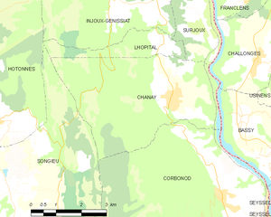
Challonges (Challonges)

- коммуна во Франции
 Hiking in Challonges
Challonges is a charming area located in the Auvergne-Rhône-Alpes region of France, near the border with Switzerland. It offers a variety of hiking opportunities for different skill levels, with beautiful landscapes featuring rolling hills, forests, and the stunning backdrop of the Alps.
Hiking Trails
-
Local Trails: There are several marked trails in and around Challonges that range from easy walks to more challenging hikes. These typically include countryside paths that weave through picturesque villages, vineyards, and woodlands.
-
Mont Salève: Just a short drive away from Challonges, Mont Salève offers more demanding hikes with spectacular views of Geneva, Lake Geneva, and the surrounding Alps. Trails vary in difficulty, and you can choose routes that suit your experience level.
-
Nature Parks: The nearby nature parks provide opportunities for longer treks, where you can explore diverse flora and fauna while enjoying peaceful settings away from the hustle and bustle.
Tips for Hiking in Challonges
- Prepare for Varying Weather: The weather can change quickly in mountainous regions, so it’s essential to check the forecast and dress in layers. Bring a waterproof jacket and ensure you have good hiking boots.
- Stay Hydrated: Carry enough water and snacks to keep your energy up during your hike.
- Local Maps and Guides: It’s a good idea to carry a map or download local hiking apps to stay oriented. Some trails may not be well-marked.
- Respect Nature: Follow the Leave No Trace principles by carrying out all trash and respecting wildlife and natural habitats.
Best Time to Hike
The best times to hike in Challonges are typically late spring (May to June) and early autumn (September to October) when the weather is mild and the landscapes are at their most vibrant. Summer can also be enjoyable but be prepared for warmer temperatures.
Conclusion
Hiking in Challonges is a wonderful way to experience the natural beauty of the region. With its scenic trails and wonderful vistas, it caters to both casual walkers and experienced hikers. Whether you're exploring alone or with friends and family, you're sure to have a memorable outdoor experience.
- Страна:

- Почтовый код: 74910
- Координаты: 46° 1' 10" N, 5° 49' 52" E


- GPS треки (wikiloc): [Ссылка]
- Площадь: 7.9 кв.км
- Население: 501
- Википедия английская: wiki(en)
- Википедия национальная: wiki(fr)
- Хранилище Wikidata: Wikidata: Q734587
- Катеория в википедии: [Ссылка]
- код Freebase: [/m/03ntyg1]
- код GeoNames: Альт: [6451033]
- номер SIREN: [217400555]
- код BNF: [152743144]
- код муниципалитета INSEE: 74055
Граничит с регионами:

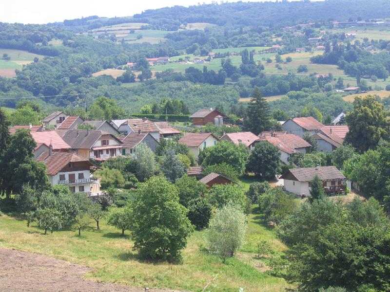
Шане
- коммуна во Франции, департамент Эн
Hiking in Шане
Hiking in Chanay, a picturesque destination in the Auvergne-Rhône-Alpes region of France, offers a variety of trails that cater to different skill levels, from easy walks suitable for families to more challenging hikes for experienced adventurers. The area is characterized by its stunning landscapes, featuring rolling hills, dense forests, and breathtaking views of the surrounding mountains....
- Страна:
- Почтовый код: 01420
- Координаты: 46° 0' 22" N, 5° 47' 8" E
- GPS треки (wikiloc): [Ссылка]
- Площадь: 18.1 кв.км
- Население: 640
- Веб сайт: [Ссылка]

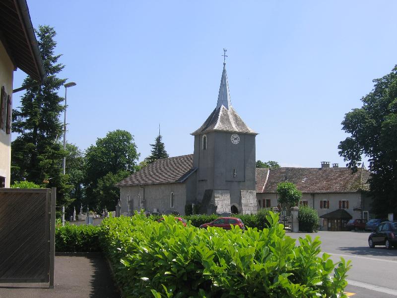
Сюржу
- коммуна во Франции
Hiking in Сюржу
Surjoux, located in the Auvergne-Rhône-Alpes region of France, offers a variety of hiking opportunities amid stunning natural landscapes. This area is characterized by its lush forests, rolling hills, and picturesque views, making it an appealing destination for hikers of all levels....
- Страна:
- Почтовый код: 01420
- Координаты: 46° 1' 27" N, 5° 48' 10" E
- GPS треки (wikiloc): [Ссылка]
- Площадь: 4.31 кв.км
- Население: 72

Bassy
- коммуна во Франции
Hiking in Bassy
It seems there might be a typo or misunderstanding regarding "Bassy," as it doesn't correspond to a well-known hiking destination. However, if you meant "Basilicata" in Italy, "Basse-Terre" in Guadeloupe, or a similar-sounding location, I can provide information on those areas....
- Страна:
- Почтовый код: 74910
- Координаты: 45° 58' 51" N, 5° 49' 47" E
- GPS треки (wikiloc): [Ссылка]
- Площадь: 7.57 кв.км
- Население: 417

Chêne-en-Semine
- коммуна во Франции
Hiking in Chêne-en-Semine
Chêne-en-Semine is a charming destination for hiking enthusiasts, located in the Auvergne-Rhône-Alpes region of France. Known for its picturesque natural surroundings, this area offers a variety of trails suitable for different skill levels. Here are some highlights of hiking in Chêne-en-Semine:...
- Страна:
- Почтовый код: 74270
- Координаты: 46° 2' 49" N, 5° 51' 31" E
- GPS треки (wikiloc): [Ссылка]
- Площадь: 9.46 кв.км
- Население: 463
- Веб сайт: [Ссылка]


Franclens
- коммуна во Франции
Hiking in Franclens
Franclens is a charming area located in the Haute-Savoie region of the French Alps. It offers beautiful landscapes and a range of hiking opportunities, suitable for various skill levels. Here are some highlights and tips for hiking in Franclens:...
- Страна:
- Почтовый код: 74910
- Координаты: 46° 2' 33" N, 5° 49' 47" E
- GPS треки (wikiloc): [Ссылка]
- Площадь: 5.37 кв.км
- Население: 529


Usinens
- коммуна во Франции
Hiking in Usinens
Usinens isn't a widely recognized hiking destination, and there may be a misunderstanding regarding the location. If you meant the general area of the U.S. or a specific region or park (like Yosemite in California or another area), please clarify, and I’d be happy to provide detailed information....
- Страна:
- Почтовый код: 74910
- Координаты: 46° 0' 32" N, 5° 50' 28" E
- GPS треки (wikiloc): [Ссылка]
- Площадь: 7.63 кв.км
- Население: 391