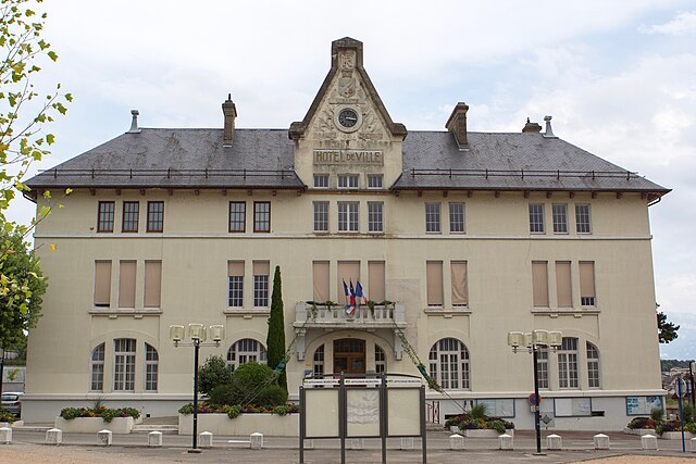
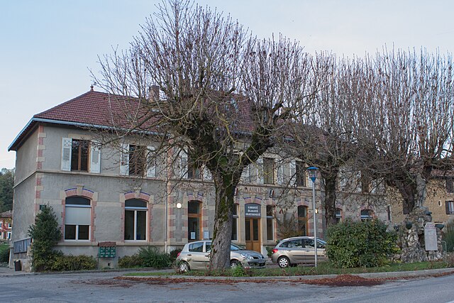
Шарнекль (Charnècles, Charnècles)

- коммуна во Франции
 Hiking in Шарнекль
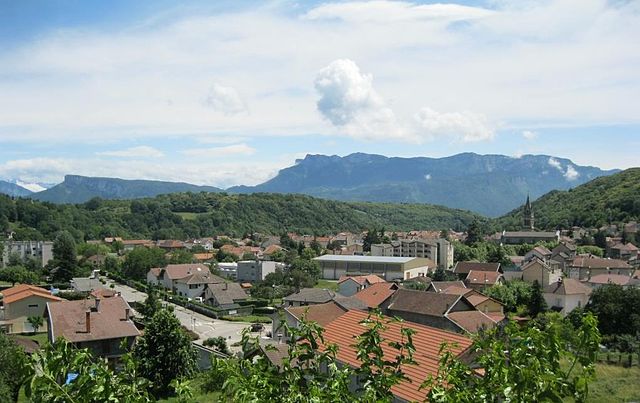
Charnècles is a charming village located in the Isère department of the Auvergne-Rhône-Alpes region in France. It offers a scenic backdrop for hiking enthusiasts, with various trails that showcase the area's natural beauty and rich landscapes.
Hiking Trails
-
Local Trails: There are several local trails around Charnècles that provide hikers with views of the surrounding countryside, including fields, woodlands, and streams. These paths are often well-marked and suitable for different skill levels.
-
The Mount Outheran Trail: This is a more challenging hike, offering stunning vistas of the nearby mountains and valleys for those looking for a rewarding trek.
-
Lac de Paladru: Not far from Charnècles is Lac de Paladru, where you can enjoy lakeside trails that are great for leisurely walks, picnics, and birdwatching.
Difficulty Levels
- Easy to Moderate: Many trails in and around Charnècles are accessible for families and beginners, with gentle slopes and well-maintained paths.
- Moderate to Challenging: For experienced hikers, there are trails that involve steeper ascents and rugged terrain.
Best Time to Hike
- Spring and Fall: The best times to hike in Charnècles are typically during spring and fall when temperatures are mild, and the flora is vibrant.
- Summer: While summer can be warm, it’s also an ideal time to enjoy longer daylight hours and fully embrace nature.
Tips for Hiking in Charnècles
- Stay Hydrated: Bring enough water, especially on warmer days.
- Appropriate Gear: Wear comfortable hiking shoes and dress in layers to adapt to changing conditions.
- Check Trail Maps: Familiarize yourself with trail maps or local guides to navigate effectively.
- Respect Nature: Follow Leave No Trace principles to preserve the natural beauty of the area.
Local Attractions
- Villages and Markets: Enjoy the local culture by visiting nearby towns and their markets.
- Cultural Sites: Check out historical landmarks or churches in the region for a touch of local history.
Whether you're looking for a leisurely stroll or an adventurous hike, Charnècles offers a great natural escape in the French Alps.
- Страна:

- Почтовый код: 38140
- Координаты: 45° 20' 36" N, 5° 31' 40" E


- GPS треки (wikiloc): [Ссылка]
- Площадь: 5.23 кв.км
- Население: 1505
- Веб сайт: http://www.charnecles.fr
- Википедия русская: wiki(ru)
- Википедия английская: wiki(en)
- Википедия национальная: wiki(fr)
- Хранилище Wikidata: Wikidata: Q1003017
- Катеория в википедии: [Ссылка]
- код Freebase: [/m/03nvggh]
- код GeoNames: Альт: [6448752]
- номер SIREN: [213800840]
- код BNF: [15257912d]
- код муниципалитета INSEE: 38084
Граничит с регионами:

Рив
Hiking in Рив
Rives, located in the Isère department of the Auvergne-Rhône-Alpes region in southeastern France, offers a range of outdoor activities, including hiking. The area is characterized by its picturesque landscapes, mountainous terrain, and proximity to the French Alps, making it a great starting point for various hiking adventures....
- Страна:
- Почтовый код: 38140
- Координаты: 45° 21' 3" N, 5° 30' 8" E
- GPS треки (wikiloc): [Ссылка]
- Площадь: 10.93 кв.км
- Население: 6242
- Веб сайт: [Ссылка]


Вуре
- коммуна во Франции
Hiking in Вуре
Vourey is a charming village located in the Auvergne-Rhône-Alpes region of France, surrounded by picturesque landscapes ideal for hiking enthusiasts. The area offers a variety of trails that cater to different skill levels, from easy walks through scenic meadows to more challenging hikes that lead into the nearby hills and forests....
- Страна:
- Почтовый код: 38210
- Координаты: 45° 19' 15" N, 5° 31' 12" E
- GPS треки (wikiloc): [Ссылка]
- Площадь: 6.88 кв.км
- Население: 1711
- Веб сайт: [Ссылка]

Реомон
- коммуна во Франции
Hiking in Реомон
Réaumont is a picturesque village located in the Isère department of the Auvergne-Rhône-Alpes region in southeastern France. It's surrounded by beautiful landscapes, making it an ideal destination for hiking enthusiasts. Here’s what you need to know when considering a hike in Réaumont:...
- Страна:
- Почтовый код: 38140
- Координаты: 45° 22' 11" N, 5° 31' 33" E
- GPS треки (wikiloc): [Ссылка]
- Площадь: 4.95 кв.км
- Население: 1037
- Веб сайт: [Ссылка]


Муаран
- коммуна во Франции
Hiking in Муаран
Moirans, located in the Auvergne-Rhône-Alpes region of France, is surrounded by beautiful landscapes that are perfect for hiking enthusiasts. Here are some key points to consider if you're planning a hiking trip in this area:...
- Страна:
- Почтовый код: 38430
- Координаты: 45° 19' 30" N, 5° 33' 52" E
- GPS треки (wikiloc): [Ссылка]
- Площадь: 20.06 кв.км
- Население: 8022
- Веб сайт: [Ссылка]

Ренаж
- коммуна во Франции
Hiking in Ренаж
Renage is a picturesque village located in the Isère department in the Auvergne-Rhône-Alpes region of southeastern France. Surrounded by stunning natural landscapes, it's an excellent base for various hiking adventures....
- Страна:
- Почтовый код: 38140
- Координаты: 45° 20' 0" N, 5° 29' 7" E
- GPS треки (wikiloc): [Ссылка]
- Площадь: 5.1 кв.км
- Население: 3557
- Веб сайт: [Ссылка]