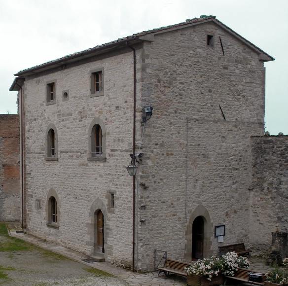
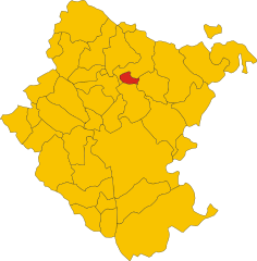
Кьюзи-делла-Верна (Chiusi della Verna, Chiusi della Verna)
.svg)
- коммуна Италии
 Hiking in Кьюзи-делла-Верна
Chiusi della Verna, nestled in the Casentino Forests of Tuscany, Italy, is a fantastic destination for hikers. It offers a blend of natural beauty, historical significance, and a variety of trails catering to different skill levels. Here are some key points to consider when hiking in Chiusi della Verna:
Trails and Routes
-
Variety of Trails: There are numerous hiking trails around Chiusi della Verna, ranging from easy walks suitable for families to more challenging routes for seasoned hikers.
-
Beautiful Landscapes: The trails traverse through lush forests, offering diverse flora and fauna, stunning views of the Casentino Valley, and the chance to see wildlife.
-
Historical Significance: The area is home to the famous Sanctuary of La Verna, where Saint Francis of Assisi received the stigmata. Hiking routes often lead to this significant religious site, making your hike not only a physical journey but also a spiritual one.
Hiking Tips
- Footwear: Wear sturdy hiking boots or shoes with good grip, as trails can be rocky and uneven.
- Weather: Check the weather forecast before your hike. Conditions in the mountains can change quickly.
- Start Early: To make the most of your day, start your hike early, especially in the summer months when temperatures can rise.
- Stay Hydrated: Carry sufficient water to stay hydrated throughout your hike, especially if you’re tackling longer routes.
Best Time to Visit
- Spring and Autumn: These seasons offer mild weather and beautiful scenery, with wildflowers blooming in spring and stunning foliage in autumn.
- Summer: Early morning hikes can be pleasant, but afternoons can get hot, so plan accordingly.
Additional Considerations
- Guided Tours: If you're unfamiliar with the area or prefer a guided experience, consider local hiking tours that provide knowledgeable guides.
- Local Cuisine: After your hike, indulge in the local Tuscan cuisine at nearby trattorias to refuel.
Conclusion
Hiking in Chiusi della Verna is a wonderful way to connect with nature while exploring rich cultural history. With its breathtaking landscapes and numerous trails, it offers an unforgettable experience for hikers of all levels. Remember to respect the natural environment and enjoy your adventure in this beautiful region of Tuscany!
- Страна:

- Почтовый код: 52010
- Телефонный код: 0575
- Код автомобильного номера: AR
- Координаты: 43° 41' 54" N, 11° 56' 10" E


- GPS треки (wikiloc): [Ссылка]
- Высота над уровнем моря: 960 м m
- Площадь: 102.33 кв.км
- Население: 2000
- Веб сайт: http://www.comune.chiusi-della-verna.ar.it
- Википедия русская: wiki(ru)
- Википедия английская: wiki(en)
- Википедия национальная: wiki(it)
- Хранилище Wikidata: Wikidata: Q52077
- Галерея изображений в википедии: [Ссылка]
- Катеория в википедии: [Ссылка]
- код Freebase: [/m/0gm03l]
- код GeoNames: Альт: [6538588]
- код VIAF: Альт: [129186201]
- ID отношения в OpenStreetMap: [42555]
- UN/LOCODE: [ITCH2]
- код ISTAT: 051015
- кадастровый код Италии: C663
Граничит с регионами:


Биббьена
- коммуна Италии
Hiking in Биббьена
Bibbiena, located in the Casentino area of Tuscany, Italy, is a fantastic destination for hiking enthusiasts. The region is characterized by its lush landscapes, rolling hills, and rich history. Here are some highlights to consider when hiking in and around Bibbiena:...
- Страна:
- Почтовый код: 52011
- Телефонный код: 0575
- Код автомобильного номера: AR
- Координаты: 43° 41' 51" N, 11° 48' 52" E
- GPS треки (wikiloc): [Ссылка]
- Высота над уровнем моря: 425 м m
- Площадь: 87 кв.км
- Население: 12177
- Веб сайт: [Ссылка]

Капрезе-Микеланджело
- коммуна Италии
Hiking in Капрезе-Микеланджело
Caprese Michelangelo, a small town in Tuscany, Italy, is surrounded by beautiful landscapes, making it a great destination for hikers. Nestled in the Casentino Forests, the area is characterized by its rich natural beauty, historical sites, and diverse flora and fauna....
- Страна:
- Почтовый код: 52033
- Телефонный код: 0575
- Код автомобильного номера: AR
- Координаты: 43° 38' 27" N, 11° 59' 9" E
- GPS треки (wikiloc): [Ссылка]
- Высота над уровнем моря: 653 м m
- Площадь: 66.53 кв.км
- Население: 1406
- Веб сайт: [Ссылка]


Кастель-Фоконьяно
- коммуна Италии
Hiking in Кастель-Фоконьяно
Castel Focognano is a charming area located in the Tuscany region of Italy, known for its beautiful landscapes and hiking opportunities. Nestled in the Casentino Valley, this location is surrounded by nature, with trails that lead through picturesque forests, rolling hills, and offer stunning views of the surrounding countryside....
- Страна:
- Почтовый код: 52016
- Телефонный код: 0575
- Код автомобильного номера: AR
- Координаты: 43° 39' 12" N, 11° 47' 17" E
- GPS треки (wikiloc): [Ссылка]
- Высота над уровнем моря: 310 м m
- Площадь: 56.63 кв.км
- Население: 3093
- Веб сайт: [Ссылка]

Китиньяно
- коммуна Италии
Hiking in Китиньяно
Chitignano, a charming village in the province of Arezzo, Tuscany, offers beautiful landscapes and a variety of hiking opportunities for outdoor enthusiasts. Nestled in the Casentino area, the region is characterized by its rolling hills, lush forests, and picturesque views that are perfect for hiking and nature walks....
- Страна:
- Почтовый код: 52010
- Телефонный код: 0575
- Код автомобильного номера: AR
- Координаты: 43° 39' 48" N, 11° 52' 56" E
- GPS треки (wikiloc): [Ссылка]
- Высота над уровнем моря: 582 м m
- Площадь: 14.89 кв.км
- Население: 910
- Веб сайт: [Ссылка]

Пьеве-Санто-Стефано
- коммуна Италии
Hiking in Пьеве-Санто-Стефано
Pieve Santo Stefano, located in Tuscany, Italy, is an enchanting destination for hikers. Nestled in the Casentino region, it offers a diverse range of trails that cater to various skill levels, all while showcasing stunning landscapes, rich history, and cultural heritage....
- Страна:
- Почтовый код: 52036
- Телефонный код: 0575
- Код автомобильного номера: AR
- Координаты: 43° 40' 21" N, 12° 2' 32" E
- GPS треки (wikiloc): [Ссылка]
- Высота над уровнем моря: 431 м m
- Площадь: 156.1 кв.км
- Население: 3117
- Веб сайт: [Ссылка]


Поппи
- коммуна Италии
Hiking in Поппи
Poppi, located in the Tuscany region of Italy, offers wonderful hiking opportunities that allow you to explore both the natural beauty of the surrounding landscape and the rich history of the area. Here are some highlights for hiking in Poppi:...
- Страна:
- Почтовый код: 52014
- Телефонный код: 0575
- Код автомобильного номера: AR
- Координаты: 43° 44' 9" N, 11° 45' 42" E
- GPS треки (wikiloc): [Ссылка]
- Высота над уровнем моря: 437 м m
- Площадь: 97.09 кв.км
- Население: 6153
- Веб сайт: [Ссылка]


Суббьяно
- коммуна Италии
Hiking in Суббьяно
Subbiano, located in the Tuscan region of Italy, is surrounded by beautiful landscapes, making it a great destination for hiking enthusiasts. The area offers a variety of trails that cater to different skill levels, from easy walks to more challenging hikes....
- Страна:
- Почтовый код: 52010
- Телефонный код: 0575
- Код автомобильного номера: AR
- Координаты: 43° 34' 48" N, 11° 52' 20" E
- GPS треки (wikiloc): [Ссылка]
- Высота над уровнем моря: 266 м m
- Площадь: 77.84 кв.км
- Население: 6373
- Веб сайт: [Ссылка]

Баньо-ди-Романья
- коммуна регионе Эмилия-Романья, Италия
Hiking in Баньо-ди-Романья
Bagno di Romagna, located in the Emilia-Romagna region of Italy, is a beautiful destination for hiking enthusiasts. Nestled in the Casentino Forests, Monte Falterona, and Campigna National Park, this area offers a variety of trails that cater to different skill levels and interests, all within stunning natural surroundings....
- Страна:
- Почтовый код: 47021
- Телефонный код: 0543
- Код автомобильного номера: FC
- Координаты: 43° 50' 0" N, 11° 58' 0" E
- GPS треки (wikiloc): [Ссылка]
- Высота над уровнем моря: 491 м m
- Площадь: 233.52 кв.км
- Население: 5874
- Веб сайт: [Ссылка]
Вергерето
- коммуна регионе Эмилия-Романья, Италия
Hiking in Вергерето
Verghereto, located in the province of Forlì-Cesena in Emilia-Romagna, Italy, is an excellent destination for hiking enthusiasts. Nestled in the Apennine Mountains, the region is characterized by its stunning landscapes, lush forests, and a variety of trails suitable for different skill levels....
- Страна:
- Почтовый код: 47028
- Телефонный код: 0543
- Код автомобильного номера: FC
- Координаты: 43° 48' 0" N, 11° 58' 0" E
- GPS треки (wikiloc): [Ссылка]
- Высота над уровнем моря: 812 м m
- Площадь: 117.9 кв.км
- Население: 1860
- Веб сайт: [Ссылка]