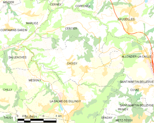
Cuvat (Cuvat)

- коммуна во Франции
 Hiking in Cuvat
Cuvat is not widely recognized as a prominent hiking destination, as it might be a less-known locale or a misspelling of a more popular region. However, if you are referring to a specific area or a different name, please provide more context.
If you're considering hiking in general or looking for information on a known area that may sound similar (such as Cuva or even a common spelling of a destination), here are some general tips for planning a hike:
-
Research Trails: Look up the hiking trails in the area. Websites like AllTrails or local hiking forums can provide detailed information on routes, terrain, and difficulty levels.
-
Check Regulations: Some areas require permits for hiking or have specific regulations about camping and trail use.
-
Prepare Accordingly: Bring appropriate gear, including sturdy hiking boots, weather-appropriate clothing, plenty of water, snacks, and a first-aid kit.
-
Know the Area: Familiarize yourself with the terrain, weather conditions, and any potential wildlife you may encounter.
-
Stay Safe: Always let someone know your hiking plans, carry a map or GPS device, and, if possible, hike with a partner.
If you meant a specific location or have further details, feel free to share, and I can provide more focused information!
- Страна:

- Почтовый код: 74350
- Координаты: 45° 58' 39" N, 6° 7' 8" E


- GPS треки (wikiloc): [Ссылка]
- Площадь: 4.72 кв.км
- Население: 1213
- Веб сайт: http://www.cuvat.org
- Википедия английская: wiki(en)
- Википедия национальная: wiki(fr)
- Хранилище Wikidata: Wikidata: Q735087
- Катеория в википедии: [Ссылка]
- код Freebase: [/m/03ntyqn]
- код GeoNames: Альт: [6451057]
- номер SIREN: [217400985]
- код BNF: [152743562]
- WOEID: [588315]
- код муниципалитета INSEE: 74098
Граничит с регионами:

Choisy, Haute-Savoie
- коммуна во Франции
Hiking in Choisy, Haute-Savoie
Choisy, located in the Haute-Savoie department in the Auvergne-Rhône-Alpes region of France, offers stunning hiking opportunities amid the picturesque landscapes of the French Alps. Here are some highlights and tips for hiking in Choisy:...
- Страна:
- Почтовый код: 74330
- Координаты: 45° 59' 34" N, 6° 3' 27" E
- GPS треки (wikiloc): [Ссылка]
- Площадь: 16.57 кв.км
- Население: 1558
- Веб сайт: [Ссылка]


Pringy, Haute-Savoie
Hiking in Pringy, Haute-Savoie
Pringy, located in the Haute-Savoie region of France, offers beautiful hiking opportunities that allow you to immerse yourself in the stunning Alpine landscape. The area is characterized by its picturesque scenery, including the backdrop of Mont Blanc and rolling hills, charming villages, and lush green forests....
- Страна:
- Почтовый код: 74370
- Координаты: 45° 56' 48" N, 6° 7' 19" E
- GPS треки (wikiloc): [Ссылка]
- Площадь: 9.06 кв.км
- Население: 4063
- Веб сайт: [Ссылка]

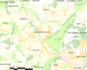
La Balme-de-Sillingy
- коммуна во Франции
Hiking in La Balme-de-Sillingy
La Balme-de-Sillingy, located in the Haute-Savoie region of France, offers some lovely hiking opportunities amidst beautiful Alpine scenery. The area is characterized by rolling hills, lush forests, and stunning views of the surrounding mountains, making it a delightful spot for both casual walkers and more experienced hikers....
- Страна:
- Почтовый код: 74330
- Координаты: 45° 57' 40" N, 6° 2' 31" E
- GPS треки (wikiloc): [Ссылка]
- Площадь: 16.51 кв.км
- Население: 5027


Allonzier-la-Caille
- коммуна во Франции
Hiking in Allonzier-la-Caille
Allonzier-la-Caille is a beautiful commune located in the Haute-Savoie department in the Auvergne-Rhône-Alpes region of southeastern France. Nestled amid stunning natural landscapes, it offers various hiking opportunities suitable for different skill levels....
- Страна:
- Почтовый код: 74350
- Координаты: 46° 0' 12" N, 6° 7' 0" E
- GPS треки (wikiloc): [Ссылка]
- Площадь: 9.62 кв.км
- Население: 1944
- Веб сайт: [Ссылка]


Saint-Martin-Bellevue
- коммуна во Франции
Hiking in Saint-Martin-Bellevue
Saint-Martin-Bellevue is a charming commune located in the Haute-Savoie department in the Auvergne-Rhône-Alpes region of southeastern France. It is nestled near the foothills of the Alps, making it an excellent starting point for various hiking adventures. Here’s what you can expect when hiking in and around this picturesque area:...
- Страна:
- Почтовый код: 74370
- Координаты: 45° 57' 44" N, 6° 8' 55" E
- GPS треки (wikiloc): [Ссылка]
- Площадь: 9.33 кв.км
- Население: 2646
- Веб сайт: [Ссылка]