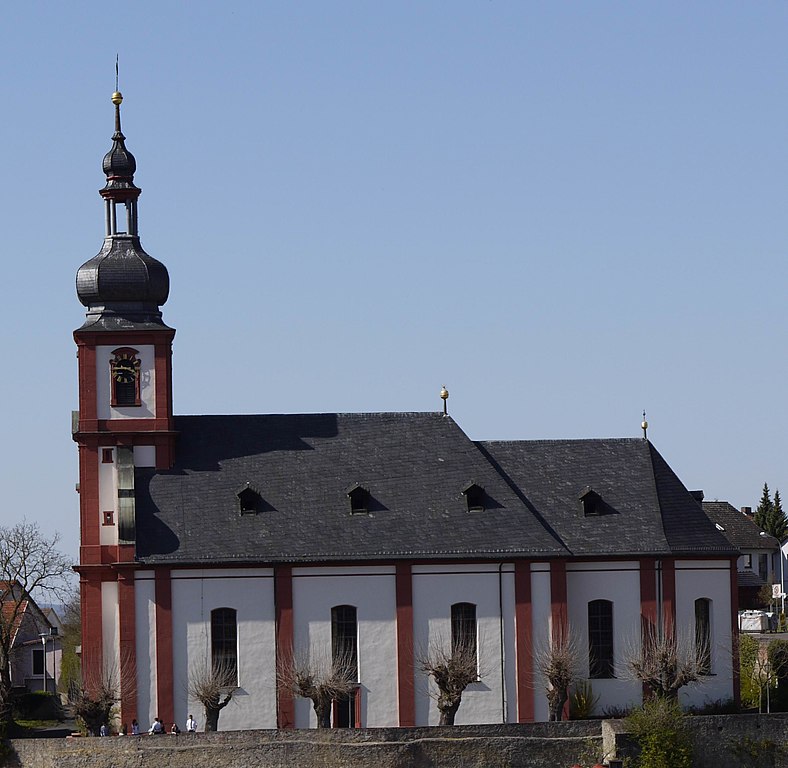
Эрлабрунн (Erlabrunn, Erlabrunn)

 Hiking in Эрлабрунн
Erlabrunn, a picturesque village in Bavaria, Germany, offers several opportunities for hiking enthusiasts. Nestled in the lush countryside and close to the stunning landscape of the Franconian Switzerland region, it provides a serene environment for walkers and nature lovers.
Hiking Trails
-
Local Trails: There are various marked trails around Erlabrunn that range in difficulty. These trails lead through dense forests, alongside rivers, and offer panoramic views of the surrounding countryside.
-
Franconian Switzerland Trail: This famous trail passes nearby, allowing hikers to explore the unique rock formations, caves, and charming little towns typical of this region.
-
Nature Experiences: The area is rich in biodiversity, and hikers can often spot local wildlife, unique plants, and beautiful landscapes, especially during the spring and summer months.
Best Times to Hike
- Spring (April to June): Ideal for seeing wildflowers and lush greenery.
- Fall (September to November): Offers stunning autumn foliage, making for beautiful hikes.
Tips for Hiking in Erlabrunn
- Proper Footwear: Invest in good hiking boots, as many trails can be uneven and rocky.
- Local Maps: It’s advisable to have a local hiking map or use a GPS app to navigate the trails effectively.
- Safety: Always inform someone about your hiking plans and carry a first aid kit, especially if you plan to hike alone.
- Stay Hydrated: Carry enough water and snacks, especially on longer hikes.
Nearby Attractions
- Historical Sites: After a day of hiking, consider visiting local landmarks such as traditional Bavarian architecture or local breweries.
- Caves and Rock Formations: Explore the unique geological formations in the Franconian Switzerland area, adding another layer to your outdoor experience.
Whether you are an experienced hiker or a casual walker, Erlabrunn and its surroundings provide a variety of landscapes and challenges that make for an enjoyable hiking experience. Be sure to check local resources for the latest trail conditions and any guided hiking options that may be available during your visit!
- Страна:

- Почтовый код: 97250
- Телефонный код: 09364
- Координаты: 49° 52' 0" N, 9° 51' 0" E


- GPS треки (wikiloc): [Ссылка]
- Высота над уровнем моря: 180 м m
- Площадь: 4.01 кв.км
- Население: 1320
- Веб сайт: http://www.gemeinde-erlabrunn.de/
- Википедия русская: wiki(ru)
- Википедия английская: wiki(en)
- Википедия национальная: wiki(de)
- Хранилище Wikidata: Wikidata: Q504236
- Катеория в википедии: [Ссылка]
- код Freebase: [/m/02rl9th]
- код GeoNames: Альт: [2929594]
- код VIAF: Альт: [140841763]
- ID отношения в OpenStreetMap: [181150]
- код GND: Альт: [4217234-2]
- код LCNAF: Альт: [n89146812]
- Bavarikon ID: [ODB_A00000499]
- идентификатор муниципалитетов в Германии: 09679128
Граничит с регионами:
Целлинген
Hiking in Целлинген
Zellingen, a charming municipality located in Bavaria, Germany, is an ideal location for hiking enthusiasts. It's situated near the Main River, which provides a beautiful backdrop for outdoor activities. Here are some highlights and tips for hiking in and around Zellingen:...
- Страна:
- Почтовый код: 97225
- Телефонный код: 09396; 09364
- Код автомобильного номера: MSP
- Координаты: 49° 54' 0" N, 9° 49' 0" E
- GPS треки (wikiloc): [Ссылка]
- Высота над уровнем моря: 170 м m
- Площадь: 41.45 кв.км
- Население: 5651
- Веб сайт: [Ссылка]


Лайнах
Hiking in Лайнах
Leinach, located in Bavaria, Germany, offers beautiful landscapes and a variety of hiking trails suitable for different skill levels. The area is characterized by rolling hills, lush forests, and picturesque views of the surrounding countryside. Here are some highlights and tips for hiking in Leinach:...
- Страна:
- Почтовый код: 97274
- Телефонный код: 09364
- Координаты: 49° 52' 0" N, 9° 48' 0" E
- GPS треки (wikiloc): [Ссылка]
- Высота над уровнем моря: 280 м m
- Площадь: 28.02 кв.км
- Население: 2568
- Веб сайт: [Ссылка]


Тюнгерсхайм
Hiking in Тюнгерсхайм
Thüngersheim is a charming village located in the Würzburg district of Bavaria, Germany, known for its picturesque vineyards and beautiful landscapes. Hiking in and around Thüngersheim offers stunning views of the Main Valley and the surrounding countryside, making it a popular destination for nature lovers and outdoor enthusiasts....
- Страна:
- Почтовый код: 97291
- Телефонный код: 09364
- Координаты: 49° 52' 0" N, 9° 50' 0" E
- GPS треки (wikiloc): [Ссылка]
- Высота над уровнем моря: 169 м m
- Площадь: 11.06 кв.км
- Население: 2453
- Веб сайт: [Ссылка]