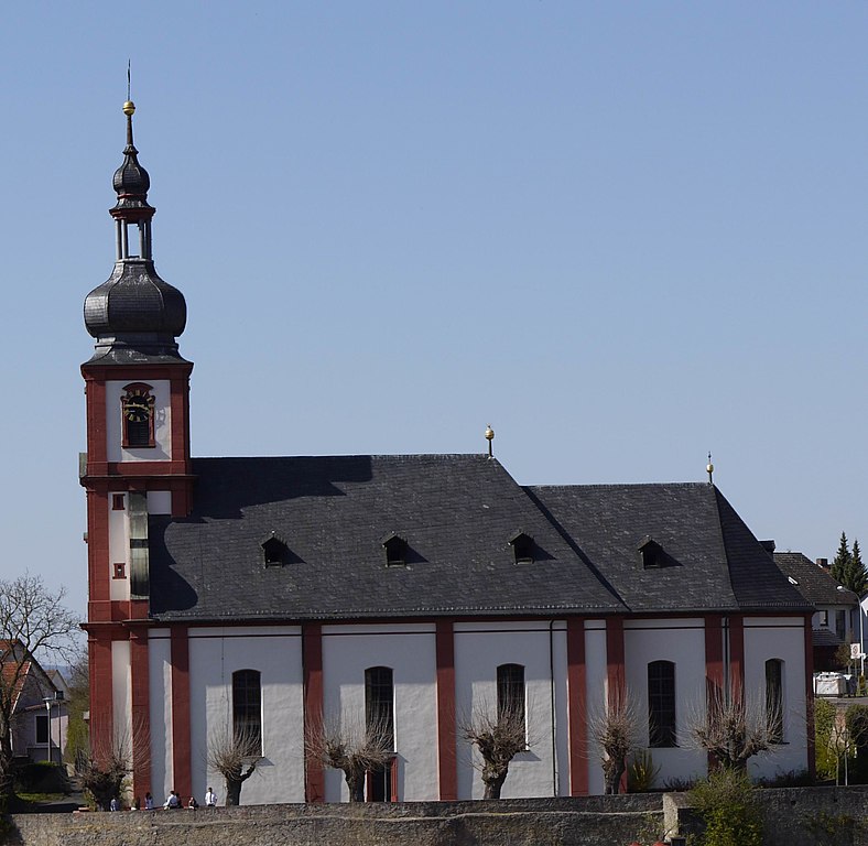
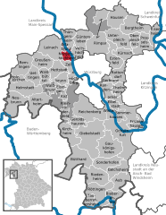
Лайнах (Leinach, Leinach)

 Hiking in Лайнах
Leinach, located in Bavaria, Germany, offers beautiful landscapes and a variety of hiking trails suitable for different skill levels. The area is characterized by rolling hills, lush forests, and picturesque views of the surrounding countryside. Here are some highlights and tips for hiking in Leinach:
Hiking Trails
-
Local Trails: Leinach features several well-marked trails that allow hikers to explore the natural beauty of the region. Trails may vary in length and difficulty, so be sure to choose one that matches your fitness level.
-
Scenic Routes: Many trails offer scenic vistas of the surrounding hills and valleys. Look for routes that take you through forests, along rivers, or past local farms to fully immerse yourself in the Bavarian landscape.
-
Nature Reserves: Some trails may intersect with nature reserves, where you can observe local wildlife and flora. Keep an eye out for signs indicating protected areas and be respectful of the environment.
Preparation Tips
-
Weather: Check the weather forecast before heading out, as conditions can change quickly. Dress in layers to accommodate temperature fluctuations.
-
Footwear: Wear sturdy, comfortable hiking boots with good traction to navigate varied terrain safely.
-
Navigation: Carry a physical map or download trail maps on your smartphone. While trails are often well-marked, having a backup navigation method can be helpful.
-
Hydration and Snacks: Bring sufficient water and snacks to keep your energy up during the hike.
-
Safety: Let someone know your hiking plans and estimated return time, especially if hiking alone.
Local Attractions
-
Historical Sites: While hiking, you may come across historical landmarks or points of interest in and around Leinach, providing a mix of nature and culture.
-
Wildlife: Enjoy the natural habitat and keep an eye out for local wildlife, such as deer, birds, and various native plants.
Conclusion
Hiking in Leinach can be a rewarding experience, combining physical activity with the chance to enjoy the stunning Bavarian countryside. Whether you’re an experienced hiker or a beginner, there’s something for everyone to appreciate in this beautiful region. Be sure to respect the trails, adhere to local regulations, and most importantly, enjoy your time in nature!
- Страна:

- Почтовый код: 97274
- Телефонный код: 09364
- Координаты: 49° 52' 0" N, 9° 48' 0" E


- GPS треки (wikiloc): [Ссылка]
- Высота над уровнем моря: 280 м m
- Площадь: 28.02 кв.км
- Население: 2568
- Веб сайт: http://www.leinach.de
- Википедия русская: wiki(ru)
- Википедия английская: wiki(en)
- Википедия национальная: wiki(de)
- Хранилище Wikidata: Wikidata: Q290380
- Катеория в википедии: [Ссылка]
- код Freebase: [/m/02q95fc]
- код GeoNames: Альт: [3274982]
- ID отношения в OpenStreetMap: [181149]
- код GND: Альт: [1707287-6]
- Bavarikon ID: [ODB_A00000538]
- идентификатор муниципалитетов в Германии: 09679200
Граничит с регионами:
Целлинген
Hiking in Целлинген
Zellingen, a charming municipality located in Bavaria, Germany, is an ideal location for hiking enthusiasts. It's situated near the Main River, which provides a beautiful backdrop for outdoor activities. Here are some highlights and tips for hiking in and around Zellingen:...
- Страна:
- Почтовый код: 97225
- Телефонный код: 09396; 09364
- Код автомобильного номера: MSP
- Координаты: 49° 54' 0" N, 9° 49' 0" E
- GPS треки (wikiloc): [Ссылка]
- Высота над уровнем моря: 170 м m
- Площадь: 41.45 кв.км
- Население: 5651
- Веб сайт: [Ссылка]


Целль-на-Майне
Hiking in Целль-на-Майне
Zell am Main is a picturesque village located in Bavaria, Germany, known for its beautiful landscapes and outdoor activities, including hiking. The area offers a variety of trails suitable for different skill levels, from easy walks to more challenging hikes, making it an excellent destination for both beginners and experienced hikers....
- Страна:
- Почтовый код: 97299
- Телефонный код: 0931
- Координаты: 49° 49' 0" N, 9° 52' 0" E
- GPS треки (wikiloc): [Ссылка]
- Высота над уровнем моря: 179 м m
- Площадь: 9.96 кв.км
- Население: 3226
- Веб сайт: [Ссылка]


Эрлабрунн
Hiking in Эрлабрунн
Erlabrunn, a picturesque village in Bavaria, Germany, offers several opportunities for hiking enthusiasts. Nestled in the lush countryside and close to the stunning landscape of the Franconian Switzerland region, it provides a serene environment for walkers and nature lovers....
- Страна:
- Почтовый код: 97250
- Телефонный код: 09364
- Координаты: 49° 52' 0" N, 9° 51' 0" E
- GPS треки (wikiloc): [Ссылка]
- Высота над уровнем моря: 180 м m
- Площадь: 4.01 кв.км
- Население: 1320
- Веб сайт: [Ссылка]

Биркенфельд
- муниципалитет в Германии, Бавария, Нижняя Франкония, Майн-Шпессарт
Hiking in Биркенфельд
Birkenfeld, located in Bavaria, Germany, is a charming town surrounded by beautiful landscapes, ideal for hiking enthusiasts. The region offers a variety of trails that cater to different skill levels, making it accessible for both novice and experienced hikers. Here are some highlights and tips for hiking in the area:...
- Страна:
- Почтовый код: 97834
- Телефонный код: 09398
- Код автомобильного номера: MSP
- Координаты: 49° 52' 0" N, 9° 42' 0" E
- GPS треки (wikiloc): [Ссылка]
- Высота над уровнем моря: 210 м m
- Площадь: 29.15 кв.км
- Население: 2151
- Веб сайт: [Ссылка]
Хетштадт
Hiking in Хетштадт
Hettstadt is a charming municipality located in the Lower Franconia region of Bavaria, Germany. It’s surrounded by beautiful landscapes, making it a great destination for hiking enthusiasts. Here are a few highlights about hiking in and around Hettstadt:...
- Страна:
- Почтовый код: 97265
- Телефонный код: 0931
- Координаты: 49° 48' 0" N, 9° 49' 0" E
- GPS треки (wikiloc): [Ссылка]
- Высота над уровнем моря: 307 м m
- Площадь: 13.92 кв.км
- Население: 2235
- Веб сайт: [Ссылка]

Маргетсхёхгайм
Hiking in Маргетсхёхгайм
Margetshöchheim is a small municipality near Würzburg, Germany, known for its picturesque landscapes and access to beautiful hiking trails. The area is characterized by its rolling hills, vineyards, and views of the Main River, making it a charming destination for outdoor enthusiasts....
- Страна:
- Почтовый код: 97276
- Телефонный код: 0931
- Координаты: 49° 50' 0" N, 9° 51' 0" E
- GPS треки (wikiloc): [Ссылка]
- Высота над уровнем моря: 170 м m
- Площадь: 6.67 кв.км
- Население: 2768
- Веб сайт: [Ссылка]

Гройсенхайм
Hiking in Гройсенхайм
Greußenheim is a small municipality in Bavaria, Germany, situated near the scenic landscapes of the Fränkisches Würzburg region, which makes it an attractive destination for hiking enthusiasts. Here are some highlights about hiking in and around Greußenheim:...
- Страна:
- Почтовый код: 97259
- Телефонный код: 09369
- Координаты: 49° 49' 0" N, 9° 46' 0" E
- GPS треки (wikiloc): [Ссылка]
- Высота над уровнем моря: 259 м m
- Площадь: 17.66 кв.км
- Население: 1251
- Веб сайт: [Ссылка]