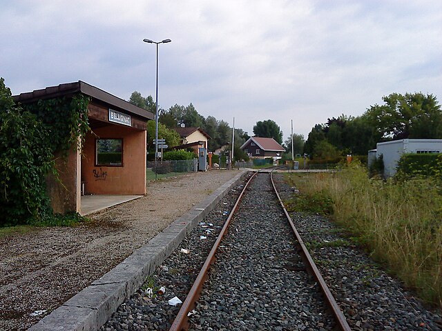
Жеоврессе (Géovreisset, Géovreisset)
- коммуна во Франции
 Hiking in Жеоврессе
Géovreisset is a charming commune located in the Jura department of France, known for its natural beauty and outdoor activities. Hiking in this area offers a variety of scenic trails that cater to different skill levels, ranging from easy walks to more challenging hikes.
Key Features of Hiking in Géovreisset:
-
Stunning Scenery: The Jura region is characterized by rolling hills, dense forests, and picturesque landscapes, providing hikers with breathtaking views and serene environments.
-
Diverse Trails: Trails range from gentle paths suitable for families and beginners to more demanding routes that can challenge experienced hikers. Many of the trails are well-marked, making navigation easier.
-
Flora and Fauna: Expect to encounter diverse flora and fauna along the trails, including native trees, wildflowers, and various wildlife. The Jura region is known for its rich biodiversity.
-
Cultural Heritage: Some hiking trails may take you past historical sites, traditional farms, and local villages, allowing you to appreciate the cultural heritage of the area.
-
Seasonal Variations: Hiking in Géovreisset can be enjoyed year-round, but each season offers different experiences, from vibrant autumn foliage to snow-covered landscapes in winter.
Popular Nearby Trails:
- Sentiers des Marnes: This local trail offers beautiful views and is suitable for various skill levels.
- Circuits des Crêtes: A more challenging hike that rewards with panoramic views of the region.
Tips for Hiking in Géovreisset:
- Check Weather Conditions: The weather in the Jura can change quickly, so it’s important to check the forecast before heading out.
- Explore Local Resources: Visit the local tourist office or consult maps for guided trail options and recommendations.
- Pack Accordingly: Ensure you have the right gear, including sturdy hiking boots, water, snacks, and a first-aid kit.
- Leave No Trace: Practice responsible hiking by sticking to marked trails, taking your litter home, and respecting wildlife.
Hiking in Géovreisset can be a delightful experience for nature lovers and those seeking an adventurous outdoor activity. Be sure to take your time and enjoy the beauty of this enchanting region!
- Страна:

- Почтовый код: 01100
- Координаты: 46° 15' 22" N, 5° 37' 4" E


- GPS треки (wikiloc): [Ссылка]
- Площадь: 3.31 кв.км
- Население: 909
- Веб сайт: http://www.geovreisset.fr
- Википедия русская: wiki(ru)
- Википедия английская: wiki(en)
- Википедия национальная: wiki(fr)
- Хранилище Wikidata: Wikidata: Q275362
- Катеория в википедии: [Ссылка]
- Карты в википедии: [Ссылка]
- код Freebase: [/m/03h1mvd]
- код Freebase: [/m/03h1mvd]
- код Freebase: [/m/03h1mvd]
- код GeoNames: Альт: [6424534]
- код GeoNames: Альт: [6424534]
- код GeoNames: Альт: [6424534]
- номер SIREN: [210101713]
- номер SIREN: [210101713]
- номер SIREN: [210101713]
- код муниципалитета INSEE: 01171
- код муниципалитета INSEE: 01171
- код муниципалитета INSEE: 01171
Граничит с регионами:

Ойонна
- коммуна во Франции
Hiking in Ойонна
Oyonnax, located in the Auvergne-Rhône-Alpes region of France, is well-known for its beautiful natural landscapes and outdoor recreational opportunities. The area is situated near the Jura Mountains, making it an excellent destination for hiking enthusiasts. Here are some insights and tips for hiking in Oyonnax:...
- Страна:
- Почтовый код: 01100
- Координаты: 46° 15' 20" N, 5° 39' 18" E
- GPS треки (wikiloc): [Ссылка]
- Площадь: 36.37 кв.км
- Население: 22392
- Веб сайт: [Ссылка]
Беллинья
- коммуна во Франции
Hiking in Беллинья
Bellignat is a charming area located in the Auvergne-Rhône-Alpes region of France, near the city of Bourg-en-Bresse. It offers a variety of hiking opportunities for outdoor enthusiasts, ranging from casual walks to more challenging trails. Here are some key points to consider when planning a hike in Bellignat:...
- Страна:
- Почтовый код: 01100
- Координаты: 46° 14' 41" N, 5° 37' 58" E
- GPS треки (wikiloc): [Ссылка]
- Площадь: 7.83 кв.км
- Население: 3612
- Веб сайт: [Ссылка]

Изернор
- коммуна во Франции
Hiking in Изернор
Izernore, located in the Ain department of the Auvergne-Rhône-Alpes region in eastern France, offers a beautiful environment for hiking enthusiasts. The area is characterized by its stunning natural landscapes, including rolling hills, forests, and views of the surrounding mountains. Here are some key points for hiking in Izernore:...
- Страна:
- Почтовый код: 01580
- Координаты: 46° 13' 14" N, 5° 33' 14" E
- GPS треки (wikiloc): [Ссылка]
- Площадь: 20.86 кв.км
- Население: 2275
- Веб сайт: [Ссылка]

Груасья
- коммуна во Франции
Hiking in Груасья
Groissiat is a charming village located in the Ain department of the Auvergne-Rhône-Alpes region in eastern France. While it may not be as widely known as some of the larger hiking destinations, it offers beautiful natural surroundings that can be appealing for those looking to escape into nature....
- Страна:
- Почтовый код: 01100
- Координаты: 46° 13' 45" N, 5° 36' 45" E
- GPS треки (wikiloc): [Ссылка]
- Площадь: 6.32 кв.км
- Население: 1213
- Веб сайт: [Ссылка]
Самонья
- коммуна во Франции
Hiking in Самонья
It seems like there may be a misunderstanding in the name "Samognat," as it does not correspond to a well-known hiking destination or region. If you meant a different location or if Samognat is a lesser-known local area, I would recommend checking local hiking resources or tourism websites for that particular region....
- Страна:
- Почтовый код: 01580
- Координаты: 46° 15' 28" N, 5° 34' 34" E
- GPS треки (wikiloc): [Ссылка]
- Площадь: 14.01 кв.км
- Население: 660
- Веб сайт: [Ссылка]