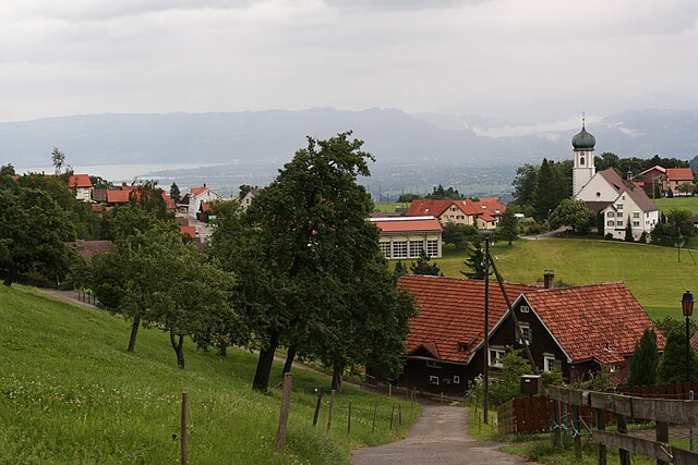
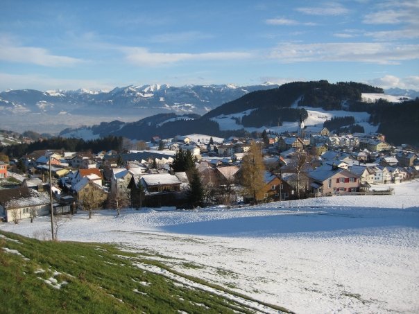
Хайден (Heiden, Heiden)

- коммуна в кантоне Аппенцелль-Ауссерроден (Швейцария)
 Hiking in Хайден
Heiden is a picturesque village located in the Appenzell region of Switzerland, known for its stunning views of Lake Constance and its surrounding mountains. Hiking in and around Heiden offers a range of scenic trails suitable for different skill levels, making it a delightful destination for outdoor enthusiasts. Here are some highlights:
Trail Options:
-
Heiden – Rorschach Trail: This relatively easy trail takes you along the banks of Lake Constance, offering beautiful views of the lake and the Alps in the background. It’s a great choice for families and casual hikers.
-
Hiking to the Hoher Kasten: For those seeking more challenging hikes, the trail to Hoher Kasten, one of the area’s peaks, is a rewarding option. The panoramic views from the summit are breathtaking, particularly on clear days when you can see far into the distance.
-
Cultural and Historical Trails: Some trails explore the local culture and history, taking you to historical landmarks and offering insights into the region's heritage.
Tips for Hiking in Heiden:
- Season: Late spring through early autumn (May to October) is generally the best time for hiking, as the weather is mild and the trails are well-maintained.
- Equipment: Wear sturdy hiking boots and carry plenty of water, especially on longer hikes. A trekking pole can be helpful for steep sections.
- Maps and Signage: Trails are usually well-marked, but it's a good idea to have a map or download a hiking app for offline use, especially in more remote areas.
- Local Amenities: Heiden offers charming accommodations, restaurants, and cafes for when you want to relax after a hike.
Accessibility:
Heiden is well connected by public transport, and you can reach it easily from larger cities like St. Gallen. Additionally, local cable cars may provide access to higher trails or peaks, aiding those who prefer to hike at elevation without the strenuous ascent.
Before heading out, always check the local weather conditions and trail status for the best and safest hiking experience!
- Страна:

- Почтовый код: 9410
- Телефонный код: 071
- Код автомобильного номера: AR
- Координаты: 47° 26' 28" N, 9° 31' 52" E


- GPS треки (wikiloc): [Ссылка]
- Высота над уровнем моря: 802 м m
- Площадь: 7.5 кв.км
- Население: 4192
- Веб сайт: http://www.heiden.ch
- Википедия русская: wiki(ru)
- Википедия английская: wiki(en)
- Википедия национальная: wiki(de)
- Хранилище Wikidata: Wikidata: Q68315
- Катеория в википедии: [Ссылка]
- код Freebase: [/m/01v6ds]
- код GeoNames: Альт: [7286047]
- ID отношения в OpenStreetMap: [1683892]
- идентификатор местоположения ArchINFORM: [3921]
- код LCNAF: Альт: [n90723171]
- код темы Quora: [Heiden-Switzerland]
- идентификатор HDS: [1306]
- код швейцарского муниципалитета: [3032]
Граничит с регионами:


Таль
Hiking in Таль
Thal, located in the canton of St. Gallen, Switzerland, offers some beautiful hiking opportunities that cater to different skill levels. The region is characterized by picturesque landscapes, rolling hills, and stunning views of the surrounding mountains. Here are some highlights and tips for hiking in Thal:...
- Страна:
- Почтовый код: 9425
- Телефонный код: 071
- Код автомобильного номера: SG
- Координаты: 47° 28' 42" N, 9° 33' 24" E
- GPS треки (wikiloc): [Ссылка]
- Высота над уровнем моря: 397 м m
- Площадь: 9.58 кв.км
- Население: 6480
- Веб сайт: [Ссылка]


Вольфхальден
Hiking in Вольфхальден
Wolfhalden is a picturesque municipality in the Appenzell Innerrhoden region of Switzerland, surrounded by beautiful landscapes and offering a range of hiking opportunities. Here’s what you need to know about hiking in this area:...
- Страна:
- Почтовый код: 9427
- Телефонный код: 071
- Код автомобильного номера: AR
- Координаты: 47° 26' 59" N, 9° 33' 38" E
- GPS треки (wikiloc): [Ссылка]
- Высота над уровнем моря: 673 м m
- Площадь: 6.95 кв.км
- Население: 1836
- Веб сайт: [Ссылка]


Ройте
Hiking in Ройте
Reute is a beautiful area located in Germany, particularly noted for its picturesque landscapes and hiking opportunities. Here are some key points about hiking in Reute:...
- Страна:
- Почтовый код: 9411
- Телефонный код: 071
- Код автомобильного номера: AR
- Координаты: 47° 25' 10" N, 9° 34' 30" E
- GPS треки (wikiloc): [Ссылка]
- Высота над уровнем моря: 703 м m
- Площадь: 4.99 кв.км
- Население: 690
- Веб сайт: [Ссылка]

Эггерсрит
Hiking in Эггерсрит
Eggersriet is a charming little town located in the canton of St. Gallen, Switzerland, nestled amidst beautiful landscapes. Hiking in and around Eggersriet allows you to enjoy breathtaking views of the surrounding hills, forests, and rural scenery....
- Страна:
- Почтовый код: 9034
- Телефонный код: 071
- Код автомобильного номера: SG
- Координаты: 47° 26' 59" N, 9° 27' 59" E
- GPS треки (wikiloc): [Ссылка]
- Высота над уровнем моря: 817 м m
- Площадь: 8.82 кв.км
- Население: 2275
- Веб сайт: [Ссылка]


Вальд
- община в Швейцарии, Аппенцелль-Ауссерроден
Hiking in Вальд
Wald, located in the Appenzell Ausserrhoden region of Switzerland, offers beautiful hiking opportunities amidst stunning natural landscapes. The area is characterized by rolling hills, vibrant meadows, and picturesque views of the nearby mountains, making it a fantastic destination for both casual walkers and seasoned hikers....
- Страна:
- Почтовый код: 9044
- Телефонный код: 071
- Код автомобильного номера: AR
- Координаты: 47° 24' 56" N, 9° 29' 25" E
- GPS треки (wikiloc): [Ссылка]
- Высота над уровнем моря: 962 м m
- Площадь: 6.82 кв.км
- Население: 857
- Веб сайт: [Ссылка]


Лутценберг
Hiking in Лутценберг
Lutzenberg is a charming community located in the Appenzell District of Switzerland, known for its picturesque landscapes and proximity to the beautiful Appenzell region. Hiking in Lutzenberg offers stunning vistas of rolling hills, lush forests, and scenic views of the Swiss Alps....
- Страна:
- Почтовый код: 9426
- Телефонный код: 071
- Код автомобильного номера: AR
- Координаты: 47° 27' 29" N, 9° 35' 1" E
- GPS треки (wikiloc): [Ссылка]
- Высота над уровнем моря: 523 м m
- Площадь: 2.26 кв.км
- Население: 1253
- Веб сайт: [Ссылка]


Реэтобель
Hiking in Реэтобель
Rehetobel is a scenic area located in the canton of Appenzell in Switzerland, known for its picturesque landscapes and hiking opportunities. Here are some highlights and tips for hiking in Rehetobel:...
- Страна:
- Почтовый код: 9038
- Телефонный код: 071
- Код автомобильного номера: AR
- Координаты: 47° 25' 40" N, 9° 28' 54" E
- GPS треки (wikiloc): [Ссылка]
- Высота над уровнем моря: 940 м m
- Площадь: 6.72 кв.км
- Население: 1750
- Веб сайт: [Ссылка]


Груб
Hiking in Груб
Grub, located in the Appenzell Ausserrhoden region of Switzerland, is known for its stunning scenic beauty and a variety of hiking trails that cater to different skill levels. Here’s a brief overview of what you can expect when hiking in this beautiful area:...
- Страна:
- Почтовый код: 9035
- Телефонный код: 071
- Код автомобильного номера: AR
- Координаты: 47° 26' 53" N, 9° 30' 34" E
- GPS треки (wikiloc): [Ссылка]
- Высота над уровнем моря: 986 м m
- Площадь: 4.22 кв.км
- Население: 1045
- Веб сайт: [Ссылка]
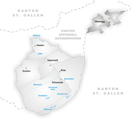
Оберегг
- коммуна в Швейцарии, в кантоне Аппенцелль-Иннерроден
Hiking in Оберегг
Hiking in the Oberegg District, located in the canton of Appenzell Innerrhoden in Switzerland, offers a beautiful blend of scenic landscapes, cultural experiences, and varied terrains. This area is characterized by rolling hills, lush fields, and magnificent views of the surrounding mountains, making it a perfect destination for both novice and experienced hikers....
- Страна:
- Почтовый код: 9413
- Телефонный код: 071
- Код автомобильного номера: AI
- Координаты: 47° 25' 1" N, 9° 33' 27" E
- GPS треки (wikiloc): [Ссылка]
- Высота над уровнем моря: 885 м m
- Площадь: 14.7 кв.км
- Население: 1907
- Веб сайт: [Ссылка]