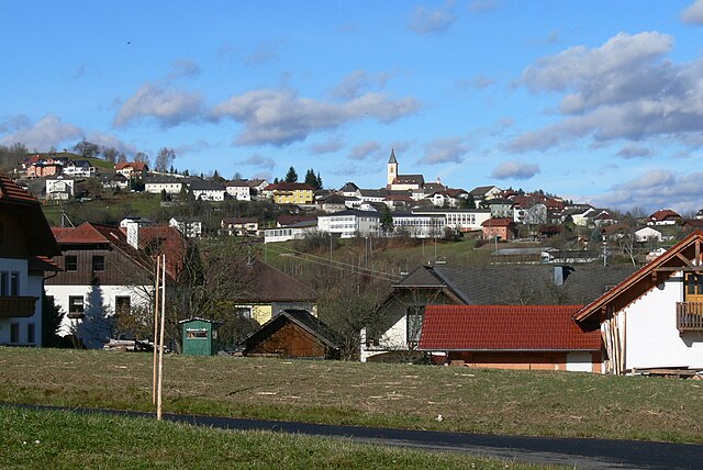
Юльбах (Julbach, Julbach)
- коммуна в федеральной земле Верхняя Австрия, Австрия
 Hiking in Юльбах
Julbach, a picturesque village in the Austrian region of Upper Austria, offers a variety of hiking opportunities that showcase the stunning landscapes of the Bohemian Forest (Böhmerwald) and the surrounding areas. Here’s an overview of what you can expect when hiking in Julbach:
Scenic Routes
-
St. Oswald Water Trail: This trail takes you through beautiful forested areas and along the water, providing a serene hiking experience. It's ideal for families and less experienced hikers.
-
Bohemian Forest Trail: This more challenging hike is part of a larger network of trails that stock the natural beauty and diverse flora and fauna of the region. The path offers scenic viewpoints and opportunities for wildlife spotting.
-
Almweg Path: This path leads to traditional alpine pastures (Almen) and offers spectacular views of the surrounding mountains and valleys. It’s an excellent choice for those looking to experience culinary delights with local produce available at the huts along the way.
Trail Difficulty
- The trails around Julbach range from easy family-friendly walks to more demanding hikes requiring a good level of fitness. Choose a route that matches your ability and experience.
Best Times to Hike
- The hiking season typically runs from early spring through late autumn. Late spring and early autumn are particularly beautiful, as the landscape is vibrant with wildflowers or stunning autumn foliage.
Important Tips
- Preparation: Always check the weather forecast, wear suitable footwear, and have a map or GPS device handy.
- Stay Hydrated: Carry enough water, especially on longer hikes.
- Local Regulations: Respect local wildlife and nature, adhere to marked trails, and follow any specific local guidelines.
Additional Activities
In addition to hiking, Julbach and its surroundings offer opportunities for mountain biking, Nordic walking, and in winter, cross-country skiing.
Conclusion
Hiking in Julbach provides a wonderful opportunity to explore the enchanting landscapes of Austria while enjoying the tranquility of nature. Whether you are an experienced hiker or a beginner, you will find trails that fit your needs, making it a great destination for outdoor enthusiasts.
- Страна:

- Почтовый код: 4162
- Телефонный код: 07288
- Код автомобильного номера: RO
- Координаты: 48° 39' 32" N, 13° 52' 5" E


- GPS треки (wikiloc): [Ссылка]
- Высота над уровнем моря: 589 м m
- Площадь: 22 кв.км
- Население: 1537
- Веб сайт: http://www.julbach.ooe.gv.at/
- Википедия русская: wiki(ru)
- Википедия английская: wiki(en)
- Википедия национальная: wiki(de)
- Хранилище Wikidata: Wikidata: Q693810
- Катеория в википедии: [Ссылка]
- код Freebase: [/m/03gv9rm]
- код GeoNames: Альт: [7873195]
- код VIAF: Альт: [245667706]
- код австрийского муниципалитета: [41313]
Граничит с регионами:


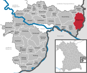
Брайтенберг
Hiking in Брайтенберг
Breitenberg, located in Lower Bavaria, is a fantastic destination for hiking enthusiasts. The region features a mix of scenic landscapes, charming villages, and diverse flora and fauna, making it ideal for both casual hikers and experienced trekkers....
- Страна:

- Почтовый код: 94139
- Телефонный код: 08584
- Код автомобильного номера: PA
- Координаты: 48° 42' 14" N, 13° 47' 39" E
- GPS треки (wikiloc): [Ссылка]
- Высота над уровнем моря: 689 м m
- Площадь: 29.87 кв.км
- Население: 2109
- Веб сайт: [Ссылка]

Вегшайд
Hiking in Вегшайд
Wegscheid, located in Bavaria, Germany, is a charming destination for hiking enthusiasts. The area is characterized by its picturesque landscapes, including rolling hills, lush forests, and panoramic views of the surrounding region. Here are some highlights and tips for hiking in Wegscheid:...
- Страна:
- Почтовый код: 94110; W-8396; 8396
- Телефонный код: 08592
- Координаты: 48° 36' 0" N, 13° 47' 0" E
- GPS треки (wikiloc): [Ссылка]
- Высота над уровнем моря: 718 м m
- Площадь: 80.64 кв.км
- Население: 5393
- Веб сайт: [Ссылка]
Небельберг
Hiking in Небельберг
Nebelberg is a picturesque destination in the heart of Austria that offers a variety of hiking opportunities for enthusiasts of all levels. Nestled in the region of Upper Austria, this area is characterized by stunning landscapes, lush forests, rolling hills, and charming villages....
- Страна:
- Почтовый код: 4155
- Телефонный код: 07287
- Код автомобильного номера: RO
- Координаты: 48° 37' 44" N, 13° 50' 51" E
- GPS треки (wikiloc): [Ссылка]
- Высота над уровнем моря: 695 м m
- Площадь: 9.15 кв.км
- Население: 632
- Веб сайт: [Ссылка]
Пайльштайн-им-Мюльфиртель
Hiking in Пайльштайн-им-Мюльфиртель
Peilstein im Mühlviertel is a charming village in the Mühlviertel region of Austria, surrounded by beautiful landscapes that offer numerous hiking opportunities. The area is characterized by its rolling hills, dense forests, and picturesque views of the Danube Valley....
- Страна:
- Почтовый код: 4153
- Телефонный код: 07287
- Код автомобильного номера: RO
- Координаты: 48° 37' 6" N, 13° 53' 41" E
- GPS треки (wikiloc): [Ссылка]
- Высота над уровнем моря: 584 м m
- Площадь: 23 кв.км
- Население: 1541
- Веб сайт: [Ссылка]

Ульриксберг
Hiking in Ульриксберг
Ulrichsberg is a beautiful location for hiking, situated in the Upper Austria region near the border with the Czech Republic. This area is known for its stunning natural landscapes, including rolling hills, lush forests, and scenic views....
- Страна:
- Почтовый код: 4161
- Телефонный код: 07288
- Код автомобильного номера: RO
- Координаты: 48° 40' 32" N, 13° 54' 44" E
- GPS треки (wikiloc): [Ссылка]
- Высота над уровнем моря: 626 м m
- Площадь: 57 кв.км
- Население: 2843
- Веб сайт: [Ссылка]