
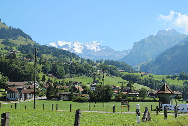
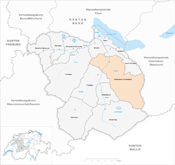
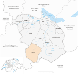
Кандерштег (Kandersteg, Kandersteg)

 Hiking in Кандерштег
Kandersteg is a picturesque village located in the Bernese Oberland region of Switzerland, surrounded by stunning mountain ranges, lush valleys, and enchanting alpine scenery. It's a fantastic destination for hiking enthusiasts of all levels, offering a variety of trails with breathtaking views.
Popular Hiking Trails in Kandersteg
-
Oeschinen Lake Trail:
- Distance: Approximately 10 km round trip
- Difficulty: Moderate
- Description: This trail leads to the beautiful Oeschinen Lake, a UNESCO World Heritage site. The route offers stunning views of the lake and surrounding mountains. You can also take a cable car from Kandersteg to the upper trails, which makes access easier.
-
Kandersteg to Blüemlisalp Hut:
- Distance: About 20 km round trip
- Difficulty: Moderate to strenuous
- Description: This hike takes you into the heart of the mountains, providing panoramic views along the way. The final destination, the Blüemlisalp Hut, is a great place to rest and enjoy refreshments.
-
Allmenalp:
- Distance: Approximately 9 km round trip
- Difficulty: Easy to moderate
- Description: Accessible via a short cable car ride, the Allmenalp hiking trail offers stunning views of the valley and opportunities to see local wildlife. It's an ideal trail for families and those looking for a gentler hike.
-
Gemmi Pass:
- Distance: 12 km one way
- Difficulty: Moderate to challenging
- Description: This ridge hike connects Kandersteg to Leukerbad. The path is a bit steep and rocky in places, but the stunning views and high-altitude experience are well worth the effort.
Tips for Hiking in Kandersteg
- Weather Conditions: Always check the weather forecast before heading out, as conditions can change rapidly in the mountains.
- Trail Markings: Follow the signposts and trail markers to ensure you stay on the correct path. Most trails are well marked.
- Equipment: Wear proper hiking boots and clothing suitable for mountain weather. Bring water, snacks, and possibly a first aid kit.
- Wildlife: Keep an eye out for local wildlife, but remember to respect their space and avoid feeding them.
- Acclimatization: If you're not used to hiking at high altitudes, take it easy on your first few hikes to allow your body to acclimatize.
Additional Activities
In addition to hiking, Kandersteg offers numerous outdoor activities, including mountain biking, paragliding, and skiing in the winter months. The town also has a charming atmosphere with quaint shops, local cuisine, and opportunities to experience Swiss culture.
Kandersteg is a haven for nature lovers and those seeking adventure, making it a must-visit destination for hikers in Switzerland!
- Страна:

- Почтовый код: 3718
- Телефонный код: 033
- Код автомобильного номера: BE
- Координаты: 46° 28' 9" N, 7° 42' 30" E


- GPS треки (wikiloc): [Ссылка]
- Высота над уровнем моря: 2662 м m
- Площадь: 134.5 кв.км
- Население: 1301
- Веб сайт: http://www.kandersteg.ch
- Википедия русская: wiki(ru)
- Википедия английская: wiki(en)
- Википедия национальная: wiki(de)
- Хранилище Wikidata: Wikidata: Q66218
- Катеория в википедии: [Ссылка]
- код Freebase: [/m/027yjk]
- код GeoNames: Альт: [7286178]
- код VIAF: Альт: [124393284]
- ID отношения в OpenStreetMap: [1682502]
- код LCNAF: Альт: [n85017090]
- код темы Quora: [Kandersteg]
- идентификатор HDS: [323]
- код швейцарского муниципалитета: [0565]
Граничит с регионами:


Лаутербруннен
Hiking in Лаутербруннен
Lauterbrunnen is a stunning valley located in the Swiss Alps, known for its dramatic cliffs and impressive waterfalls. It serves as a gateway to the Jungfrau region and offers a variety of hiking opportunities, suitable for different skill levels. Here are some key highlights and tips for hiking in Lauterbrunnen:...
- Страна:
- Почтовый код: 3822
- Телефонный код: 033
- Код автомобильного номера: BE
- Координаты: 46° 33' 6" N, 7° 53' 37" E
- GPS треки (wikiloc): [Ссылка]
- Высота над уровнем моря: 1407 м m
- Площадь: 164.4 кв.км
- Население: 2732
- Веб сайт: [Ссылка]


Кандергрунд
Hiking in Кандергрунд
Kandergrund is a picturesque village located in the Bernese Oberland region of Switzerland, known for its stunning landscapes and numerous hiking trails. Here are some key points about hiking in this beautiful area:...
- Страна:
- Почтовый код: 3716
- Телефонный код: 033
- Код автомобильного номера: BE
- Координаты: 46° 32' 10" N, 7° 40' 37" E
- GPS треки (wikiloc): [Ссылка]
- Высота над уровнем моря: 1310 м m
- Площадь: 32.1 кв.км
- Население: 780
- Веб сайт: [Ссылка]


Фрутиген
Hiking in Фрутиген
Frutigen, located in the Bernese Oberland region of Switzerland, is a fantastic destination for hiking enthusiasts. Nestled between majestic mountains and lush valleys, it offers a variety of trails suitable for all skill levels, from leisurely walks to more challenging hikes. Here are some highlights of hiking in Frutigen:...
- Страна:
- Почтовый код: 3714
- Телефонный код: 033
- Код автомобильного номера: BE
- Координаты: 46° 33' 30" N, 7° 37' 1" E
- GPS треки (wikiloc): [Ссылка]
- Высота над уровнем моря: 918 м m
- Площадь: 71.8 кв.км
- Население: 6917
- Веб сайт: [Ссылка]
Райхенбах
- община швейцарии в Швейцарии, Берн
Hiking in Райхенбах
Reichenbach im Kandertal, located in Switzerland, is a beautiful destination for hiking enthusiasts. Situated in the Bernese Oberland, the area boasts stunning landscapes characterized by rolling hills, lush valleys, and impressive mountain views. Here are some key aspects of hiking in Reichenbach im Kandertal:...
- Страна:
- Почтовый код: 3713
- Телефонный код: 033
- Код автомобильного номера: BE
- Координаты: 46° 34' 31" N, 7° 44' 13" E
- GPS треки (wikiloc): [Ссылка]
- Высота над уровнем моря: 1081 м m
- Площадь: 125.8 кв.км
- Население: 3616
- Веб сайт: [Ссылка]


Wiler
Hiking in Wiler
Wiler, located in the beautiful Valais region of Switzerland, offers a variety of stunning hiking opportunities. Nestled in the Alps, it provides picturesque views, lush green landscapes, and interesting trails that cater to various skill levels. Here are some highlights and tips regarding hiking in Wiler:...
- Страна:
- Почтовый код: 3918
- Телефонный код: 027
- Код автомобильного номера: VS
- Координаты: 46° 23' 0" N, 7° 46' 0" E
- GPS треки (wikiloc): [Ссылка]
- Высота над уровнем моря: 1424 м m
- Площадь: 14.68 кв.км
- Население: 571
- Веб сайт: [Ссылка]

Blatten
Hiking in Blatten
Blatten, located in the Lötschen Valley of Switzerland, is a fantastic destination for hiking enthusiasts. This picturesque village is part of the municipality of Naters in the canton of Valais, offering stunning panoramic views of the surrounding mountains....
- Страна:
- Почтовый код: 3919
- Телефонный код: 027
- Код автомобильного номера: VS
- Координаты: 46° 25' 0" N, 7° 49' 0" E
- GPS треки (wikiloc): [Ссылка]
- Высота над уровнем моря: 1542 м m
- Площадь: 90.63 кв.км
- Население: 294
- Веб сайт: [Ссылка]

Ferden
Hiking in Ferden
Ferden is a small village located in the canton of Valais in Switzerland, known for its stunning landscapes and access to beautiful hiking trails. Here are some highlights for hiking in the Ferden area:...
- Страна:
- Почтовый код: 3916
- Телефонный код: 027
- Код автомобильного номера: VS
- Координаты: 46° 22' 0" N, 7° 45' 0" E
- GPS треки (wikiloc): [Ссылка]
- Высота над уровнем моря: 1384 м m
- Площадь: 27.89 кв.км
- Население: 251
- Веб сайт: [Ссылка]

Адельбоден
Hiking in Адельбоден
Adelboden, located in the Bernese Oberland region of Switzerland, is a fantastic destination for hiking enthusiasts. Surrounded by breathtaking alpine scenery, lush meadows, and impressive mountain peaks, it offers a diverse range of hiking trails suited for all levels of experience....
- Страна:
- Почтовый код: 3715
- Телефонный код: 033
- Код автомобильного номера: BE
- Координаты: 46° 28' 25" N, 7° 33' 19" E
- GPS треки (wikiloc): [Ссылка]
- Высота над уровнем моря: 1457 м m
- Площадь: 88.2 кв.км
- Население: 3371
- Веб сайт: [Ссылка]


Лойкербад
- община Швейцарии
Hiking in Лойкербад
Leukerbad, located in the Swiss Alps, is a fantastic destination for hiking enthusiasts. Known for its stunning scenery, thermal baths, and an array of hiking trails, it offers something for everyone, from beginners to experienced hikers. Here are some key points about hiking in the area:...
- Страна:
- Почтовый код: 3954
- Телефонный код: 027
- Код автомобильного номера: VS
- Координаты: 46° 23' 0" N, 7° 38' 0" E
- GPS треки (wikiloc): [Ссылка]
- Высота над уровнем моря: 1402 м m
- Площадь: 67.32 кв.км
- Население: 1413
- Веб сайт: [Ссылка]