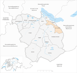
Райхенбах (Reichenbach im Kandertal, Reichenbach im Kandertal)

- община швейцарии в Швейцарии, Берн
 Hiking in Райхенбах
Reichenbach im Kandertal, located in Switzerland, is a beautiful destination for hiking enthusiasts. Situated in the Bernese Oberland, the area boasts stunning landscapes characterized by rolling hills, lush valleys, and impressive mountain views. Here are some key aspects of hiking in Reichenbach im Kandertal:
Hiking Trails
- Various Difficulty Levels: There are trails suitable for all skill levels, from family-friendly walks to challenging mountain hikes.
- Scenic Routes: Many of the trails offer breathtaking views of the Swizz Alps, dense forests, and charming local villages.
- Marked Trails: The trails in the region are generally well-marked, making it easy to navigate.
Popular Hikes
- Kander Gorge (Kandergrund): A stunning hike that takes you through the dramatic Kander Gorge, with its steep cliffs and roaring river.
- Blumenstein Loop: A moderate circular hike offering panoramic views of the Kandertal region.
- Alpine Trails: For adventurous hikers, there are routes leading up to mountain passes, such as the hike to the nearby Schmadribach Falls, which is particularly rewarding in terms of scenery.
Accessibility
- Starting Point: Reichenbach has good public transport connections, making it easy to start your hikes from the village itself or nearby towns.
- Trails for Families: Many trails are accessible for families with children, providing a wonderful way to explore the natural beauty together.
Best Time to Hike
- Summer and Early Autumn: The best time for hiking in this region is generally from late spring to early autumn. The weather is mild and the trails are mostly clear of snow during this period.
Safety and Preparation
- Weather Conditions: Always check the weather forecast before heading out, as mountain weather can be unpredictable.
- Gear: Make sure to wear sturdy hiking boots and bring appropriate gear such as water, snacks, and first-aid supplies.
- Navigation: While trails are marked, carrying a map or a GPS device can be beneficial.
Local Amenities
- After a day of hiking, you can enjoy local cuisine at nearby restaurants or cafes, offering traditional Swiss dishes and refreshments.
Overall, Reichenbach im Kandertal provides a fantastic hiking experience amidst stunning natural beauty, ideal for both relaxation and adventure.
- Страна:

- Почтовый код: 3713
- Телефонный код: 033
- Код автомобильного номера: BE
- Координаты: 46° 34' 31" N, 7° 44' 13" E


- GPS треки (wikiloc): [Ссылка]
- Высота над уровнем моря: 1081 м m
- Площадь: 125.8 кв.км
- Население: 3616
- Веб сайт: http://www.reichenbach.ch
- Википедия русская: wiki(ru)
- Википедия английская: wiki(en)
- Википедия национальная: wiki(de)
- Хранилище Wikidata: Wikidata: Q66378
- Катеория в википедии: [Ссылка]
- код Freebase: [/m/0cg9zm]
- код GeoNames: Альт: [7286872]
- ID отношения в OpenStreetMap: [1682616]
- место в MusicBrainz: [b7cae000-e436-41c7-b887-1404ca57640b]
- идентификатор HDS: [8478]
- код швейцарского муниципалитета: [0567]
Граничит с регионами:


Лаутербруннен
Hiking in Лаутербруннен
Lauterbrunnen is a stunning valley located in the Swiss Alps, known for its dramatic cliffs and impressive waterfalls. It serves as a gateway to the Jungfrau region and offers a variety of hiking opportunities, suitable for different skill levels. Here are some key highlights and tips for hiking in Lauterbrunnen:...
- Страна:
- Почтовый код: 3822
- Телефонный код: 033
- Код автомобильного номера: BE
- Координаты: 46° 33' 6" N, 7° 53' 37" E
- GPS треки (wikiloc): [Ссылка]
- Высота над уровнем моря: 1407 м m
- Площадь: 164.4 кв.км
- Население: 2732
- Веб сайт: [Ссылка]


Виммис
Hiking in Виммис
Wimmis, located in the Bernese Oberland region of Switzerland, is a charming village surrounded by stunning mountain scenery, making it an excellent destination for hiking enthusiasts. Here are some details about hiking in and around Wimmis:...
- Страна:
- Почтовый код: 3752
- Телефонный код: 033
- Код автомобильного номера: BE
- Координаты: 46° 40' 31" N, 7° 38' 15" E
- GPS треки (wikiloc): [Ссылка]
- Высота над уровнем моря: 1039 м m
- Площадь: 22.23 кв.км
- Население: 2446
- Веб сайт: [Ссылка]


Димтиген
Hiking in Димтиген
Diemtigen is a beautiful region in Switzerland, located in the Bernese Oberland, known for its stunning landscapes, lush green valleys, and picturesque alpine scenery. Hiking in Diemtigen offers a range of trails suitable for various skill levels, from leisurely walks to challenging hikes. Here are some key points to consider when hiking in Diemtigen:...
- Страна:
- Почтовый код: 3754
- Телефонный код: 033
- Код автомобильного номера: BE
- Координаты: 46° 38' 58" N, 7° 33' 54" E
- GPS треки (wikiloc): [Ссылка]
- Высота над уровнем моря: 1565 м m
- Площадь: 129.94 кв.км
- Население: 2200
- Веб сайт: [Ссылка]


Фрутиген
Hiking in Фрутиген
Frutigen, located in the Bernese Oberland region of Switzerland, is a fantastic destination for hiking enthusiasts. Nestled between majestic mountains and lush valleys, it offers a variety of trails suitable for all skill levels, from leisurely walks to more challenging hikes. Here are some highlights of hiking in Frutigen:...
- Страна:
- Почтовый код: 3714
- Телефонный код: 033
- Код автомобильного номера: BE
- Координаты: 46° 33' 30" N, 7° 37' 1" E
- GPS треки (wikiloc): [Ссылка]
- Высота над уровнем моря: 918 м m
- Площадь: 71.8 кв.км
- Население: 6917
- Веб сайт: [Ссылка]


Кандерштег
Hiking in Кандерштег
Kandersteg is a picturesque village located in the Bernese Oberland region of Switzerland, surrounded by stunning mountain ranges, lush valleys, and enchanting alpine scenery. It's a fantastic destination for hiking enthusiasts of all levels, offering a variety of trails with breathtaking views....
- Страна:
- Почтовый код: 3718
- Телефонный код: 033
- Код автомобильного номера: BE
- Координаты: 46° 28' 9" N, 7° 42' 30" E
- GPS треки (wikiloc): [Ссылка]
- Высота над уровнем моря: 2662 м m
- Площадь: 134.5 кв.км
- Население: 1301
- Веб сайт: [Ссылка]

Эши-Шпиц
Hiking in Эши-Шпиц
Aeschi bei Spiez is a charming village located in the Bernese Oberland region of Switzerland, offering a range of hiking opportunities with stunning views of the surrounding landscape, including Lake Thun and the majestic Alps. Here are some highlights for hiking in Aeschi bei Spiez:...
- Страна:
- Почтовый код: 3703
- Телефонный код: 033
- Код автомобильного номера: BE
- Координаты: 46° 37' 25" N, 7° 44' 55" E
- GPS треки (wikiloc): [Ссылка]
- Высота над уровнем моря: 1268 м m
- Площадь: 30.9 кв.км
- Население: 2285
- Веб сайт: [Ссылка]