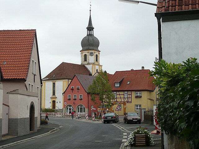
Китцинген (Kitzingen, Landkreis Kitzingen)

 Hiking in Китцинген
Kitzingen district, located in Bavaria, Germany, offers a variety of scenic landscapes suitable for hiking. The region is characterized by vineyards, rolling hills, and charming riverside paths along the Main River. Here are some highlights for hiking in Kitzingen district:
Trail Highlights:
-
Main River Valley Trails: The main draw for hikers is the network of trails that follow the banks of the Main River. These routes often provide picturesque views of vineyards, charming towns, and historical sites.
-
Frankenweg (Franconian Way): This long-distance trail runs through Franconia, including the Kitzingen area. It offers hikers a chance to explore diverse landscapes, from forested areas to open fields and vineyards.
-
Vineyard Paths: A network of paths leads through the numerous vineyards in the region. These trails often provide opportunities for wine tasting and enjoying local specialties.
-
Nature Reserves and Parks: The district has several nature reserves that provide marked hiking trails. These areas often feature a rich variety of flora and fauna, making them excellent spots for nature lovers.
-
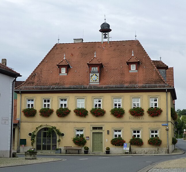
Cultural Hikes: Combine hiking with cultural experiences by exploring the towns of Kitzingen, Ochsenfurt, and other nearby villages. Many trails connect these towns, allowing hikers to enjoy local history and architecture along the way.
Best Season to Hike:
The best time for hiking in Kitzingen is during the spring and autumn months when the weather is mild, and the countryside is particularly beautiful. Summer can also be pleasant, although it can get quite warm.
Tips for Hikers:
- Preparation: Always check the weather forecast before heading out, and dress in layers.
- Hydration: Carry enough water, especially in warmer months, as some trails may not have water sources along the way.
- Footwear: Good hiking shoes are essential, as some trails may be uneven or muddy.
- Safety: While the region is generally safe for hikers, it’s always wise to inform someone about your hiking plans.
Local Amenities:
Kitzingen district has various accommodations, from hotels to guesthouses, making it easy for hikers to find places to stay. Additionally, local restaurants offer traditional Franconian cuisine, providing a perfect way to recharge after a day on the trails.
Whether you’re an experienced hiker or a casual walker, Kitzingen district has plenty to offer for an enjoyable hiking experience.
- Страна:

- Столица: Китцинген
- Код автомобильного номера: KT
- Координаты: 49° 45' 0" N, 10° 15' 36" E


- GPS треки (wikiloc): [Ссылка]
- Высота над уровнем моря: 231 м m
- Площадь: 684.00 кв.км
- Население: 79304
- Веб сайт: http://www.landkreis-kitzingen.de
- Википедия русская: wiki(ru)
- Википедия английская: wiki(en)
- Википедия национальная: wiki(de)
- Хранилище Wikidata: Wikidata: Q10459
- Катеория в википедии: [Ссылка]
- Карты в википедии: [Ссылка]
- код Freebase: [/m/01x2v5]
- код GeoNames: Альт: [3220892]
- код VIAF: Альт: [312821309]
- ID отношения в OpenStreetMap: [62457]
- код GND: Альт: [4030901-0]
- идентификатор местоположения ArchINFORM: [2476]
- код LCNAF: Альт: [n85298185]
- код TGN: [7077079]
- Bavarikon ID: [ODB_A00000356]
- код NUTS: [DE268]
- код BabelNet: [02686601n]
- код района Германии: 09675
Включает регионы:


Визентайд
Hiking in Визентайд
Wiesentheid is a charming village located in Bavaria, Germany, known for its picturesque landscape and quiet rural charm. While it may not be a major hiking destination, it can serve as a lovely base for exploring the surrounding area, which offers various trails and opportunities for outdoor activities....
- Страна:
- Почтовый код: 97353
- Телефонный код: 09383
- Код автомобильного номера: KT
- Координаты: 49° 48' 0" N, 10° 21' 0" E
- GPS треки (wikiloc): [Ссылка]
- Высота над уровнем моря: 249 м m
- Площадь: 33.33 кв.км
- Население: 4840
- Веб сайт: [Ссылка]

Рёдельзее
Hiking in Рёдельзее
Rödelsee is a charming village located in the Franconian region of Bavaria, Germany, known for its vineyards and picturesque landscapes. Hiking in this area is a delightful experience, offering a mix of scenic views, historic landmarks, and natural beauty. Here are some highlights and tips for hiking around Rödelsee:...
- Страна:
- Почтовый код: 97348
- Телефонный код: 09323
- Код автомобильного номера: KT
- Координаты: 49° 44' 0" N, 10° 15' 0" E
- GPS треки (wikiloc): [Ссылка]
- Высота над уровнем моря: 236 м m
- Площадь: 11.49 кв.км
- Население: 1323
- Веб сайт: [Ссылка]


Альбертсхофен
Hiking in Альбертсхофен
Albertshofen is a small village located in the Bavaria region of Germany, surrounded by beautiful landscapes that offer great hiking opportunities. While it may not be as well-known as larger hiking destinations, the area around Albertshofen features charming rural trails and scenic views that can be enjoyed by hikers of various skill levels....
- Страна:
- Почтовый код: 97320
- Телефонный код: 09321
- Код автомобильного номера: KT
- Координаты: 49° 46' 0" N, 10° 10' 0" E
- GPS треки (wikiloc): [Ссылка]
- Высота над уровнем моря: 187 м m
- Площадь: 3.8 кв.км
- Население: 1792
- Веб сайт: [Ссылка]


Китцинген
- община Германии
Hiking in Китцинген
Kitzingen is a charming town located in Bavaria, Germany, nestled along the Main River. While it may not be as widely known for hiking as some other regions in the Bavarian Alps, it offers several attractive hiking opportunities in and around the area....
- Страна:
- Почтовый код: 97318
- Телефонный код: 09321
- Код автомобильного номера: KT
- Координаты: 49° 44' 0" N, 10° 10' 0" E
- GPS треки (wikiloc): [Ссылка]
- Высота над уровнем моря: 205 м m
- Площадь: 46.99 кв.км
- Население: 20474
- Веб сайт: [Ссылка]

Визенбронн
Hiking in Визенбронн
Wiesenbronn is a small village in the Lower Franconia region of Bavaria, Germany. While it may not be widely recognized as a hiking destination, it is surrounded by beautiful countryside and offers various opportunities for outdoor activities, including hiking. Here are some things to keep in mind when hiking in and around Wiesenbronn:...
- Страна:
- Почтовый код: 97355
- Телефонный код: 09325
- Код автомобильного номера: KT
- Координаты: 49° 45' 0" N, 10° 18' 0" E
- GPS треки (wikiloc): [Ссылка]
- Высота над уровнем моря: 262 м m
- Площадь: 10.57 кв.км
- Население: 848
- Веб сайт: [Ссылка]

Кастелль
Hiking in Кастелль
Castell, located in Bavaria, Germany, is known for its beautiful landscapes and rich history, making it a great destination for hiking enthusiasts. Situated near the picturesque Main River and surrounded by rolling hills and vineyards, Castell offers a variety of trails that cater to different levels of hiking experience....
- Страна:
- Почтовый код: 97355
- Телефонный код: 09325
- Код автомобильного номера: KT
- Координаты: 49° 45' 0" N, 10° 20' 0" E
- GPS треки (wikiloc): [Ссылка]
- Высота над уровнем моря: 317 м m
- Площадь: 22.93 кв.км
- Население: 819
- Веб сайт: [Ссылка]


Sommerach
Hiking in Sommerach
Sommerach is a charming village located in the Franconia region of Germany, situated along the Main River in Bavaria. It's known for its picturesque landscapes, vineyards, and historical architecture, making it an excellent destination for hiking enthusiasts....
- Страна:
- Почтовый код: 97334
- Телефонный код: 09381
- Код автомобильного номера: KT
- Координаты: 49° 49' 0" N, 10° 11' 0" E
- GPS треки (wikiloc): [Ссылка]
- Высота над уровнем моря: 202 м m
- Площадь: 5.67 кв.км
- Население: 1163
- Веб сайт: [Ссылка]


Абтсвинд
Hiking in Абтсвинд
Abtswind, a small municipality located in Bavaria, Germany, is surrounded by picturesque landscapes that offer a variety of hiking opportunities. Although it may not be as well-known as larger hiking destinations, the region is characterized by gentle hills, charming woodlands, and scenic countryside, making it suitable for hikers of all levels....
- Страна:
- Почтовый код: 97355
- Телефонный код: 09383
- Код автомобильного номера: KT
- Координаты: 49° 46' 0" N, 10° 22' 0" E
- GPS треки (wikiloc): [Ссылка]
- Высота над уровнем моря: 291 м m
- Площадь: 12.81 кв.км
- Население: 851
- Веб сайт: [Ссылка]


Приксенштадт
Hiking in Приксенштадт
Prichsenstadt, located in the Franconian region of Bavaria, Germany, is a charming town that offers a variety of hiking opportunities amidst beautiful landscapes. Here are some key highlights for hiking in and around Prichsenstadt:...
- Страна:
- Почтовый код: 97357
- Телефонный код: 09383; 09382
- Код автомобильного номера: KT
- Координаты: 49° 49' 0" N, 10° 20' 0" E
- GPS треки (wikiloc): [Ссылка]
- Высота над уровнем моря: 248 м m
- Площадь: 48.87 кв.км
- Население: 2786
- Веб сайт: [Ссылка]


Ипхофен
Hiking in Ипхофен
Iphofen is a charming town located in Bavaria, Germany, known for its scenic landscapes and rich history, making it a lovely destination for hiking enthusiasts. The region features a diverse array of hiking trails suitable for different skill levels, surrounded by beautiful vineyards, rolling hills, and historical sites....
- Страна:
- Почтовый код: 97346
- Телефонный код: 09323
- Код автомобильного номера: KT
- Координаты: 49° 42' 0" N, 10° 16' 0" E
- GPS треки (wikiloc): [Ссылка]
- Высота над уровнем моря: 250 м m
- Площадь: 78.01 кв.км
- Население: 4584
- Веб сайт: [Ссылка]


Марктстефт
Hiking in Марктстефт
Marktsteft is a charming village located in Bavaria, Germany, and while it may not be as well-known as some larger hiking destinations, it offers several opportunities for outdoor enthusiasts. Here are some key points to consider for hiking in and around Marktsteft:...
- Страна:
- Почтовый код: 97342
- Телефонный код: 09332
- Код автомобильного номера: KT
- Координаты: 49° 42' 0" N, 10° 7' 0" E
- GPS треки (wikiloc): [Ссылка]
- Высота над уровнем моря: 189 м m
- Площадь: 10.51 кв.км
- Население: 1623
- Веб сайт: [Ссылка]


Шварцах-на-Майне
Hiking in Шварцах-на-Майне
Schwarzach am Main is a charming town in Bavaria, Germany, and it offers several opportunities for hiking and enjoying the natural beauty of the region. Here are some highlights for hikers in Schwarzach am Main:...
- Страна:
- Почтовый код: 97359
- Телефонный код: 09324
- Код автомобильного номера: KT
- Координаты: 49° 48' 0" N, 10° 14' 0" E
- GPS треки (wikiloc): [Ссылка]
- Высота над уровнем моря: 197 м m
- Площадь: 21.11 кв.км
- Население: 3190
- Веб сайт: [Ссылка]


Бухбрунн
Hiking in Бухбрунн
Buchbrunn is a small village located in Bavaria, Germany, near the city of Würzburg. While it may not be as widely known for hiking as some larger regions, it still offers opportunities for outdoor enthusiasts, particularly those who enjoy rural landscapes and serene walks....
- Страна:
- Почтовый код: 97320
- Телефонный код: 09321
- Код автомобильного номера: KT
- Координаты: 49° 46' 0" N, 10° 8' 0" E
- GPS треки (wikiloc): [Ссылка]
- Высота над уровнем моря: 249 м m
- Площадь: 4.57 кв.км
- Население: 827
- Веб сайт: [Ссылка]


Нордхайм-на-Майне
Hiking in Нордхайм-на-Майне
Nordheim am Main is a charming village located in Bavaria, Germany, known for its picturesque landscapes and the scenic trails that line the Main River. While it may not be the most famous hiking destination, it offers several options for nature lovers and hikers of varying abilities. Here are some key points to consider if you're planning a hike in and around Nordheim am Main:...
- Страна:
- Почтовый код: 97334
- Телефонный код: 09381
- Код автомобильного номера: KT
- Координаты: 49° 51' 33" N, 10° 11' 8" E
- GPS треки (wikiloc): [Ссылка]
- Высота над уровнем моря: 196 м m
- Площадь: 5.30 кв.км
- Население: 993
- Веб сайт: [Ссылка]

Рюденхаузен
Hiking in Рюденхаузен
Rüdenhausen is a charming village in Bavaria, Germany, and while it might not be as widely known as some larger hiking destinations, it offers beautiful landscapes and a peaceful hiking experience. Here are some aspects to consider when hiking in and around Rüdenhausen:...
- Страна:
- Почтовый код: 97355
- Телефонный код: 09383
- Код автомобильного номера: KT
- Координаты: 49° 46' 0" N, 10° 21' 0" E
- GPS треки (wikiloc): [Ссылка]
- Высота над уровнем моря: 264 м m
- Площадь: 6.88 кв.км
- Население: 688
- Веб сайт: [Ссылка]


Вилланцхайм
Hiking in Вилланцхайм
Willanzheim is a small village located in Bavaria, Germany, generally known for its picturesque landscapes and tranquil environment. While it may not be a major hiking destination compared to some larger national parks or mountainous regions, there are still opportunities for enjoyable walks and hikes in the surrounding areas....
- Страна:
- Почтовый код: 97348
- Телефонный код: 09326; 09323
- Код автомобильного номера: KT
- Координаты: 49° 41' 0" N, 10° 14' 0" E
- GPS треки (wikiloc): [Ссылка]
- Высота над уровнем моря: 260 м m
- Площадь: 25.19 кв.км
- Население: 1399
- Веб сайт: [Ссылка]

Мартинсхайм
Hiking in Мартинсхайм
Martinsheim is a charming village located in the Bavaria region of Germany, known for its picturesque landscapes and outdoor opportunities. Hiking in and around Martinsheim offers a blend of natural beauty, scenic views, and cultural experiences. Here are some highlights and tips for hiking in the area:...
- Страна:
- Почтовый код: 97340
- Телефонный код: 09339; 09332
- Код автомобильного номера: KT
- Координаты: 49° 37' 0" N, 10° 9' 0" E
- GPS треки (wikiloc): [Ссылка]
- Высота над уровнем моря: 286 м m
- Площадь: 23.22 кв.км
- Население: 979
- Веб сайт: [Ссылка]


Зегниц
Hiking in Зегниц
Segnitz is a charming village located in the Lower Franconia region of Bavaria, Germany, near the banks of the Main River. The area is known for its picturesque landscapes, vineyards, and a range of hiking opportunities. Here are some key points about hiking in Segnitz and its surroundings:...
- Страна:
- Почтовый код: 97340
- Телефонный код: 09332
- Код автомобильного номера: KT
- Координаты: 49° 40' 0" N, 10° 8' 0" E
- GPS треки (wikiloc): [Ссылка]
- Высота над уровнем моря: 181 м m
- Площадь: 2.72 кв.км
- Население: 877
- Веб сайт: [Ссылка]


Деттельбах
Hiking in Деттельбах
Dettelbach, a charming town in Bavaria, Germany, is surrounded by beautiful landscapes that make it an excellent destination for hiking enthusiasts. The region is known for its scenic vineyards, rolling hills, and scenic routes that provide both leisurely walks and more challenging hikes....
- Страна:
- Почтовый код: 97337; 97335
- Телефонный код: 09324
- Код автомобильного номера: KT
- Координаты: 49° 48' 0" N, 10° 11' 0" E
- GPS треки (wikiloc): [Ссылка]
- Высота над уровнем моря: 200 м m
- Площадь: 60.94 кв.км
- Население: 6968
- Веб сайт: [Ссылка]


Обернбрайт
Hiking in Обернбрайт
Obernbreit is a charming village located in Bavaria, Germany, and it offers a variety of hiking opportunities for outdoor enthusiasts. The region is known for its picturesque landscapes, which include rolling hills, vineyards, and scenic views of the countryside. Here are some aspects to consider when hiking in Obernbreit:...
- Страна:
- Почтовый код: 97342
- Телефонный код: 09332
- Код автомобильного номера: KT
- Координаты: 49° 39' 0" N, 10° 10' 0" E
- GPS треки (wikiloc): [Ссылка]
- Высота над уровнем моря: 202 м m
- Площадь: 9.84 кв.км
- Население: 1484
- Веб сайт: [Ссылка]


Фольках
Hiking in Фольках
Volkach is a charming town located in the Franconia region of Germany, known for its beautiful landscapes, vineyards, and the Main River. Hiking in and around Volkach offers a variety of scenic trails suitable for different skill levels. Here are some highlights and features of hiking in this area:...
- Страна:
- Почтовый код: 97332
- Телефонный код: 09381
- Код автомобильного номера: KT
- Координаты: 49° 52' 0" N, 10° 13' 0" E
- GPS треки (wikiloc): [Ссылка]
- Высота над уровнем моря: 203 м m
- Площадь: 60.19 кв.км
- Население: 8721
- Веб сайт: [Ссылка]


Грослангхайм
Hiking in Грослангхайм
Großlangheim is a charming village located in Bavaria, Germany, surrounded by beautiful landscapes that make it an excellent destination for hiking enthusiasts. While the village itself may be smaller and less known, the surrounding region offers a variety of hiking opportunities....
- Страна:
- Почтовый код: 97320
- Телефонный код: 09325
- Код автомобильного номера: KT
- Координаты: 49° 45' 0" N, 10° 14' 0" E
- GPS треки (wikiloc): [Ссылка]
- Высота над уровнем моря: 224 м m
- Площадь: 14.77 кв.км
- Население: 1293
- Веб сайт: [Ссылка]


Майнбернхайм
Hiking in Майнбернхайм
Mainbernheim is a picturesque town located in Bavaria, Germany, known for its charming landscapes and outdoor activities, including hiking. The region is characterized by its natural beauty, rolling hills, and vineyards, making it a delightful destination for outdoor enthusiasts....
- Страна:
- Почтовый код: 97350
- Телефонный код: 09323
- Код автомобильного номера: KT
- Координаты: 49° 42' 0" N, 10° 13' 0" E
- GPS треки (wikiloc): [Ссылка]
- Высота над уровнем моря: 226 м m
- Площадь: 12.00 кв.км
- Население: 2190
- Веб сайт: [Ссылка]


Маркт-Айнерсхайм
Hiking in Маркт-Айнерсхайм
Markt Einersheim is a charming village located in the Franconian region of Germany, near the scenic Main River. While it may not be a well-known hiking destination, the surrounding areas offer lovely trails and beautiful natural landscapes worth exploring....
- Страна:
- Почтовый код: 97348
- Телефонный код: 09326
- Код автомобильного номера: KT
- Координаты: 49° 41' 0" N, 10° 18' 0" E
- GPS треки (wikiloc): [Ссылка]
- Высота над уровнем моря: 290 м m
- Площадь: 7.74 кв.км
- Население: 1114
- Веб сайт: [Ссылка]


Зайнсхайм
Hiking in Зайнсхайм
Seinsheim is a small village located in the Lower Franconia region of Bavaria, Germany. While it may not be as well-known for hiking as some larger areas, it is surrounded by beautiful landscapes that are ideal for outdoor enthusiasts....
- Страна:
- Почтовый код: 97342
- Телефонный код: 09332
- Код автомобильного номера: KT
- Координаты: 49° 37' 0" N, 10° 13' 0" E
- GPS треки (wikiloc): [Ссылка]
- Высота над уровнем моря: 252 м m
- Площадь: 17.52 кв.км
- Население: 1049
- Веб сайт: [Ссылка]


Клайнлангхайм
Hiking in Клайнлангхайм
Kleinlangheim is a small village located in Bavaria, Germany, known for its picturesque scenery and proximity to natural landscapes. Hiking in this region offers a unique opportunity to explore beautiful vineyards, rolling hills, and tranquil countryside....
- Страна:
- Почтовый код: 97355
- Телефонный код: 09325
- Код автомобильного номера: KT
- Координаты: 49° 46' 0" N, 10° 16' 0" E
- GPS треки (wikiloc): [Ссылка]
- Высота над уровнем моря: 224 м m
- Площадь: 19.09 кв.км
- Население: 1447
- Веб сайт: [Ссылка]


Майнстокхайм
Hiking in Майнстокхайм
Mainstockheim, located in the Franconia region of Bavaria, Germany, offers a pleasant environment for hiking enthusiasts. While it may not be as famous as some larger hiking destinations in Germany, its scenic landscapes and pleasant trails make it an attractive option for outdoor activities....
- Страна:
- Почтовый код: 97320
- Телефонный код: 09321
- Код автомобильного номера: KT
- Координаты: 49° 46' 0" N, 10° 10' 0" E
- GPS треки (wikiloc): [Ссылка]
- Высота над уровнем моря: 207 м m
- Площадь: 8.52 кв.км
- Население: 1630
- Веб сайт: [Ссылка]


Зульцфельд-на-Майне
Hiking in Зульцфельд-на-Майне
Sulzfeld am Main is a picturesque village located in Bavaria, Germany, nestled along the banks of the Main River. It’s a great spot for hikers and nature enthusiasts, offering a mix of scenic views, historical sites, and a variety of trails suitable for different skill levels. Here are some key highlights for hiking in and around Sulzfeld am Main:...
- Страна:
- Почтовый код: 97320
- Телефонный код: 09321
- Код автомобильного номера: KT
- Координаты: 49° 42' 0" N, 10° 7' 0" E
- GPS треки (wikiloc): [Ссылка]
- Высота над уровнем моря: 202 м m
- Площадь: 7.68 кв.км
- Население: 1240
- Веб сайт: [Ссылка]


Бибельрид
Hiking in Бибельрид
Biebelried is a small community located in Bavaria, Germany. While it may not be as widely recognized for hiking as some other regions, it offers access to beautiful landscapes and scenic trails typical of the Bavarian countryside. Here are some aspects you might consider if you plan to hike in and around Biebelried:...
- Страна:
- Почтовый код: 97318
- Телефонный код: 09302
- Код автомобильного номера: KT
- Координаты: 49° 46' 0" N, 10° 5' 0" E
- GPS треки (wikiloc): [Ссылка]
- Высота над уровнем моря: 277 м m
- Площадь: 22.70 кв.км
- Население: 1040
- Веб сайт: [Ссылка]


Гайзельвинд
Hiking in Гайзельвинд
Geiselwind, located in Bavaria, Germany, offers a range of hiking opportunities that showcase the scenic beauty of the region. Nestled in the heart of Franconia, the area features rolling hills, lush forests, and picturesque landscapes that can be explored through various hiking trails. Here are some highlights for hiking in Geiselwind:...
- Страна:
- Почтовый код: 96160
- Телефонный код: 09556; 09555
- Код автомобильного номера: KT
- Координаты: 49° 46' 0" N, 10° 28' 0" E
- GPS треки (wikiloc): [Ссылка]
- Высота над уровнем моря: 349 м m
- Площадь: 48.77 кв.км
- Население: 2016
- Веб сайт: [Ссылка]

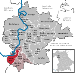
Марктбрайт
- община Германии
Hiking in Марктбрайт
Marktbreit is a charming town located on the banks of the Main River in Bavaria, Germany. It is known for its picturesque old town, historical buildings, and beautiful natural surroundings, making it an appealing destination for hiking enthusiasts. Here are some highlights and tips for hiking in and around Marktbreit:...
- Страна:
- Почтовый код: 97340
- Телефонный код: 09332
- Код автомобильного номера: KT
- Координаты: 49° 39' 0" N, 10° 10' 0" E
- GPS треки (wikiloc): [Ссылка]
- Высота над уровнем моря: 191 м m
- Площадь: 20.15 кв.км
- Население: 3669
- Веб сайт: [Ссылка]
Граничит с регионами:
Бамберг
Hiking in Бамберг
Bamberg district, located in Bavaria, Germany, offers a variety of scenic hiking opportunities amidst its charming landscapes, historical sites, and cultural attractions. Here’s an overview of what you can expect when hiking in the region:...
- Страна:
- Столица: Бамберг
- Код автомобильного номера: BA
- Координаты: 49° 49' 48" N, 10° 49' 48" E
- GPS треки (wikiloc): [Ссылка]
- Высота над уровнем моря: 275 м m
- Площадь: 1168.00 кв.км
- Население: 119829
- Веб сайт: [Ссылка]
Нойштадт-ан-дер-Айш-Бад-Виндсхайм
- район в Баварии, Германия
Hiking in Нойштадт-ан-дер-Айш-Бад-Виндсхайм
Neustadt (Aisch)-Bad Windsheim, located in the Franconian region of Bavaria, Germany, offers a variety of scenic hiking opportunities for outdoor enthusiasts. The area is characterized by its picturesque landscapes, charming villages, and the rich cultural heritage of Franconia. Here are some highlights of hiking in this region:...
- Страна:
- Столица: Нойштадт-ан-дер-Айш
- Код автомобильного номера: UFF; SEF; NEA
- Координаты: 49° 34' 48" N, 10° 30' 0" E
- GPS треки (wikiloc): [Ссылка]
- Высота над уровнем моря: 384 м m
- Площадь: 1267.54 кв.км
- Население: 85686
- Веб сайт: [Ссылка]

Вюрцбург
Hiking in Вюрцбург
Würzburg, located in the Lower Franconia region of Bavaria, Germany, is surrounded by beautiful landscapes, making it a great starting point for hiking adventures. Here are some highlights and considerations for hiking in and around the Würzburg district:...
- Страна:
- Столица: Вюрцбург
- Код автомобильного номера: OCH; WÜ
- Координаты: 49° 39' 36" N, 10° 0' 0" E
- GPS треки (wikiloc): [Ссылка]
- Высота над уровнем моря: 346 м m
- Площадь: 967.56 кв.км
- Население: 161340
- Веб сайт: [Ссылка]

Швайнфурт
Hiking in Швайнфурт
Schweinfurt, located in the northern part of Bavaria, Germany, offers a variety of hiking opportunities that showcase the beautiful landscapes of the region. The area is characterized by rolling hills, forests, and scenic valleys, making it ideal for both leisurely strolls and more challenging hikes....
- Страна:
- Столица: Швайнфурт
- Код автомобильного номера: GEO; SW
- Координаты: 50° 1' 12" N, 10° 15' 36" E
- GPS треки (wikiloc): [Ссылка]
- Высота над уровнем моря: 222 м m
- Площадь: 842.00 кв.км
- Население: 103697
- Веб сайт: [Ссылка]