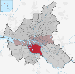
Малый Грасброк (Kleiner Grasbrook, Kleiner Grasbrook)

- квартал Гамбурга, Германия
 Hiking in Малый Грасброк
Kleiner Grasbrook is a small island located in the harbor area of Hamburg, Germany. While it may not be a traditional hiking destination like national parks or mountain regions, it does offer opportunities for walking and enjoying the waterfront scenery. Here are a few highlights about the area:
-
Urban Walking Trails: The island is part of a developed urban area, so walking paths offer a chance to explore the waterfront, parks, and the view of the harbor. You can enjoy a leisurely stroll along the Elbe River, which provides delightful views of the water and the city.
-
Recreational Areas: The surrounding areas often have parks and green spaces where you can relax, have a picnic, or take a break between walking. Nearby, you may find areas like the Grasbrook Park, which can enhance your urban hiking experience.
-
Cultural Points: As you walk around Kleiner Grasbrook, you can explore the local architecture and cultural sites. The area reflects Hamburg's rich history and development as a port city.
-
Accessibility: The island is easily accessible from various parts of Hamburg via public transportation. This makes it convenient for a short hike or walk while visiting the city.
-
Combine with Other Activities: If you're in the city, consider combining your urban walk with other activities, such as visiting nearby museums, enjoying a meal at local restaurants, or taking a harbor tour.
While Kleiner Grasbrook may not offer the rugged trails found in more remote hiking areas, it provides a lovely urban environment for walkers and those looking to enjoy some fresh air and scenery in Hamburg. Always make sure to check local maps and guides for the best walking routes and safety tips.
- Страна:

- Координаты: 53° 31' 52" N, 9° 59' 37" E


- GPS треки (wikiloc): [Ссылка]
- Высота над уровнем моря: 6 м m
- Площадь: 4.5 кв.км
- Население: 1218
- Википедия английская: wiki(en)
- Википедия национальная: wiki(de)
- Хранилище Wikidata: Wikidata: Q1573
- Галерея изображений в википедии: [Ссылка]
- Катеория в википедии: [Ссылка]
- Карты в википедии: [Ссылка]
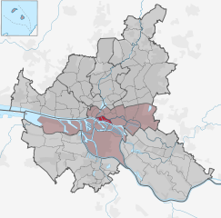
Граничит с регионами:

Вильгельмсбург
- район в Гамбурге, Германия
Hiking in Вильгельмсбург
Wilhelmsburg, a district in Hamburg, Germany, is known for its unique blend of nature and urban life. While it may not be a traditional hiking destination like the Alps or national parks, there are still several opportunities for outdoor adventures and exploring scenic routes....
- Страна:
- Координаты: 53° 29' 42" N, 10° 0' 40" E
- GPS треки (wikiloc): [Ссылка]
- Высота над уровнем моря: -2 м m
- Площадь: 35.3 кв.км

Хафен-Сити
- квартал в Гамбурге, Германия
Hiking in Хафен-Сити
HafenCity is primarily known as a modern urban development project in Hamburg, Germany, rather than a traditional hiking destination. This area features a mix of residential, commercial, and recreational spaces along the waterfront. While it may not offer typical hiking trails like those found in natural parks or mountainous regions, there are still plenty of opportunities for walking and exploring....
- Страна:
- Телефонный код: 040
- Координаты: 53° 32' 30" N, 9° 59' 36" E
- GPS треки (wikiloc): [Ссылка]
- Высота над уровнем моря: 8 м m
- Площадь: 2.4 кв.км

Штайнвердер
- квартал Гамбурга, Германия
Hiking in Штайнвердер
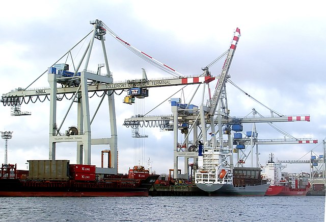
Steinwerder is a district in Hamburg, Germany, located on the south banks of the River Elbe. While it may not be a traditional hiking destination with extensive trails, it does offer some opportunities for outdoor activities, particularly along the waterfront and in nearby parks....
- Страна:
- Координаты: 53° 32' 4" N, 9° 57' 26" E
- GPS треки (wikiloc): [Ссылка]
- Высота над уровнем моря: 2 м m
- Площадь: 10.4 кв.км
- Население: 38


Веддель
- район Гамбурга, Германия
Hiking in Веддель
Veddel is a district in Hamburg, Germany, primarily known for its urban environment, so it may not be a traditional hiking destination. However, there are opportunities for pleasant walks and explorations in and around the area. Here are some suggestions for enjoying outdoor activities near Veddel:...
- Страна:
- Координаты: 53° 31' 0" N, 10° 2' 0" E
- GPS треки (wikiloc): [Ссылка]
- Высота над уровнем моря: 25 м m
- Площадь: 4.4 кв.км
- Население: 4632
- Веб сайт: [Ссылка]