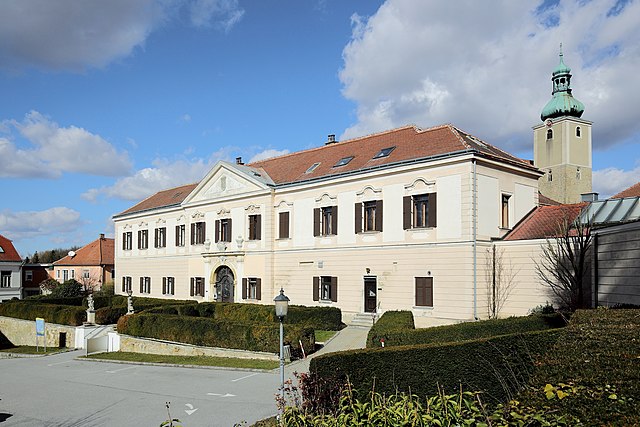
Кройталь (Kreuttal, Kreuttal)
 Hiking in Кройталь
Kreuttal is a picturesque valley located in Austria, known for its stunning landscapes, diverse flora and fauna, and well-marked hiking trails. If you're considering a hiking trip in Kreuttal, here are some key points to keep in mind:
Trail Options
-
Beginner Trails: There are several easy trails suitable for beginners or families, often with gentle slopes and beautiful views of the surrounding mountains and meadows.
-
Intermediate Trails: For those with some hiking experience, there are moderate trails that offer a bit more challenge, possibly including steeper sections or varying terrain. These trails often lead to breathtaking viewpoints or natural landmarks.
-
Advanced Trails: Seasoned hikers can tackle advanced trails that may involve rugged paths, steeper ascents, and longer distances. These hikes often reward adventurers with panoramic views and unique geological formations.
Scenic Highlights
- Flora and Fauna: The valley is home to a variety of plant species and wildlife. Keep an eye out for native flowers in the spring and summer, as well as opportunities to spot local wildlife.
- Waterfalls and Streams: Many trails wind alongside creeks and rivers, where you can enjoy the sound of flowing water and the sight of cascading waterfalls.
- Cultural Landmarks: Depending on the specific area you hike, you might encounter historical sites, charming villages, and local cultural spots along the way.
Preparation Tips
- Weather: Always check the local weather conditions before heading out, as mountain weather can change rapidly.
- Gear and Supplies: Wear sturdy hiking boots, dress in layers, and carry sufficient water and snacks. A map or GPS device is also essential to navigate the trails effectively.
- Safety: Always tell someone your planned route and expected return time. Be aware of your surroundings and any potential wildlife encounters.
Best Time to Hike
The best hiking season in Kreuttal typically falls between late spring and early fall (May to September), when the weather is generally mild and the trails are clear of snow. However, autumn offers stunning foliage, and winter hiking can provide a unique and serene experience if you're prepared for colder conditions.
Local Amenities
Check out local visitor centers or tourist information points for maps, trail advice, and guided hiking options if you prefer a local expert to accompany you.
Remember to respect nature while hiking, sticking to designated trails, and following Leave No Trace principles. Enjoy your hiking adventure in Kreuttal!
- Страна:

- Почтовый код: 2123
- Телефонный код: 02245
- Код автомобильного номера: MI
- Координаты: 48° 26' 0" N, 16° 29' 0" E


- GPS треки (wikiloc): [Ссылка]
- Высота над уровнем моря: 207 м m
- Площадь: 21.51 кв.км
- Население: 1429
- Веб сайт: http://www.kreuttal.at/
- Википедия русская: wiki(ru)
- Википедия английская: wiki(en)
- Википедия национальная: wiki(de)
- Хранилище Wikidata: Wikidata: Q608588
- Катеория в википедии: [Ссылка]
- код Freebase: [/m/02qyhfd]
- код GeoNames: Альт: [7872963]
- код VIAF: Альт: [243211663]
- идентификатор местоположения ArchINFORM: [10088]
- код австрийского муниципалитета: [31627]
Граничит с регионами:

Кройцштеттен
Hiking in Кройцштеттен
Kreuzstetten, located in Austria, offers a variety of scenic hiking opportunities for outdoor enthusiasts. While the area itself may not be as widely known as some of the alpine regions, it is surrounded by beautiful landscapes that provide a peaceful environment for hiking....
- Страна:
- Почтовый код: 2124
- Телефонный код: 02263
- Код автомобильного номера: MI
- Координаты: 48° 28' 0" N, 16° 28' 0" E
- GPS треки (wikiloc): [Ссылка]
- Высота над уровнем моря: 224 м m
- Площадь: 24.33 кв.км
- Население: 1541
- Веб сайт: [Ссылка]

Ульрикскирхен-Шлайнбах
Hiking in Ульрикскирхен-Шлайнбах
Ulrichskirchen-Schleinbach, located in Austria, is a charming area characterized by rolling hills, lush landscapes, and scenic views. While it might not be the most famous hiking destination, it offers several opportunities for hiking enthusiasts to explore the natural beauty of the region....
- Страна:
- Почтовый код: 2122
- Телефонный код: 02245
- Код автомобильного номера: MI
- Координаты: 48° 24' 3" N, 16° 29' 28" E
- GPS треки (wikiloc): [Ссылка]
- Высота над уровнем моря: 192 м m
- Площадь: 26.52 кв.км
- Население: 2630
- Веб сайт: [Ссылка]

Хохлайтен
Hiking in Хохлайтен
Hochleithen is a picturesque area that offers various hiking opportunities, nestled in the scenic landscapes of Austria. Here’s a brief overview for anyone considering a hiking trip in Hochleithen:...
- Страна:
- Почтовый код: 2123
- Телефонный код: 02245
- Код автомобильного номера: MI
- Координаты: 48° 27' 0" N, 16° 31' 0" E
- GPS треки (wikiloc): [Ссылка]
- Высота над уровнем моря: 226 м m
- Площадь: 19.91 кв.км
- Население: 1166
- Веб сайт: [Ссылка]
Гросрусбах
Hiking in Гросрусбах
Großrußbach, a charming village in Lower Austria, is an excellent destination for hiking enthusiasts. Nestled in the picturesque landscapes of the Weinviertel region, it offers a mix of scenic trails, lovely vineyards, and an abundance of natural beauty....
- Страна:
- Почтовый код: 2114
- Телефонный код: 02263
- Код автомобильного номера: KO
- Координаты: 48° 28' 22" N, 16° 24' 55" E
- GPS треки (wikiloc): [Ссылка]
- Высота над уровнем моря: 291 м m
- Площадь: 32.74 кв.км
- Население: 2194
- Веб сайт: [Ссылка]

Хармансдорф
Hiking in Хармансдорф
Harmannsdorf is a quaint village in Austria, located close to the larger city of Vienna. The surrounding areas offer a variety of hiking opportunities that cater to different skill levels, from leisurely walks to more challenging hikes....
- Страна:
- Почтовый код: 2111
- Телефонный код: 02264
- Код автомобильного номера: KO
- Координаты: 48° 23' 30" N, 16° 22' 16" E
- GPS треки (wikiloc): [Ссылка]
- Высота над уровнем моря: 180 м m
- Площадь: 55.54 кв.км
- Население: 3951
- Веб сайт: [Ссылка]