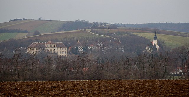
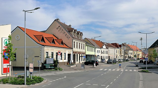
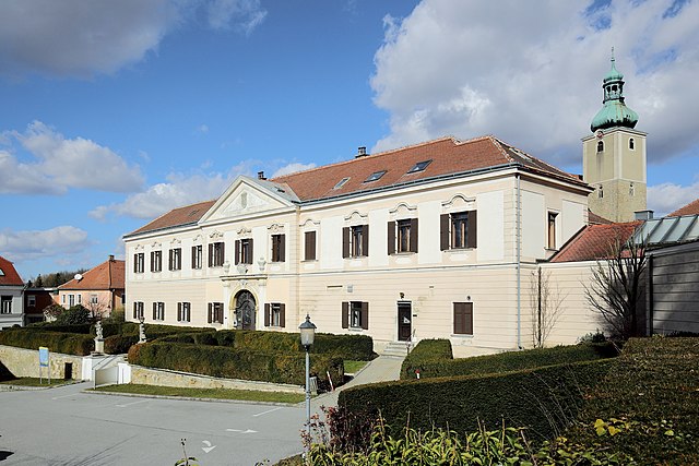
Кройцштеттен (Kreuzstetten, Kreuzstetten)
 Hiking in Кройцштеттен
Kreuzstetten, located in Austria, offers a variety of scenic hiking opportunities for outdoor enthusiasts. While the area itself may not be as widely known as some of the alpine regions, it is surrounded by beautiful landscapes that provide a peaceful environment for hiking.
Hiking Trails
-
Scenic Routes: The trails around Kreuzstetten often wind through picturesque countryside, vineyards, and fields. This is a great opportunity to enjoy the local flora and fauna, especially during spring and summer.
-
Difficulty Levels: The hiking trails in this region typically range from easy to moderate in difficulty, making them suitable for families and casual hikers.
-
Nature Reserves and Parks: Nearby natural reserves may offer additional trails and unique ecosystems to explore. Always check local maps or guidebooks for detailed information.
Tips for Hiking in Kreuzstetten
- Weather Preparations: Check the weather forecast before heading out, as conditions can change. Dress in layers and bring rain gear if necessary.
- Trail Maps: Obtain a map of the hiking trails to help you navigate the area. Local tourist information centers can provide resources.
- Stay Hydrated: Bring enough water, especially on warmer days, to keep yourself hydrated.
- Footwear: Wear comfortable and sturdy hiking boots for better support on uneven terrain.
Nearby Attractions
- Vineyards: Consider pairing your hiking trip with a visit to local vineyards; some may offer tours or tastings, enhancing your experience of the region.
- Cultural Sites: Look for opportunities to explore local history or cultural landmarks after your hike.
Before heading out, I recommend checking local hiking groups or resources for any guided hikes or events in the area, as they can enhance your experience and provide insights into the local environment. Enjoy your hiking adventure in Kreuzstetten!
- Страна:

- Почтовый код: 2124
- Телефонный код: 02263
- Код автомобильного номера: MI
- Координаты: 48° 28' 0" N, 16° 28' 0" E


- GPS треки (wikiloc): [Ссылка]
- Высота над уровнем моря: 224 м m
- Площадь: 24.33 кв.км
- Население: 1541
- Веб сайт: http://www.kreuzstetten.at/
- Википедия русская: wiki(ru)
- Википедия английская: wiki(en)
- Википедия национальная: wiki(de)
- Хранилище Wikidata: Wikidata: Q665417
- Катеория в википедии: [Ссылка]
- код Freebase: [/m/02qyhh3]
- код GeoNames: Альт: [7872964]
- код VIAF: Альт: [247827125]
- идентификатор местоположения ArchINFORM: [15893]
- код австрийского муниципалитета: [31628]
- код Цифрового атласа Римской империи: [42806]
Граничит с регионами:

Кройталь
Hiking in Кройталь
Kreuttal is a picturesque valley located in Austria, known for its stunning landscapes, diverse flora and fauna, and well-marked hiking trails. If you're considering a hiking trip in Kreuttal, here are some key points to keep in mind:...
- Страна:
- Почтовый код: 2123
- Телефонный код: 02245
- Код автомобильного номера: MI
- Координаты: 48° 26' 0" N, 16° 29' 0" E
- GPS треки (wikiloc): [Ссылка]
- Высота над уровнем моря: 207 м m
- Площадь: 21.51 кв.км
- Население: 1429
- Веб сайт: [Ссылка]
Ладендорф
Hiking in Ладендорф
Ladendorf, a charming village in Austria, offers a picturesque setting for hiking enthusiasts. Its location in the Lower Austria region provides access to beautiful landscapes, including rolling hills, vineyards, and forested areas....
- Страна:
- Почтовый код: 2126
- Телефонный код: 02575
- Код автомобильного номера: MI
- Координаты: 48° 32' 0" N, 16° 29' 0" E
- GPS треки (wikiloc): [Ссылка]
- Высота над уровнем моря: 228 м m
- Площадь: 50.05 кв.км
- Население: 2298
- Веб сайт: [Ссылка]

Хохлайтен
Hiking in Хохлайтен
Hochleithen is a picturesque area that offers various hiking opportunities, nestled in the scenic landscapes of Austria. Here’s a brief overview for anyone considering a hiking trip in Hochleithen:...
- Страна:
- Почтовый код: 2123
- Телефонный код: 02245
- Код автомобильного номера: MI
- Координаты: 48° 27' 0" N, 16° 31' 0" E
- GPS треки (wikiloc): [Ссылка]
- Высота над уровнем моря: 226 м m
- Площадь: 19.91 кв.км
- Население: 1166
- Веб сайт: [Ссылка]
Гавайнсталь
Hiking in Гавайнсталь
Gaweinstal is a small village located in the Lower Austria region of Austria, known for its beautiful landscapes and proximity to the natural beauty of the country. While not a major hiking destination like some larger national parks or mountainous areas, Gaweinstal offers several opportunities for outdoor enthusiasts to explore the surrounding countryside. Here’s what you can expect when hiking in this area:...
- Страна:
- Почтовый код: 2191
- Телефонный код: 02574
- Код автомобильного номера: MI
- Координаты: 48° 28' 41" N, 16° 35' 21" E
- GPS треки (wikiloc): [Ссылка]
- Высота над уровнем моря: 199 м m
- Площадь: 51.71 кв.км
- Население: 3947
- Веб сайт: [Ссылка]
Гросрусбах
Hiking in Гросрусбах
Großrußbach, a charming village in Lower Austria, is an excellent destination for hiking enthusiasts. Nestled in the picturesque landscapes of the Weinviertel region, it offers a mix of scenic trails, lovely vineyards, and an abundance of natural beauty....
- Страна:
- Почтовый код: 2114
- Телефонный код: 02263
- Код автомобильного номера: KO
- Координаты: 48° 28' 22" N, 16° 24' 55" E
- GPS треки (wikiloc): [Ссылка]
- Высота над уровнем моря: 291 м m
- Площадь: 32.74 кв.км
- Население: 2194
- Веб сайт: [Ссылка]