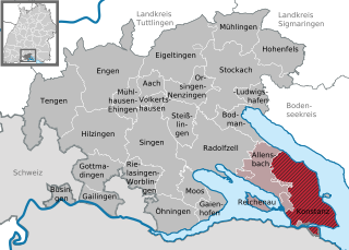
Кройцлинген (Kreuzlingen, Kreuzlingen)

 Hiking in Кройцлинген
Kreuzlingen is a quaint town located on the shores of Lake Constance in Switzerland, near the borders of Germany. It's a great starting point for various hiking adventures, as it boasts beautiful landscapes, lakeside paths, and access to regional trails.
Hiking Options in Kreuzlingen:
-
Lakeside Promenade:
- A flat, easy hike along the shores of Lake Constance. The promenade connects Kreuzlingen with the nearby town of Konstanz in Germany. You can enjoy stunning views of the lake, numerous parks, and public art installations.
-
Reichenau Island:
- A short distance from Kreuzlingen, this UNESCO World Heritage site can be reached by a pleasant hike or bike ride. The island offers scenic views, vineyards, and a chance to explore historical sites along the way.
-
Kreuzlinger Stadtwald (Kreuzlingen City Forest):
- This area offers several shaded trails through a lovely forest, making it an ideal spot for nature walks and picnics. The environment here is peaceful and filled with various flora and fauna.
-
The Swiss National Park (Nearby):
- Though not right in Kreuzlingen, this national park is accessible if you're willing to drive a bit. It features breathtaking alpine scenery, and there are numerous trails for all skill levels.
-
The Rhine Falls:
- A bit further afield but worth the trip, the Rhine Falls is the largest waterfall in Europe. There are several hiking trails in the surrounding area that provide excellent views of the falls and the river.
Tips for Hiking in Kreuzlingen:
- Weather: Check the local weather before heading out, as conditions can change rapidly especially near the lake.
- Footwear: Wear appropriate hiking shoes, especially if you're planning on venturing into forested or uneven terrain.
- Hydration: Carry enough water, as some trails may not have access to facilities.
- Maps and Guides: Keep a hiking map handy or download GPS applications, as some trails may not be well-marked.
- Wildlife: Be mindful of wildlife and respect the natural environment.
Kreuzlingen offers not only great hiking opportunities but also a chance to enjoy the charming Swiss-German cultural blend. Happy hiking!
- Страна:

- Почтовый код: 8280
- Телефонный код: 071
- Код автомобильного номера: TG
- Координаты: 47° 38' 45" N, 9° 10' 42" E


- GPS треки (wikiloc): [Ссылка]
- Высота над уровнем моря: 397 м m
- Площадь: 11.49 кв.км
- Население: 21801
- Веб сайт: http://www.kreuzlingen.ch
- Википедия русская: wiki(ru)
- Википедия английская: wiki(en)
- Википедия национальная: wiki(de)
- Хранилище Wikidata: Wikidata: Q63905
- Галерея изображений в википедии: [Ссылка]
- Катеория в википедии: [Ссылка]
- Карты в википедии: [Ссылка]
- код Freebase: [/m/03zqb7]
- код GeoNames: Альт: [7286222]
- код BNF: [137706702]
- код VIAF: Альт: [146643813]
- ID отношения в OpenStreetMap: [1684537]
- код GND: Альт: [4097071-1]
- идентификатор местоположения ArchINFORM: [1647]
- место в MusicBrainz: [b010fd00-7c1d-4523-b252-b7bda7e3475d]
- идентификатор HDS: [1932]
- код швейцарского муниципалитета: [4671]
Граничит с регионами:

Констанц
- город в земле Баден-Вюртемберг, Германия
Hiking in Констанц
Konstanz, located on the shores of Lake Constance (Bodensee) in Germany, is a beautiful city that offers various hiking opportunities in the surrounding areas. The region is known for its stunning landscapes, including lakes, hills, and forests. Here are some highlights and tips for hiking around Konstanz:...
- Страна:

- Почтовый код: 78462–78467
- Телефонный код: 7531; 7533
- Код автомобильного номера: KN
- Координаты: 47° 39' 48" N, 9° 10' 31" E
- GPS треки (wikiloc): [Ссылка]
- Высота над уровнем моря: 402 м m
- Площадь: 54.11 кв.км
- Население: 81692
- Веб сайт: [Ссылка]


Кемменталь
Hiking in Кемменталь
Kemmental, located in the canton of Thurgau in Switzerland, offers a beautiful setting for hiking enthusiasts. The region is characterized by rolling hills, lush landscapes, and picturesque villages, making it ideal for both leisurely walks and more challenging hikes....
- Страна:
- Почтовый код: 8573
- Телефонный код: 071
- Код автомобильного номера: TG
- Координаты: 47° 36' 59" N, 9° 9' 59" E
- GPS треки (wikiloc): [Ссылка]
- Высота над уровнем моря: 548 м m
- Площадь: 28.4 кв.км
- Население: 2494
- Веб сайт: [Ссылка]