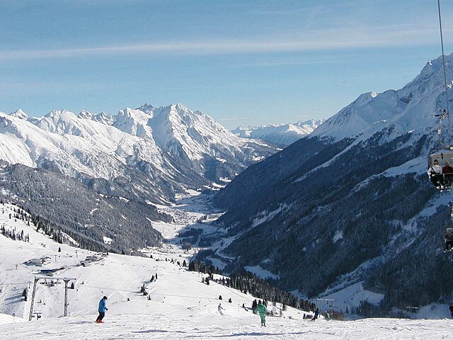
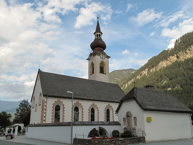
Ландек (Landeck District, Bezirk Landeck)
 Hiking in Ландек
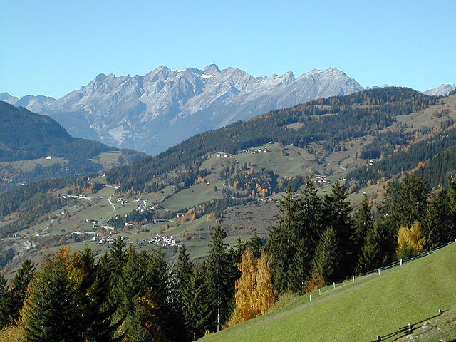
Landeck District, situated in the Tyrol region of Austria, offers a wealth of hiking opportunities, characterized by its stunning landscapes, diverse terrain, and rich natural beauty. Here’s an overview of what you can expect when hiking in this region:
- Zugspitze and Ötztal Alps: The district is a gateway to the Ötztal Alps, home to some iconic peaks. Trails range from easy walks to challenging hikes, providing options for all skill levels.
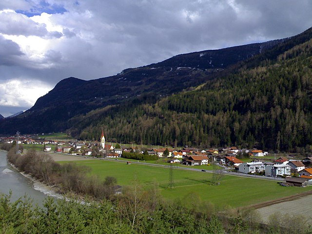
- Inn Valley: The Inn River runs through the district, and there are numerous trails along the riverbank that are ideal for leisurely walks or cycling.
- Nature Reserves: The nearby nature reserves offer a chance to explore untouched wilderness and observe local wildlife. Trails in these areas often emphasize ecological education.
- Family-Friendly Hikes: There are several manageable trails suitable for families and beginners, often featuring rest areas and picnic spots.
- Challenging Hikes: More experienced hikers can find routes that include steep ascents, rocky paths, and breathtaking vantage points over the valleys.
- Themed Trails: Look for trails that focus on specific themes, such as geology, flora, and local culture, enriching the hiking experience with educational elements.
- Summer: The best time for hiking, with fully accessible trails and blooming wildflowers. However, it's important to check local conditions, especially at higher elevations.
- Autumn: Fall colors provide a stunning backdrop, making it a picturesque time for hiking. Weather can be variable, so be prepared for changing conditions.
- Winter: While traditional hiking may be limited, there are opportunities for snowshoeing and winter trekking in the region's valleys and lower elevations.
- Maps and Signage: Most trails are well-marked with clear signage, but having a map or hiking app can help with navigation.
- Weather Conditions: Always check the weather forecast before your hike, as conditions can change rapidly in mountainous areas.
- Gear: Proper footwear and clothing are essential. Layers are recommended to accommodate temperature changes as you gain altitude.
- Hydration and Nutrition: Carry enough water and snacks to maintain your energy throughout your hike.
- Accommodations: There are various lodging options, from hotels to mountain huts, which can provide a cozy retreat after a day of hiking.
- Guided Tours: If you're new to the area or want a more in-depth experience, consider joining a guided hiking tour to benefit from local knowledge.
Landeck is accessible by public transport and car, making it easy to reach various trailheads. Local transportation options may also include shuttles to popular hiking locations.
Whether you are an experienced hiker or a beginner, the Landeck District offers an array of trails and natural beauty that can make for an unforgettable outdoor adventure.
- Страна:

- Столица: Ландек
- Код автомобильного номера: LA
- Координаты: 47° 6' 0" N, 10° 30' 0" E


- GPS треки (wikiloc): [Ссылка]
- Высота над уровнем моря: 1091 м m
- Площадь: 1594.81 кв.км
- Население: 44189
- Веб сайт: http://www.tirol.gv.at/bh-landeck
- Википедия русская: wiki(ru)
- Википедия английская: wiki(en)
- Википедия национальная: wiki(de)
- Хранилище Wikidata: Wikidata: Q665605
- Катеория в википедии: [Ссылка]
- Карты в википедии: [Ссылка]
- код Freebase: [/m/06sh5h]
- код GeoNames: Альт: [2773069]
- код VIAF: Альт: [239912928]
- код GND: Альт: [4098985-9]
- идентификатор местоположения ArchINFORM: [14619]
Включает регионы:

Цамс
Hiking in Цамс
Zams, located in the Tyrol region of Austria, is a picturesque area known for its stunning alpine scenery and outdoor activities, particularly hiking. Here's what you need to know about hiking in Zams:...
- Страна:
- Почтовый код: 6511
- Телефонный код: 05442
- Код автомобильного номера: LA
- Координаты: 47° 9' 28" N, 10° 35' 22" E
- GPS треки (wikiloc): [Ссылка]
- Высота над уровнем моря: 767 м m
- Площадь: 124.97 кв.км
- Население: 3409
- Веб сайт: [Ссылка]

Пруц
Hiking in Пруц
Prutz is a charming village located in the Tyrol region of Austria, and it serves as a great base for hiking enthusiasts. The stunning natural landscape surrounding Prutz features breathtaking mountain views, lush forests, and crystalline rivers, making it an attractive destination for those who love outdoor activities....
- Страна:
- Почтовый код: 6522
- Телефонный код: 05472
- Код автомобильного номера: LA
- Координаты: 47° 4' 35" N, 10° 39' 49" E
- GPS треки (wikiloc): [Ссылка]
- Высота над уровнем моря: 864 м m
- Площадь: 9.74 кв.км
- Население: 1825
- Веб сайт: [Ссылка]

Штанц-Ландек
Hiking in Штанц-Ландек
Stanz bei Landeck is a beautiful region in Tyrol, Austria, known for its stunning mountain landscapes and hiking opportunities. Located near the town of Landeck, it provides access to a variety of trails suitable for different skill levels, making it an attractive destination for hikers....
- Страна:
- Почтовый код: 6500
- Телефонный код: 05442
- Код автомобильного номера: LA
- Координаты: 47° 8' 55" N, 10° 33' 12" E
- GPS треки (wikiloc): [Ссылка]
- Высота над уровнем моря: 1040 м m
- Площадь: 7.3 кв.км
- Население: 577
- Веб сайт: [Ссылка]

Фис
Hiking in Фис
Fiss is a beautiful village located in the Serfaus-Fiss-Ladis ski and hiking area in the Tyrolean Alps of Austria. Known for its stunning alpine scenery, Fiss offers a variety of hiking trails suitable for all skill levels, along with breathtaking views and a range of outdoor activities....
- Страна:
- Почтовый код: 6533
- Телефонный код: 05476
- Код автомобильного номера: LA
- Координаты: 47° 3' 19" N, 10° 37' 11" E
- GPS треки (wikiloc): [Ссылка]
- Высота над уровнем моря: 1438 м m
- Площадь: 37.7 кв.км
- Население: 1009
- Веб сайт: [Ссылка]
Зерфаус
Hiking in Зерфаус
Serfaus is a picturesque village located in the Tyrolean Alps of Austria, known for its stunning landscapes and extensive hiking opportunities. The region offers a variety of trails suitable for all levels of hikers, from families to seasoned outdoor enthusiasts. Here are some highlights about hiking in Serfaus:...
- Страна:
- Почтовый код: 6534
- Телефонный код: 05476
- Код автомобильного номера: LA
- Координаты: 47° 2' 19" N, 10° 36' 21" E
- GPS треки (wikiloc): [Ссылка]
- Высота над уровнем моря: 1429 м m
- Площадь: 59.6 кв.км
- Население: 1134
- Веб сайт: [Ссылка]

Каппль
Hiking in Каппль
Kappl is a charming village located in the Paznaun Valley in Tyrol, Austria. It's known for its stunning landscapes, making it a fantastic destination for hiking enthusiasts of all levels. Here are some key points to consider when hiking in Kappl:...
- Страна:
- Почтовый код: 6555
- Телефонный код: 05445
- Код автомобильного номера: LA
- Координаты: 47° 3' 47" N, 10° 22' 32" E
- GPS треки (wikiloc): [Ссылка]
- Высота над уровнем моря: 1258 м m
- Площадь: 97.49 кв.км
- Население: 2617
- Веб сайт: [Ссылка]
Санкт-Антон-ам-Арльберг
Hiking in Санкт-Антон-ам-Арльберг
St. Anton am Arlberg, located in the Tyrolean Alps of Austria, is renowned for its stunning alpine scenery and a variety of hiking opportunities. The area is not only famous for skiing but also offers excellent trails for hikers during the summer months....
- Страна:
- Почтовый код: 6580
- Телефонный код: 05446
- Код автомобильного номера: LA
- Координаты: 47° 7' 0" N, 10° 16' 0" E
- GPS треки (wikiloc): [Ссылка]
- Высота над уровнем моря: 1284 м m
- Площадь: 165.81 кв.км
- Население: 2417
- Веб сайт: [Ссылка]
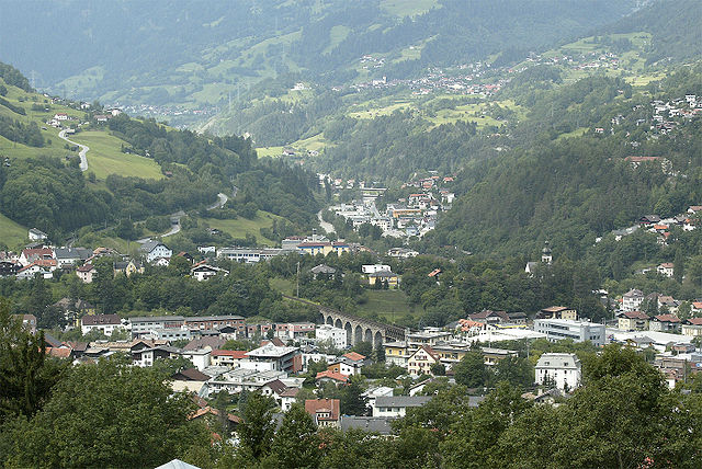

Ландек
Hiking in Ландек
Landeck, located in the Tirol region of Austria, is a fantastic destination for hiking enthusiasts. Set against a backdrop of stunning alpine scenery, this area offers a variety of trails that cater to all skill levels, from leisurely walks to challenging treks....
- Страна:
- Почтовый код: 6500
- Телефонный код: 05442
- Код автомобильного номера: LA
- Координаты: 47° 8' 0" N, 10° 34' 0" E
- GPS треки (wikiloc): [Ссылка]
- Высота над уровнем моря: 817 м m
- Площадь: 15.9 кв.км
- Население: 7725
- Веб сайт: [Ссылка]


Наудерс
Hiking in Наудерс
Nauders, located in the Tyrol region of Austria, is a fantastic destination for hiking enthusiasts. Nestled near the borders of Italy and Switzerland, it offers breathtaking alpine scenery, diverse trails, and a rich natural environment....
- Страна:
- Почтовый код: 6543
- Телефонный код: 0
- Код автомобильного номера: LA
- Координаты: 46° 52' 0" N, 10° 31' 0" E
- GPS треки (wikiloc): [Ссылка]
- Высота над уровнем моря: 1394 м m
- Площадь: 90.3 кв.км
- Население: 1542
- Веб сайт: [Ссылка]

Ишгль
Hiking in Ишгль
Ischgl, located in the Paznaun Valley of Tyrol, Austria, is renowned for its stunning alpine scenery and extensive hiking opportunities. Here are some highlights and tips for hiking in this beautiful area:...
- Страна:
- Почтовый код: 6561
- Телефонный код: 05444
- Код автомобильного номера: LA
- Координаты: 47° 0' 47" N, 10° 17' 17" E
- GPS треки (wikiloc): [Ссылка]
- Высота над уровнем моря: 1377 м m
- Площадь: 103.3 кв.км
- Население: 1593
- Веб сайт: [Ссылка]

Флис
Hiking in Флис
Fließ, located in the Austrian Tyrol region, offers beautiful hiking trails with stunning views of the surrounding mountains and valleys. The area boasts a mix of terrain suitable for hikers of all levels, from gentle walks to more challenging hikes....
- Страна:
- Почтовый код: 6521
- Телефонный код: 05449
- Код автомобильного номера: LA
- Координаты: 47° 7' 12" N, 10° 37' 39" E
- GPS треки (wikiloc): [Ссылка]
- Высота над уровнем моря: 1073 м m
- Площадь: 47.56 кв.км
- Население: 3019
- Веб сайт: [Ссылка]
Шписс
Hiking in Шписс
Hiking in the Spiš region of Slovakia offers a wonderful blend of stunning natural landscapes, rich history, and a variety of trails suitable for different skill levels. This area is characterized by its impressive mountains, including parts of the High Tatras, as well as picturesque valleys, limestone formations, and historical landmarks....
- Страна:
- Почтовый код: 6544
- Телефонный код: 05474
- Код автомобильного номера: LA
- Координаты: 46° 57' 33" N, 10° 25' 53" E
- GPS треки (wikiloc): [Ссылка]
- Высота над уровнем моря: 1628 м m
- Площадь: 24.5 кв.км
- Население: 114
- Веб сайт: [Ссылка]

Гальтюр
Hiking in Гальтюр
Galtür, located in the Paznaun Valley of Tyrol, Austria, is a stunning destination for hiking enthusiasts. Nestled in the Silvretta Alps, Galtür offers a variety of trails catering to different skill levels, making it an ideal spot for both beginners and experienced hikers. Here are some highlights of hiking in Galtür:...
- Страна:
- Почтовый код: 6563
- Телефонный код: 05443
- Код автомобильного номера: LA
- Координаты: 46° 58' 5" N, 10° 11' 13" E
- GPS треки (wikiloc): [Ссылка]
- Высота над уровнем моря: 1584 м m
- Площадь: 121.2 кв.км
- Население: 765
- Веб сайт: [Ссылка]

Фендельс
Hiking in Фендельс
Fendels is a beautiful village located in Tyrol, Austria, situated above the Inn Valley and known for its picturesque landscapes and fantastic hiking opportunities. Here’s an overview of what you can expect when hiking in and around Fendels:...
- Страна:
- Почтовый код: 6528
- Телефонный код: 05472
- Код автомобильного номера: LA
- Координаты: 47° 3' 13" N, 10° 40' 35" E
- GPS треки (wikiloc): [Ссылка]
- Высота над уровнем моря: 1352 м m
- Площадь: 13.48 кв.км
- Население: 259
- Веб сайт: [Ссылка]
Каунс
Hiking in Каунс
Kauns, a picturesque location often surrounded by beautiful natural landscapes, provides a great opportunity for hiking enthusiasts. Although it's not a widely recognized hiking destination compared to some national parks, it often features scenic trails that allow hikers to experience its rich flora and fauna....
- Страна:
- Почтовый код: 6526
- Телефонный код: 05472
- Код автомобильного номера: LA
- Координаты: 47° 4' 40" N, 10° 41' 26" E
- GPS треки (wikiloc): [Ссылка]
- Высота над уровнем моря: 1050 м m
- Площадь: 8.23 кв.км
- Население: 502
- Веб сайт: [Ссылка]
Фагген
Hiking in Фагген
Faggen, a picturesque region in the Austrian Alps, is an excellent destination for hiking enthusiasts looking for stunning landscapes, diverse trails, and a tranquil atmosphere. Here’s a brief overview of what you might expect while hiking in Faggen:...
- Страна:
- Почтовый код: 6525
- Телефонный код: 05472
- Код автомобильного номера: LA
- Координаты: 47° 4' 50" N, 10° 40' 20" E
- GPS треки (wikiloc): [Ссылка]
- Высота над уровнем моря: 900 м m
- Площадь: 3.63 кв.км
- Население: 383
- Веб сайт: [Ссылка]
Флирш
Hiking in Флирш
Flirsch, a charming village located in the Tyrolean region of Austria, is an ideal destination for hiking enthusiasts. Nestled in the majestic mountains of the Inn Valley, it offers a variety of hiking trails that cater to all levels of experience, from beginner to advanced....
- Страна:
- Почтовый код: 6572
- Телефонный код: 05447
- Код автомобильного номера: LA
- Координаты: 47° 8' 55" N, 10° 24' 31" E
- GPS треки (wikiloc): [Ссылка]
- Высота над уровнем моря: 1154 м m
- Площадь: 31.05 кв.км
- Население: 990
- Веб сайт: [Ссылка]

Каунерталь
Hiking in Каунерталь
Kaunertal is a stunningly beautiful valley located in the Tyrol region of Austria. It is known for its picturesque landscapes, diverse hiking trails, and the spectacular Kaunertaler Glacier. Here’s what you can expect when hiking in Kaunertal:...
- Страна:
- Почтовый код: 6524
- Телефонный код: 05475
- Код автомобильного номера: LA
- Координаты: 47° 2' 0" N, 10° 45' 0" E
- GPS треки (wikiloc): [Ссылка]
- Высота над уровнем моря: 1287 м m
- Площадь: 193.5 кв.км
- Население: 597
- Веб сайт: [Ссылка]

Рид
- сельская община в Австрии, Тироль, Ландек
Hiking in Рид
Ried im Oberinntal is a picturesque village located in the Tyrol region of Austria, offering a variety of hiking opportunities for outdoor enthusiasts. Nestled in the Inn Valley, it boasts stunning mountain scenery, lush meadows, and diverse landscapes, making it a great destination for hikers of all skill levels....
- Страна:
- Почтовый код: 6531
- Телефонный код: 05472
- Код автомобильного номера: LA
- Координаты: 47° 3' 19" N, 10° 39' 16" E
- GPS треки (wikiloc): [Ссылка]
- Высота над уровнем моря: 876 м m
- Площадь: 27.43 кв.км
- Население: 1261
- Веб сайт: [Ссылка]

Гринс
Hiking in Гринс
Grins, located in the beautiful region of the Swiss Alps, offers a fantastic hiking experience with stunning landscapes and a range of trails suitable for various skill levels. The area is known for its picturesque scenery, including alpine meadows, rugged mountain peaks, and serene lakes, making it a popular destination for outdoor enthusiasts....
- Страна:
- Почтовый код: 6591
- Телефонный код: 05442
- Код автомобильного номера: LA
- Координаты: 47° 8' 29" N, 10° 30' 53" E
- GPS треки (wikiloc): [Ссылка]
- Высота над уровнем моря: 1006 м m
- Площадь: 21.1 кв.км
- Население: 1398
- Веб сайт: [Ссылка]
Тёзенс
Hiking in Тёзенс
Tösens is a charming village located in the Paznaun Valley of Tyrol, Austria. It's an excellent area for hiking enthusiasts, offering scenic landscapes and a variety of trails suited for different skill levels. Here are some key points to consider when planning a hiking trip to Tösens:...
- Страна:
- Почтовый код: 6541
- Телефонный код: 05477
- Код автомобильного номера: LA
- Координаты: 47° 1' 4" N, 10° 36' 24" E
- GPS треки (wikiloc): [Ссылка]
- Высота над уровнем моря: 930 м m
- Площадь: 31.1 кв.км
- Население: 728
- Веб сайт: [Ссылка]

Пианс
Hiking in Пианс
Pians is a small village located in Austria's state of Tyrol, near the town of Landeck. The surrounding region offers beautiful landscapes, picturesque mountain views, and numerous hiking trails suitable for all skill levels. Here are some key aspects to consider if you're planning to hike in and around Pians:...
- Страна:
- Почтовый код: 6551
- Телефонный код: 05442
- Код автомобильного номера: LA
- Координаты: 47° 8' 4" N, 10° 30' 38" E
- GPS треки (wikiloc): [Ссылка]
- Высота над уровнем моря: 856 м m
- Площадь: 2.9 кв.км
- Население: 813
- Веб сайт: [Ссылка]

Штренген
Hiking in Штренген
Strengen is a beautiful municipality located in the Tyrol region of Austria, nestled in the stunning landscape of the Alps. Hiking in Strengen offers a range of trails suitable for different skill levels, and it presents hikers with breathtaking views of the surrounding mountains, lush valleys, and possibly even some picturesque alpine meadows....
- Страна:
- Почтовый код: 6571
- Телефонный код: 05447
- Код автомобильного номера: LA
- Координаты: 47° 8' 0" N, 10° 27' 0" E
- GPS треки (wikiloc): [Ссылка]
- Высота над уровнем моря: 1012 м m
- Площадь: 23.2 кв.км
- Население: 1213
- Веб сайт: [Ссылка]

Зе
Hiking in Зе
Hiking in See, Tyrol, is a fantastic experience for outdoor enthusiasts, offering breathtaking scenery and a variety of trails suitable for all skill levels. Located in the Paznaun Valley, See is surrounded by stunning mountains and lush landscapes, making it an ideal destination for nature lovers....
- Страна:
- Почтовый код: 6553
- Телефонный код: 05441
- Код автомобильного номера: LA
- Координаты: 47° 5' 0" N, 10° 28' 0" E
- GPS треки (wikiloc): [Ссылка]
- Высота над уровнем моря: 1056 м m
- Площадь: 58.08 кв.км
- Население: 1265
- Веб сайт: [Ссылка]
Каунерберг
Hiking in Каунерберг
Kaunerberg is a picturesque mountain region located in Tyrol, Austria, known for its stunning landscapes, diverse flora and fauna, and well-maintained hiking trails. Here are some key aspects of hiking in Kaunerberg:...
- Страна:
- Почтовый код: 6527
- Телефонный код: 05472
- Код автомобильного номера: LA
- Координаты: 47° 4' 53" N, 10° 42' 44" E
- GPS треки (wikiloc): [Ссылка]
- Высота над уровнем моря: 1297 м m
- Площадь: 23.45 кв.км
- Население: 437
- Веб сайт: [Ссылка]


Ладис
Hiking in Ладис
Ladis, a charming village located in the Tyrol region of Austria, is nestled within the Serfaus-Fiss-Ladis holiday area. This picturesque region offers a variety of hiking opportunities, making it a great destination for both beginners and experienced hikers....
- Страна:
- Почтовый код: 6532
- Телефонный код: 05472
- Код автомобильного номера: LA
- Координаты: 47° 4' 0" N, 10° 37' 0" E
- GPS треки (wikiloc): [Ссылка]
- Высота над уровнем моря: 1189 м m
- Площадь: 7.1 кв.км
- Население: 531
- Веб сайт: [Ссылка]

Тобадилль
Hiking in Тобадилль
Tobadill is a small village located in the picturesque Tyrolean region of Austria, nestled in the Ötztal Alps. Hiking in this area offers fantastic opportunities to explore stunning alpine landscapes, lush valleys, and charming rural scenery. Here are some highlights to consider when hiking in and around Tobadill:...
- Страна:
- Почтовый код: 6552
- Телефонный код: 05442
- Код автомобильного номера: LA
- Координаты: 47° 7' 31" N, 10° 30' 48" E
- GPS треки (wikiloc): [Ссылка]
- Высота над уровнем моря: 1136 м m
- Площадь: 16.48 кв.км
- Население: 516


Пфундс
Hiking in Пфундс
Pfunds, a charming village located in the Tyrol region of Austria, is an excellent destination for hiking enthusiasts. Nestled in the picturesque Inn Valley, it serves as a gateway to numerous hiking trails that cater to different skill levels, from easy walks to challenging mountain hikes....
- Страна:
- Почтовый код: 6542
- Телефонный код: 05474
- Код автомобильного номера: LA
- Координаты: 46° 58' 0" N, 10° 33' 0" E
- GPS треки (wikiloc): [Ссылка]
- Высота над уровнем моря: 970 м m
- Площадь: 140.4 кв.км
- Население: 2602
- Веб сайт: [Ссылка]

Петтной-на-Арльберге
Hiking in Петтной-на-Арльберге
Pettneu am Arlberg is a charming village located in the Tyrolean region of Austria, surrounded by the stunning alpine scenery of the Arlberg mountain range. The area is renowned for its outdoor activities, particularly hiking, making it a great destination for nature lovers and adventure seekers alike....
- Страна:
- Почтовый код: 6574
- Телефонный код: 05448
- Код автомобильного номера: LA
- Координаты: 47° 8' 54" N, 10° 20' 30" E
- GPS треки (wikiloc): [Ссылка]
- Высота над уровнем моря: 1222 м m
- Площадь: 56.8 кв.км
- Население: 1494
- Веб сайт: [Ссылка]
Шёнвис
Hiking in Шёнвис
Schönwies is a beautiful area located in the Tyrol region of Austria, offering a variety of hiking opportunities for different skill levels. Nestled in the Alps, it is characterized by stunning landscapes, lush forests, and picturesque mountain views. Here are some key points to consider when planning a hike in Schönwies:...
- Страна:
- Почтовый код: 6491
- Телефонный код: 05418
- Код автомобильного номера: LA
- Координаты: 47° 11' 50" N, 10° 39' 22" E
- GPS треки (wikiloc): [Ссылка]
- Высота над уровнем моря: 737 м m
- Площадь: 31.329 кв.км
- Население: 1697
- Веб сайт: [Ссылка]